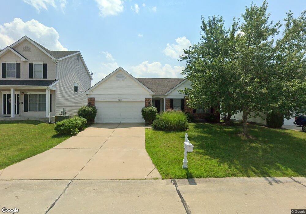
1232 Cold Spring Dr O Fallon, MO 63368
Estimated Value: $357,734 - $396,000
3
Beds
2
Baths
1,643
Sq Ft
$234/Sq Ft
Est. Value
About This Home
This home is located at 1232 Cold Spring Dr, O Fallon, MO 63368 and is currently estimated at $384,184, approximately $233 per square foot. 1232 Cold Spring Dr is a home located in St. Charles County with nearby schools including Pheasant Point Elementary School, Fort Zumwalt South Middle School, and Fort Zumwalt South High School.
Ownership History
Date
Name
Owned For
Owner Type
Purchase Details
Closed on
Feb 6, 2013
Sold by
Loos Jeffrey M and Loos Kimberly N
Bought by
Loos Kimberly N
Current Estimated Value
Home Financials for this Owner
Home Financials are based on the most recent Mortgage that was taken out on this home.
Original Mortgage
$160,000
Outstanding Balance
$112,099
Interest Rate
3.61%
Mortgage Type
New Conventional
Estimated Equity
$272,085
Purchase Details
Closed on
Jul 2, 2003
Sold by
Taylor Morley Inc
Bought by
Loos Jeffrey M and Loos Kimberly N
Home Financials for this Owner
Home Financials are based on the most recent Mortgage that was taken out on this home.
Original Mortgage
$160,000
Interest Rate
5.15%
Mortgage Type
Purchase Money Mortgage
Create a Home Valuation Report for This Property
The Home Valuation Report is an in-depth analysis detailing your home's value as well as a comparison with similar homes in the area
Home Values in the Area
Average Home Value in this Area
Purchase History
| Date | Buyer | Sale Price | Title Company |
|---|---|---|---|
| Loos Kimberly N | $200,000 | Accommodation | |
| Loos Jeffrey M | -- | -- |
Source: Public Records
Mortgage History
| Date | Status | Borrower | Loan Amount |
|---|---|---|---|
| Open | Loos Kimberly N | $160,000 | |
| Closed | Loos Jeffrey M | $160,000 | |
| Closed | Loos Jeffrey M | $20,000 |
Source: Public Records
Tax History
| Year | Tax Paid | Tax Assessment Tax Assessment Total Assessment is a certain percentage of the fair market value that is determined by local assessors to be the total taxable value of land and additions on the property. | Land | Improvement |
|---|---|---|---|---|
| 2025 | $4,116 | $63,094 | -- | -- |
| 2023 | $4,118 | $62,256 | $0 | $0 |
| 2022 | $3,598 | $50,569 | $0 | $0 |
| 2021 | $3,601 | $50,569 | $0 | $0 |
| 2020 | $3,300 | $44,878 | $0 | $0 |
| 2019 | $3,308 | $44,878 | $0 | $0 |
| 2018 | $3,393 | $43,972 | $0 | $0 |
| 2017 | $3,352 | $43,972 | $0 | $0 |
| 2016 | $2,939 | $38,397 | $0 | $0 |
| 2015 | $2,732 | $38,397 | $0 | $0 |
| 2014 | $2,592 | $35,820 | $0 | $0 |
Source: Public Records
Map
Nearby Homes
- 178 Christina Marie Dr
- 67 Simeon Ct
- 249 Dardenne Farms Dr
- 26 Dalton Valley Dr
- 661 Clifton Hill Dr
- 3 Royallbend Ct
- 2726 Brook Meadow Ln
- 367 Shamrock St
- 361 Shamrock St
- 93 Arapahoe Basin Ct
- 2628 Breckenridge Cir
- 2136 Farnsworth Dr Unit D
- 14 Sea Pines Ct
- 2 the Durango at the Grove
- 83 Foxgate Ct
- 516 Sunward Dr
- 44 Pheasant Ring Dr
- 604 Sunward Dr
- 1319 Commons Cir
- 2402 Brookfield Ln
- 1230 Cold Spring Dr
- 1234 Cold Spring Dr
- 1149 Spring Orchard Dr
- 1236 Cold Spring Dr
- 1147 Spring Orchard Dr
- 1151 Spring Orchard Dr
- 1145 Spring Orchard Dr
- 1233 Cold Spring Dr
- 1231 Cold Spring Dr
- 1238 Cold Spring Dr
- 1153 Spring Orchard Dr
- 1226 Cold Spring Dr
- 1229 Cold Spring Dr
- 1143 Spring Orchard Dr
- 1155 Spring Orchard Dr
- 1227 Cold Spring Dr
- 1240 Cold Spring Dr
- 1224 Cold Spring Dr
- 1141 Spring Orchard Dr
- 1225 Cold Spring Dr
Your Personal Tour Guide
Ask me questions while you tour the home.