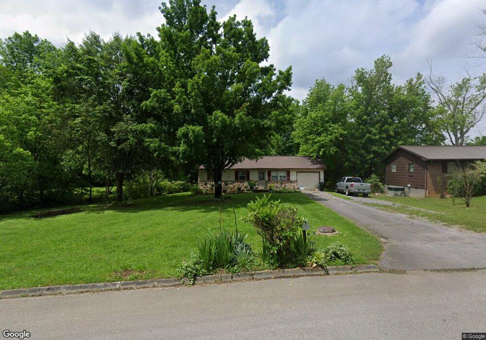
1232 Debi Cir Morristown, TN 37813
Estimated Value: $144,347 - $205,000
--
Bed
1
Bath
912
Sq Ft
$202/Sq Ft
Est. Value
About This Home
This home is located at 1232 Debi Cir, Morristown, TN 37813 and is currently estimated at $184,587, approximately $202 per square foot. 1232 Debi Cir is a home located in Hamblen County with nearby schools including Hillcrest Elementary School, Meadowview Middle School, and Morristown East High School.
Ownership History
Date
Name
Owned For
Owner Type
Purchase Details
Closed on
Apr 4, 2006
Sold by
Ray Bledsoe Teddy
Bought by
Batres Rodis G
Current Estimated Value
Home Financials for this Owner
Home Financials are based on the most recent Mortgage that was taken out on this home.
Original Mortgage
$84,500
Outstanding Balance
$66,233
Interest Rate
6.2%
Estimated Equity
$118,354
Purchase Details
Closed on
Feb 27, 1984
Bought by
Bledsoe Teddy R and Bledsoe Nancy A
Purchase Details
Closed on
Jul 20, 1979
Bought by
Mitchell David M and Mitchell Donna R
Create a Home Valuation Report for This Property
The Home Valuation Report is an in-depth analysis detailing your home's value as well as a comparison with similar homes in the area
Home Values in the Area
Average Home Value in this Area
Purchase History
| Date | Buyer | Sale Price | Title Company |
|---|---|---|---|
| Batres Rodis G | $84,500 | -- | |
| Bledsoe Teddy R | $31,900 | -- | |
| Mitchell David M | $22,800 | -- |
Source: Public Records
Mortgage History
| Date | Status | Borrower | Loan Amount |
|---|---|---|---|
| Open | Mitchell David M | $84,500 |
Source: Public Records
Tax History Compared to Growth
Tax History
| Year | Tax Paid | Tax Assessment Tax Assessment Total Assessment is a certain percentage of the fair market value that is determined by local assessors to be the total taxable value of land and additions on the property. | Land | Improvement |
|---|---|---|---|---|
| 2024 | $349 | $19,850 | $4,200 | $15,650 |
| 2023 | $349 | $19,850 | $0 | $0 |
| 2022 | $627 | $19,850 | $4,200 | $15,650 |
| 2021 | $627 | $19,850 | $4,200 | $15,650 |
| 2020 | $626 | $19,850 | $4,200 | $15,650 |
| 2019 | $585 | $17,200 | $2,975 | $14,225 |
| 2018 | $542 | $17,200 | $2,975 | $14,225 |
| 2017 | $533 | $17,200 | $2,975 | $14,225 |
| 2016 | $509 | $17,200 | $2,975 | $14,225 |
| 2015 | $474 | $17,200 | $2,975 | $14,225 |
| 2014 | -- | $17,200 | $2,975 | $14,225 |
| 2013 | -- | $18,150 | $0 | $0 |
Source: Public Records
Map
Nearby Homes
- 000 Bacon Ln
- 1205 Ledford Ave
- 0 Joe Hall Rd Unit 703714
- 816 Choctaw St
- 819 Choctaw St
- 1200 Liberty Hall Dr
- 98 Geneva Ln
- Lot 99 Geneva Ln
- Lot 100 Geneva Ln
- Lot 101 Geneva Ln
- 423 Hayter Dr
- 108 Annie Ln
- 109 Annie Ln
- 0 Russell Cir
- 808 Gaston St
- 915 Forgey Ave
- 831 Cave St
- 712 Williams St
- 828 Overlook Dr
- 1621 S Cumberland St
- 1228 Debi Cir
- 1224 Debi Cir
- 834 Hayter Dr
- 1240 Debi Cir
- 1229 Debi Cir
- 1235 Debi Cir
- 1245 Christopher Ln
- 1220 Debi Cir
- 1243 Christopher Ln
- 1243 Christopher Ln Unit 1243
- 1243 Christopher Ln Unit 428
- 1225 Debi Cir
- 1244 Debi Cir
- 1221 Debi Cir
- 1216 Debi Cir
- 1241 Debi Cir
- 1248 Debi Cir
- 1231 Christopher Ln
- 1217 Debi Cir
- 1124 Bacon Ln