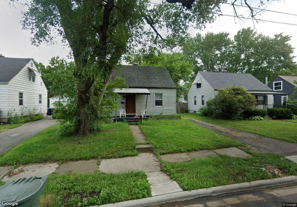
1232 Delno Ave Columbus, OH 43224
North Linden NeighborhoodEstimated Value: $142,000 - $214,000
3
Beds
1
Bath
1,426
Sq Ft
$132/Sq Ft
Est. Value
About This Home
This home is located at 1232 Delno Ave, Columbus, OH 43224 and is currently estimated at $187,629, approximately $131 per square foot. 1232 Delno Ave is a home located in Franklin County with nearby schools including Como Elementary School, Dominion Middle School, and Whetstone High School.
Ownership History
Date
Name
Owned For
Owner Type
Purchase Details
Closed on
Nov 5, 2013
Sold by
Parker Shawn F and M & P Holdings Revocable Livin
Bought by
P & M Holding Llc
Current Estimated Value
Purchase Details
Closed on
Mar 27, 2007
Sold by
Parker Shawn F and Malagreca Nicholas
Bought by
Rosing Michael and M & P Holdings Revocable Livin
Purchase Details
Closed on
Jul 28, 2003
Sold by
Morrison Penny S
Bought by
Malagreca Nicholas and Parker Shawn F
Purchase Details
Closed on
Dec 2, 1992
Bought by
Morrison Penny S
Purchase Details
Closed on
Jan 30, 1990
Create a Home Valuation Report for This Property
The Home Valuation Report is an in-depth analysis detailing your home's value as well as a comparison with similar homes in the area
Home Values in the Area
Average Home Value in this Area
Purchase History
| Date | Buyer | Sale Price | Title Company |
|---|---|---|---|
| P & M Holding Llc | -- | None Available | |
| Rosing Michael | -- | Independent | |
| Malagreca Nicholas | $57,500 | Midland Celtic Title | |
| Morrison Penny S | $49,000 | -- | |
| -- | -- | -- |
Source: Public Records
Tax History Compared to Growth
Tax History
| Year | Tax Paid | Tax Assessment Tax Assessment Total Assessment is a certain percentage of the fair market value that is determined by local assessors to be the total taxable value of land and additions on the property. | Land | Improvement |
|---|---|---|---|---|
| 2024 | $2,005 | $43,750 | $11,900 | $31,850 |
| 2023 | $1,980 | $43,750 | $11,900 | $31,850 |
| 2022 | $1,443 | $27,160 | $6,300 | $20,860 |
| 2021 | $2,061 | $27,160 | $6,300 | $20,860 |
| 2020 | $1,607 | $27,160 | $6,300 | $20,860 |
| 2019 | $1,384 | $22,260 | $5,250 | $17,010 |
| 2018 | $1,257 | $22,260 | $5,250 | $17,010 |
| 2017 | $1,384 | $22,260 | $5,250 | $17,010 |
| 2016 | $1,244 | $18,310 | $3,330 | $14,980 |
| 2015 | $1,133 | $18,310 | $3,330 | $14,980 |
| 2014 | $1,135 | $18,310 | $3,330 | $14,980 |
| 2013 | $658 | $21,525 | $3,920 | $17,605 |
Source: Public Records
Map
Nearby Homes
- 2916 Hamilton Ave
- 2913 Gerbert Rd
- 1225 Sandlin Ave
- 2905 Ontario St
- 2981 Gerbert Rd
- 2950 Grasmere Ave
- 2860 Grasmere Ave
- 3071 Karl Rd
- 2888 Howey Rd
- 2804 Grasmere Ave
- 2890 Medina Ave
- 2769 McGuffey Rd
- 3107 Hamilton Ave
- 2899 Howey Rd
- 2996 Atwood Terrace
- 2819 Norwood St
- 3129 McGuffey Rd
- 1444 Manchester Ave
- 3056 Medina Ave
- 3147 Grasmere Ave
- 1226 Delno Ave
- 1240 Delno Ave
- 1220 Delno Ave1
- 1246 Delno Ave
- 1220 Delno Ave
- 1239 Sandlin Ave
- 1233 Sandlin Ave
- 1245 Sandlin Ave
- 1214 Delno Ave
- 1252 Delno Ave
- 1251 Sandlin Ave
- 1231 Delno Ave
- 1237 Delno Ave
- 1225 Delno Ave
- 1219 Sandlin Ave
- 1257 Sandlin Ave
- 1243 Delno Ave
- 1217 Delno Ave
- 1258 Delno Ave
- 1208 Delno Ave