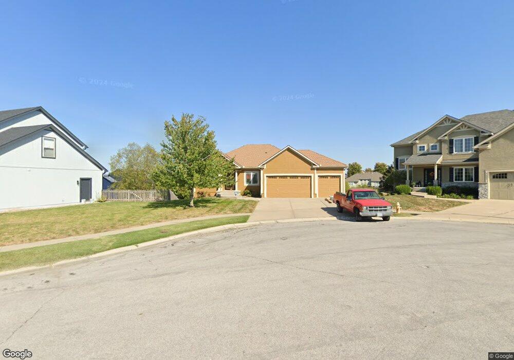
1232 Edwards Cir Raymore, MO 64083
Estimated Value: $477,000 - $527,000
5
Beds
3
Baths
1,748
Sq Ft
$283/Sq Ft
Est. Value
About This Home
This home is located at 1232 Edwards Cir, Raymore, MO 64083 and is currently estimated at $494,493, approximately $282 per square foot. 1232 Edwards Cir is a home located in Cass County with nearby schools including Creekmoor Elementary School, Raymore-Peculiar East Middle School, and Raymore-Peculiar Senior High School.
Ownership History
Date
Name
Owned For
Owner Type
Purchase Details
Closed on
Mar 28, 2007
Sold by
C And M Builders Inc
Bought by
Maxwell Deborah
Current Estimated Value
Home Financials for this Owner
Home Financials are based on the most recent Mortgage that was taken out on this home.
Original Mortgage
$299,155
Outstanding Balance
$180,571
Interest Rate
6.3%
Mortgage Type
New Conventional
Estimated Equity
$313,922
Purchase Details
Closed on
Oct 20, 2005
Sold by
Cooper Land Development Inc
Bought by
C And M Builders Inc
Home Financials for this Owner
Home Financials are based on the most recent Mortgage that was taken out on this home.
Original Mortgage
$270,850
Interest Rate
6.3%
Mortgage Type
Construction
Create a Home Valuation Report for This Property
The Home Valuation Report is an in-depth analysis detailing your home's value as well as a comparison with similar homes in the area
Home Values in the Area
Average Home Value in this Area
Purchase History
| Date | Buyer | Sale Price | Title Company |
|---|---|---|---|
| Maxwell Deborah | -- | -- | |
| C And M Builders Inc | -- | -- |
Source: Public Records
Mortgage History
| Date | Status | Borrower | Loan Amount |
|---|---|---|---|
| Open | Maxwell Deborah | $299,155 | |
| Previous Owner | C And M Builders Inc | $270,850 |
Source: Public Records
Tax History Compared to Growth
Tax History
| Year | Tax Paid | Tax Assessment Tax Assessment Total Assessment is a certain percentage of the fair market value that is determined by local assessors to be the total taxable value of land and additions on the property. | Land | Improvement |
|---|---|---|---|---|
| 2025 | $4,941 | $67,400 | $13,150 | $54,250 |
| 2024 | $4,941 | $60,710 | $11,950 | $48,760 |
| 2023 | $4,934 | $60,710 | $11,950 | $48,760 |
| 2022 | $4,518 | $55,230 | $11,950 | $43,280 |
| 2021 | $4,519 | $55,230 | $11,950 | $43,280 |
| 2020 | $4,447 | $53,390 | $11,950 | $41,440 |
| 2019 | $4,293 | $53,390 | $11,950 | $41,440 |
| 2018 | $4,268 | $51,260 | $11,950 | $39,310 |
| 2017 | $3,703 | $51,260 | $11,950 | $39,310 |
| 2016 | $3,703 | $46,160 | $11,950 | $34,210 |
| 2015 | $3,706 | $46,160 | $11,950 | $34,210 |
| 2014 | $3,707 | $46,160 | $11,950 | $34,210 |
| 2013 | -- | $46,160 | $11,950 | $34,210 |
Source: Public Records
Map
Nearby Homes
- 806 Creekmoor Pond Ln
- 1214 High Ridge Ct
- 1205 Wiltshire Blvd
- 1116 Wiltshire Blvd
- 1208 Becket Ct
- 608 Johnston Pkwy
- 600 Andypaul Ct Unit 602
- 1214 Cothran Ct
- 1010 Wiltshire Blvd
- 1025 Kaycee Dr
- 503 N Jenkins Blvd
- 901 Reed Dr
- 838 Reed Dr
- 1000 Vera Dr
- 827 Reed Dr
- 903 Reed Dr
- 614 Foxglove Ln
- 1412 W Stone Blvd
- 608 Foxglove Ln
- 610 Foxglove Ln
- 1234 Edwards Cir
- 1230 Edwards Cir
- 1308 Wiltshire Blvd
- 1235 Edwards Cir
- 1203 Hampton Dr
- 1201 Hampton Dr
- 1223 Deaton Cir
- 1205 Hampton Dr
- 1232 Wiltshire Blvd
- 1233 Edwards Cir
- 1305 Wiltshire Blvd
- 1307 Wiltshire Blvd
- 1303 Wiltshire Blvd
- 1309 Wiltshire Blvd
- 1226 Deaton Cir
- 1230 Wiltshire Blvd
- 1301 Wiltshire Blvd
- 1221 Deaton Cir
- 616 Duncan Cir
- 614 Duncan Cir