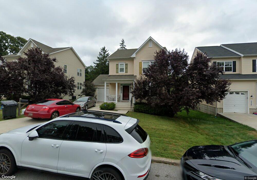
1232 Limit Ave Idlewylde, MD 21239
Idlewood NeighborhoodEstimated Value: $422,000 - $502,000
--
Bed
1
Bath
1,876
Sq Ft
$255/Sq Ft
Est. Value
About This Home
This home is located at 1232 Limit Ave, Idlewylde, MD 21239 and is currently estimated at $477,574, approximately $254 per square foot. 1232 Limit Ave is a home located in Baltimore County with nearby schools including Stoneleigh Elementary School, Dumbarton Middle School, and Towson High Law & Public Policy.
Ownership History
Date
Name
Owned For
Owner Type
Purchase Details
Closed on
Oct 14, 2010
Sold by
Evision Builders Llc
Bought by
Molock Reginald and Molock Khalidah S
Current Estimated Value
Home Financials for this Owner
Home Financials are based on the most recent Mortgage that was taken out on this home.
Original Mortgage
$295,027
Outstanding Balance
$196,266
Interest Rate
4.51%
Mortgage Type
FHA
Estimated Equity
$281,308
Purchase Details
Closed on
Jan 12, 2010
Sold by
Aleksalza Virginia G
Bought by
Envision Builders Llc
Purchase Details
Closed on
Oct 10, 1985
Sold by
White Randall C
Bought by
Aleksalza Virginia G
Create a Home Valuation Report for This Property
The Home Valuation Report is an in-depth analysis detailing your home's value as well as a comparison with similar homes in the area
Home Values in the Area
Average Home Value in this Area
Purchase History
| Date | Buyer | Sale Price | Title Company |
|---|---|---|---|
| Molock Reginald | $299,000 | -- | |
| Envision Builders Llc | $57,500 | -- | |
| Aleksalza Virginia G | $11,000 | -- |
Source: Public Records
Mortgage History
| Date | Status | Borrower | Loan Amount |
|---|---|---|---|
| Open | Molock Reginald | $295,027 |
Source: Public Records
Tax History Compared to Growth
Tax History
| Year | Tax Paid | Tax Assessment Tax Assessment Total Assessment is a certain percentage of the fair market value that is determined by local assessors to be the total taxable value of land and additions on the property. | Land | Improvement |
|---|---|---|---|---|
| 2025 | $5,050 | $357,400 | $90,600 | $266,800 |
| 2024 | $5,050 | $336,867 | $0 | $0 |
| 2023 | $2,299 | $316,333 | $0 | $0 |
| 2022 | $4,382 | $295,800 | $85,400 | $210,400 |
| 2021 | $4,166 | $291,700 | $0 | $0 |
| 2020 | $4,166 | $287,600 | $0 | $0 |
| 2019 | $4,260 | $283,500 | $85,400 | $198,100 |
| 2018 | $4,241 | $281,633 | $0 | $0 |
| 2017 | $4,712 | $279,767 | $0 | $0 |
| 2016 | $3,498 | $277,900 | $0 | $0 |
| 2015 | $3,498 | $276,867 | $0 | $0 |
| 2014 | $3,498 | $275,833 | $0 | $0 |
Source: Public Records
Map
Nearby Homes
- 1117 Walker Ave
- 1212 Cedarcroft Rd
- 1206 Cedarcroft Rd
- 6225 Chinquapin Pkwy
- 1283 Gittings Ave
- 6231 Northwood Dr
- 6416 Sherwood Rd
- 6216 Falkirk Rd
- 6204 Falkirk Rd
- 6415 Falkirk Rd
- 724 Overbrook Rd
- 1377 Walker Ave
- 1120 Litchfield Rd
- 1108 Litchfield Rd
- 1420 Cedarcroft Rd
- 724 Murdock Rd
- 710 Overbrook Rd
- 1133 E Northern Pkwy
- 707 Anneslie Rd
- 6112 Chinquapin Pkwy
- 1232 Limit Ave
- 1234 Limit Ave
- 1236 Limit Ave
- 1231 Limit Ave
- 1229 Limit Ave
- 1233 Limit Ave
- 1235 Limit Ave
- 1237 Limit Ave
- 1214 Limit Ave
- 1239 Limit Ave
- 6211 Beechwood Rd
- 6301 Beechwood Rd
- 1241 Limit Ave
- 1243 Limit Ave
- 1005 Saint Albans Rd
- 1245 Limit Ave
- 1214 Walker Ave
- 1247 Limit Ave
- 6209 Beechwood Rd
- 6303 Beechwood Rd