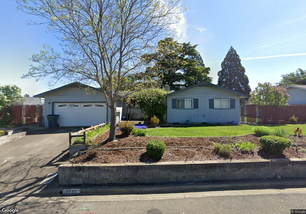
1232 Triangle Dr Central Point, OR 97502
Estimated Value: $353,000 - $415,000
4
Beds
2
Baths
1,460
Sq Ft
$261/Sq Ft
Est. Value
About This Home
This home is located at 1232 Triangle Dr, Central Point, OR 97502 and is currently estimated at $380,543, approximately $260 per square foot. 1232 Triangle Dr is a home located in Jackson County with nearby schools including Jewett Elementary School, Scenic Middle School, and Crater High School.
Ownership History
Date
Name
Owned For
Owner Type
Purchase Details
Closed on
Oct 29, 2008
Sold by
Washington Mutual Bank
Bought by
Cress Garry L and Cress Tammy A
Current Estimated Value
Home Financials for this Owner
Home Financials are based on the most recent Mortgage that was taken out on this home.
Original Mortgage
$151,200
Outstanding Balance
$96,049
Interest Rate
5.77%
Mortgage Type
Purchase Money Mortgage
Estimated Equity
$284,494
Purchase Details
Closed on
Jul 2, 2008
Sold by
Brothers Araceli A and Brothers William P
Bought by
Washington Mutual Bank
Purchase Details
Closed on
May 19, 2004
Sold by
Brothers William P and Brothers Araceli A
Bought by
Brothers William P and Brothers Araceli A
Home Financials for this Owner
Home Financials are based on the most recent Mortgage that was taken out on this home.
Original Mortgage
$158,900
Interest Rate
7.87%
Mortgage Type
Stand Alone First
Purchase Details
Closed on
Apr 9, 2002
Sold by
Pierzina Clifford J and Pierzina Margarita
Bought by
Brothers William P and Brothers Araceli A
Home Financials for this Owner
Home Financials are based on the most recent Mortgage that was taken out on this home.
Original Mortgage
$140,400
Interest Rate
6.78%
Create a Home Valuation Report for This Property
The Home Valuation Report is an in-depth analysis detailing your home's value as well as a comparison with similar homes in the area
Purchase History
| Date | Buyer | Sale Price | Title Company |
|---|---|---|---|
| Cress Garry L | $168,000 | Fidelity Natl Title Co Of Or | |
| Washington Mutual Bank | $185,000 | None Available | |
| Brothers William P | -- | Amerititle | |
| Brothers William P | $148,900 | First American Title Ins Co |
Source: Public Records
Mortgage History
| Date | Status | Borrower | Loan Amount |
|---|---|---|---|
| Open | Cress Garry L | $151,200 | |
| Previous Owner | Brothers William P | $158,900 | |
| Previous Owner | Brothers William P | $140,400 |
Source: Public Records
Tax History
| Year | Tax Paid | Tax Assessment Tax Assessment Total Assessment is a certain percentage of the fair market value that is determined by local assessors to be the total taxable value of land and additions on the property. | Land | Improvement |
|---|---|---|---|---|
| 2026 | $3,302 | $199,530 | -- | -- |
| 2025 | $3,221 | $193,720 | $73,650 | $120,070 |
| 2024 | $3,221 | $188,080 | $71,510 | $116,570 |
| 2023 | $3,117 | $182,610 | $69,430 | $113,180 |
| 2022 | $3,045 | $182,610 | $69,430 | $113,180 |
| 2021 | $2,958 | $177,300 | $67,410 | $109,890 |
| 2020 | $2,871 | $172,140 | $65,450 | $106,690 |
| 2019 | $2,801 | $162,270 | $61,690 | $100,580 |
| 2018 | $2,715 | $157,550 | $59,890 | $97,660 |
| 2017 | $2,647 | $157,550 | $59,890 | $97,660 |
| 2016 | $2,570 | $148,520 | $56,460 | $92,060 |
| 2015 | $2,462 | $148,520 | $56,460 | $92,060 |
| 2014 | $2,400 | $140,000 | $53,210 | $86,790 |
Source: Public Records
Map
Nearby Homes
- 106 Victoria Way
- 0 Peninger Rd
- 833 Hazel St
- 4065 Crestwood Cir
- 55 Crater Ln
- 0 N 3rd St
- 4626 N Pacific Hwy
- 331 N 8th St
- 731 Maple St
- 1855 Nancy Ave
- 342 Hazel St
- 356 Marian Ave Unit 40
- 1860 Cottonwood Dr
- 140 N 8th St
- 144 N 5th St
- 0 Boulder Ridge St
- 650 Golden Peak Dr
- 659 Blue Moon Dr
- 545 Bridge Creek Dr
- 1407 Rustler Peak St
- 1237 Vista Dr
- 1224 Triangle Dr
- 1247 Vista Dr
- 1227 Vista Dr
- 1231 Triangle Dr
- 1235 Triangle Dr
- 1225 Triangle Dr
- 1141 Crest Dr
- 1131 Crest Dr
- 1205 Vista Dr
- 1216 Triangle Dr
- 1221 Triangle Dr
- 1241 Triangle Dr
- 1230 Vista Dr
- 1240 Vista Dr
- 1220 Vista Dr
- 1311 Vista Dr
- 1750 N 10th St
- 1250 Vista Dr
- 1210 Vista Dr
Your Personal Tour Guide
Ask me questions while you tour the home.