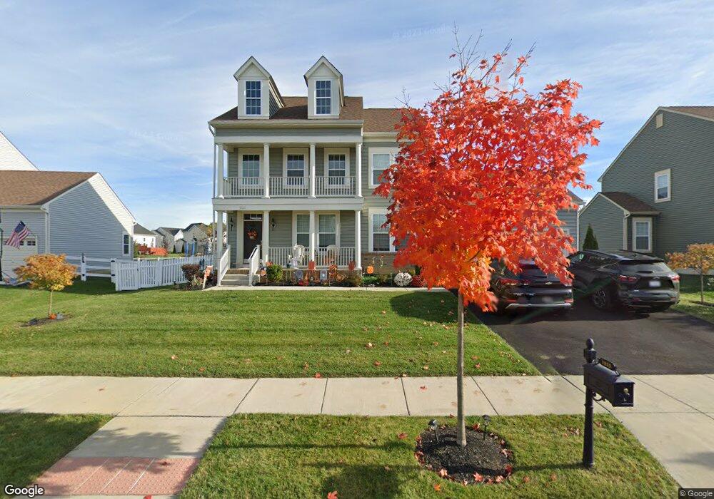
1233 N Olmsted Pkwy Middletown, DE 19709
Estimated Value: $604,000 - $684,000
4
Beds
3
Baths
2,768
Sq Ft
$231/Sq Ft
Est. Value
About This Home
This home is located at 1233 N Olmsted Pkwy, Middletown, DE 19709 and is currently estimated at $640,020, approximately $231 per square foot. 1233 N Olmsted Pkwy is a home with nearby schools including Southern Elementary School and Gunning Bedford Middle School.
Ownership History
Date
Name
Owned For
Owner Type
Purchase Details
Closed on
Feb 26, 2019
Sold by
Blenheim At Bayberry North Llc
Bought by
Clark Amy J and Clark Kenneth Wiley
Current Estimated Value
Home Financials for this Owner
Home Financials are based on the most recent Mortgage that was taken out on this home.
Original Mortgage
$372,915
Outstanding Balance
$327,856
Interest Rate
4.4%
Mortgage Type
New Conventional
Estimated Equity
$312,164
Create a Home Valuation Report for This Property
The Home Valuation Report is an in-depth analysis detailing your home's value as well as a comparison with similar homes in the area
Home Values in the Area
Average Home Value in this Area
Purchase History
| Date | Buyer | Sale Price | Title Company |
|---|---|---|---|
| Clark Amy J | -- | None Available |
Source: Public Records
Mortgage History
| Date | Status | Borrower | Loan Amount |
|---|---|---|---|
| Open | Clark Amy J | $372,915 |
Source: Public Records
Tax History Compared to Growth
Tax History
| Year | Tax Paid | Tax Assessment Tax Assessment Total Assessment is a certain percentage of the fair market value that is determined by local assessors to be the total taxable value of land and additions on the property. | Land | Improvement |
|---|---|---|---|---|
| 2024 | $3,925 | $117,700 | $11,600 | $106,100 |
| 2023 | $3,558 | $117,700 | $11,600 | $106,100 |
| 2022 | $3,731 | $117,700 | $11,600 | $106,100 |
| 2021 | $3,732 | $117,700 | $11,600 | $106,100 |
| 2020 | $3,757 | $117,700 | $11,600 | $106,100 |
| 2019 | $3,702 | $117,700 | $11,600 | $106,100 |
| 2018 | $100 | $3,200 | $3,200 | $0 |
| 2017 | $84 | $3,200 | $3,200 | $0 |
| 2016 | $84 | $3,200 | $3,200 | $0 |
| 2015 | $84 | $3,200 | $3,200 | $0 |
| 2014 | -- | $3,200 | $3,200 | $0 |
Source: Public Records
Map
Nearby Homes
- 1221 N Olmsted Pkwy
- 1218 N Olmsted Pkwy
- 218 Rossnakill Rd
- 832 Lissicasey Loop
- 1169 S Olmsted Pkwy
- 467 Hyetts Corner Rd
- 1814 S Pollock Way
- 420 Cicero Crossing
- 1553 E Matisse Dr
- 3502 Pipewell Ln
- 3031 Ivyhouse Ln
- 3029 Ivyhouse Ln
- 3134 Pett Level Dr
- 3112 Pett Level Dr
- 0 Port Penn Rd
- Armond Plan at Venue at Winchelsea 55+ - Winchelsea Carriages
- Mendocino Plan at Venue at Winchelsea 55+ - Winchelsea Singles
- Tuscany Plan at Venue at Winchelsea 55+ - Winchelsea Singles
- Beacon II Plan at Venue at Winchelsea 55+ - Winchelsea Carriages
- Sonoma Plan at Venue at Winchelsea 55+ - Winchelsea Singles
- 1231 N Olmsted Pkwy
- 1235 N Olmsted Pkwy
- 1230 N Olmsted Pkwy
- 1229 N Olmsted Pkwy
- 1237 N Olmsted Pkwy
- 1236 N Olmsted Pkwy
- 1226 N Olmsted Pkwy
- 411 Galway Ct
- 941 Johnson Dr
- 508 Ennis Ct Unit 280
- 1300 Louis Sullivan Cir
- 1238 N Olmsted Pkwy
- 409 Galway Ct
- 510 Ennis Ct
- 938 Johnson Dr
- 506 Ennis Ct
- 506 Ennis Ct Unit 279
- 407 Galway Ct
- 1222 N Olmsted Pkwy
- 405 Galway Ct