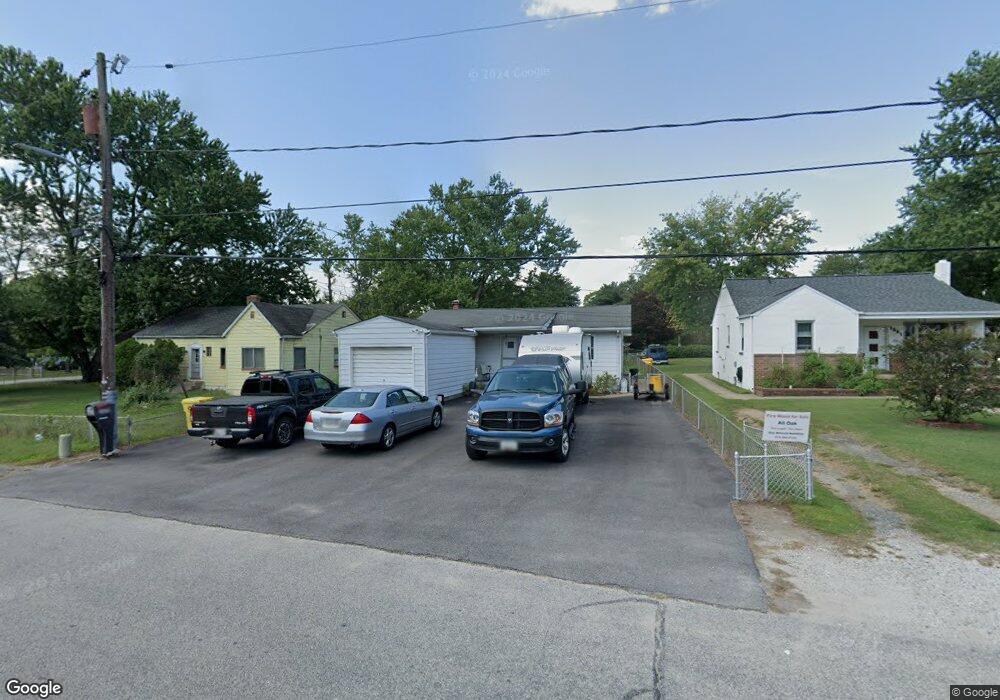
1233 Rock Hill Rd Pasadena, MD 21122
Estimated Value: $321,402 - $366,000
--
Bed
1
Bath
864
Sq Ft
$408/Sq Ft
Est. Value
About This Home
This home is located at 1233 Rock Hill Rd, Pasadena, MD 21122 and is currently estimated at $352,851, approximately $408 per square foot. 1233 Rock Hill Rd is a home located in Anne Arundel County with nearby schools including Sunset Elementary School, Northeast Middle School, and Northeast High School.
Ownership History
Date
Name
Owned For
Owner Type
Purchase Details
Closed on
Feb 12, 2013
Sold by
Mounts David M and Mounts Phyllis L
Bought by
Mounts David M
Current Estimated Value
Home Financials for this Owner
Home Financials are based on the most recent Mortgage that was taken out on this home.
Original Mortgage
$152,000
Outstanding Balance
$106,355
Interest Rate
3.43%
Mortgage Type
New Conventional
Estimated Equity
$246,496
Purchase Details
Closed on
Oct 7, 1996
Sold by
Madison Robert M
Bought by
Mounts David M and Mounts Phyllis L
Purchase Details
Closed on
Apr 18, 1994
Sold by
Galanakis Pericles J
Bought by
Madison Robert M
Home Financials for this Owner
Home Financials are based on the most recent Mortgage that was taken out on this home.
Original Mortgage
$102,588
Interest Rate
7.45%
Create a Home Valuation Report for This Property
The Home Valuation Report is an in-depth analysis detailing your home's value as well as a comparison with similar homes in the area
Home Values in the Area
Average Home Value in this Area
Purchase History
| Date | Buyer | Sale Price | Title Company |
|---|---|---|---|
| Mounts David M | -- | Courtesy Title & Escrow Corp | |
| Mounts David M | $109,900 | -- | |
| Madison Robert M | $102,000 | -- |
Source: Public Records
Mortgage History
| Date | Status | Borrower | Loan Amount |
|---|---|---|---|
| Open | Mounts David M | $152,000 | |
| Previous Owner | Madison Robert M | $102,588 | |
| Closed | Mounts David M | -- |
Source: Public Records
Tax History Compared to Growth
Tax History
| Year | Tax Paid | Tax Assessment Tax Assessment Total Assessment is a certain percentage of the fair market value that is determined by local assessors to be the total taxable value of land and additions on the property. | Land | Improvement |
|---|---|---|---|---|
| 2025 | $2,541 | $282,067 | -- | -- |
| 2024 | $2,541 | $278,300 | $183,300 | $95,000 |
| 2023 | $2,465 | $270,733 | $0 | $0 |
| 2022 | $2,300 | $263,167 | $0 | $0 |
| 2021 | $4,522 | $255,600 | $173,300 | $82,300 |
| 2020 | $2,168 | $236,167 | $0 | $0 |
| 2019 | $2,118 | $216,733 | $0 | $0 |
| 2018 | $2,001 | $197,300 | $120,400 | $76,900 |
| 2017 | $1,982 | $189,267 | $0 | $0 |
| 2016 | -- | $181,233 | $0 | $0 |
| 2015 | -- | $173,200 | $0 | $0 |
| 2014 | -- | $173,200 | $0 | $0 |
Source: Public Records
Map
Nearby Homes
- 1248 Rock Hill Rd
- 1216 Farmview Rd
- 1201 Rock Hill Rd
- 1202 Hillcreek Rd
- 1197 Hillside Rd
- 1220 Hillcreek Rd
- 1219 Hillcreek Rd
- 7818 Renshaw Rd
- 124 Club Rd
- 131 Jackpine Dr
- 8639 Cobscook Harbour
- 1326 Edna Rd
- 1208 Castine Ct
- 4 Silver Cir
- 7824 Acorn Bank
- 8566 Kim Marie Ct
- 7635 Stoney Creek Dr
- 7740 Notley Rd
- 8555 A Skipjack Place
- 1304 Tuggies Rd
- 1229 Rock Hill Rd
- 1237 Rock Hill Rd
- 1225 Rock Hill Rd
- 1212 Valley Rd
- 1217 Rock Hill Rd
- 1211 Rock Hill Rd
- 1234 Rock Hill Rd
- 1236 Rock Hill Rd
- 1232 Rock Hill Rd
- 1215 Valley Rd
- 1217 Valley Rd
- 1238 Rock Hill Rd
- 1230 Rock Hill Rd
- 1213 Valley Rd
- 1210 Valley Rd
- 1209 Rock Hill Rd
- 1240 Rock Hill Rd
- 1211 Valley Rd
- 1226 Rock Hill Rd
- 1224 Rock Hill Rd