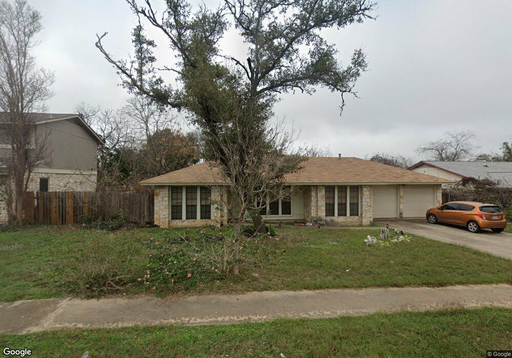
12333 Deerbrook Trail Austin, TX 78750
Anderson Mill NeighborhoodEstimated Value: $458,723 - $571,000
5
Beds
3
Baths
2,072
Sq Ft
$242/Sq Ft
Est. Value
About This Home
This home is located at 12333 Deerbrook Trail, Austin, TX 78750 and is currently estimated at $502,181, approximately $242 per square foot. 12333 Deerbrook Trail is a home located in Williamson County with nearby schools including Anderson Mill Elementary School, Noel Grisham Middle, and Westwood High School.
Ownership History
Date
Name
Owned For
Owner Type
Purchase Details
Closed on
Dec 9, 2005
Sold by
Dalton Don Fredrick
Bought by
Williams David G and Williams Donna C
Current Estimated Value
Home Financials for this Owner
Home Financials are based on the most recent Mortgage that was taken out on this home.
Original Mortgage
$144,850
Outstanding Balance
$81,093
Interest Rate
6.3%
Mortgage Type
New Conventional
Estimated Equity
$421,088
Create a Home Valuation Report for This Property
The Home Valuation Report is an in-depth analysis detailing your home's value as well as a comparison with similar homes in the area
Home Values in the Area
Average Home Value in this Area
Purchase History
| Date | Buyer | Sale Price | Title Company |
|---|---|---|---|
| Williams David G | -- | Austin Title Company |
Source: Public Records
Mortgage History
| Date | Status | Borrower | Loan Amount |
|---|---|---|---|
| Open | Williams David G | $144,850 |
Source: Public Records
Tax History Compared to Growth
Tax History
| Year | Tax Paid | Tax Assessment Tax Assessment Total Assessment is a certain percentage of the fair market value that is determined by local assessors to be the total taxable value of land and additions on the property. | Land | Improvement |
|---|---|---|---|---|
| 2025 | $3,316 | $458,581 | $88,500 | $370,081 |
| 2024 | $3,316 | $457,292 | -- | -- |
| 2023 | $3,209 | $415,720 | $0 | $0 |
| 2022 | $8,115 | $377,927 | $0 | $0 |
| 2021 | $8,440 | $343,570 | $72,000 | $288,674 |
| 2020 | $7,431 | $312,336 | $66,598 | $245,738 |
| 2019 | $7,609 | $311,082 | $60,700 | $250,382 |
| 2018 | $4,649 | $288,529 | $54,891 | $233,638 |
| 2017 | $6,704 | $268,572 | $51,300 | $240,043 |
| 2016 | $6,094 | $244,156 | $51,300 | $221,598 |
| 2015 | $4,885 | $221,960 | $42,100 | $200,153 |
| 2014 | $4,885 | $201,782 | $0 | $0 |
Source: Public Records
Map
Nearby Homes
- 11010 Froke Cedar Trail
- 12206 Saber Trail
- 12306 Split Rail Pkwy
- 12106 Grey Fawn Path
- 10812 Gates Ln Unit 441
- 11506 Powder Mill Trail
- 11512 Powder Mill Trail
- 12300 Wipple Tree Cove
- 1502 Glen Burnie Dr
- 1028 Verbena Dr
- 12601 Jen Ln
- 11405 Bristle Oak Trail
- 11908 Stout Oak Trail
- 1602 Plateau Ridge
- 11611 Quarter Horse Trail
- 12319 Double Tree Ln
- 12314 Double Tree Ln
- 10902 Hard Rock Rd
- 12306 Double Tree Ln
- 11811 Buggy Whip Trail
- 12331 Deerbrook Trail
- 12335 Deerbrook Trail
- 12402 Rusted Nail Cove
- 12329 Deerbrook Trail
- 12404 Rusted Nail Cove
- 7665 Ranch Road 620 N
- 12334 Deerbrook Trail
- 12400 Rusted Nail Cove
- 12336 Deerbrook Trail
- 12332 Deerbrook Trail
- 12327 Deerbrook Trail
- 12330 Deerbrook Trail
- 12302 Rusted Nail Cove
- 12311 Bent Cedar Cove
- 12325 Deerbrook Trail
- 12328 Deerbrook Trail
- 12405 Rusted Nail Cove
- 12309 Bent Cedar Cove
- 12313 Bent Cedar Cove
- 12300 Rusted Nail Cove