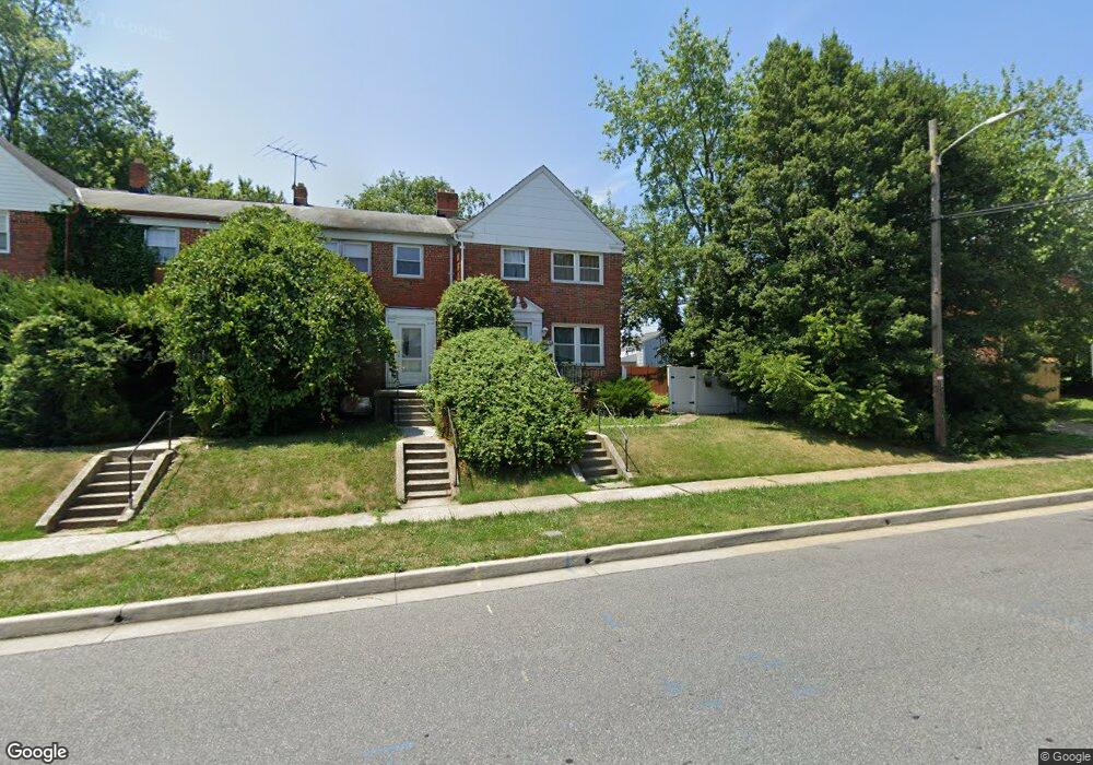
1234 Harwall Rd Gwynn Oak, MD 21207
Estimated Value: $233,000 - $258,000
--
Bed
1
Bath
1,292
Sq Ft
$186/Sq Ft
Est. Value
About This Home
This home is located at 1234 Harwall Rd, Gwynn Oak, MD 21207 and is currently estimated at $240,406, approximately $186 per square foot. 1234 Harwall Rd is a home located in Baltimore County with nearby schools including Edmondson Heights Elementary School, Southwest Academy, and Woodlawn High School.
Ownership History
Date
Name
Owned For
Owner Type
Purchase Details
Closed on
May 12, 2005
Sold by
Harris Latonya J
Bought by
Harris Latowya J
Current Estimated Value
Home Financials for this Owner
Home Financials are based on the most recent Mortgage that was taken out on this home.
Original Mortgage
$98,800
Outstanding Balance
$67,422
Interest Rate
11.15%
Mortgage Type
Adjustable Rate Mortgage/ARM
Estimated Equity
$172,984
Purchase Details
Closed on
Nov 24, 1999
Sold by
Gaske John Mitchell
Bought by
Harris Latonya J
Create a Home Valuation Report for This Property
The Home Valuation Report is an in-depth analysis detailing your home's value as well as a comparison with similar homes in the area
Home Values in the Area
Average Home Value in this Area
Purchase History
| Date | Buyer | Sale Price | Title Company |
|---|---|---|---|
| Harris Latowya J | -- | -- | |
| Harris Latonya J | $88,912 | -- |
Source: Public Records
Mortgage History
| Date | Status | Borrower | Loan Amount |
|---|---|---|---|
| Open | Harris Latowya J | $98,800 |
Source: Public Records
Tax History Compared to Growth
Tax History
| Year | Tax Paid | Tax Assessment Tax Assessment Total Assessment is a certain percentage of the fair market value that is determined by local assessors to be the total taxable value of land and additions on the property. | Land | Improvement |
|---|---|---|---|---|
| 2025 | $2,560 | $174,433 | -- | -- |
| 2024 | $2,560 | $163,200 | $50,000 | $113,200 |
| 2023 | $1,476 | $159,633 | $0 | $0 |
| 2022 | $2,763 | $156,067 | $0 | $0 |
| 2021 | $2,466 | $152,500 | $50,000 | $102,500 |
| 2020 | $2,466 | $148,500 | $0 | $0 |
| 2019 | $2,798 | $144,500 | $0 | $0 |
| 2018 | $2,237 | $140,500 | $45,000 | $95,500 |
| 2017 | $2,515 | $139,300 | $0 | $0 |
| 2016 | $2,617 | $138,100 | $0 | $0 |
| 2015 | $2,617 | $136,900 | $0 | $0 |
| 2014 | $2,617 | $136,900 | $0 | $0 |
Source: Public Records
Map
Nearby Homes
- 1228 Harwall Rd
- 1427 Barrett Rd
- 1428 Clairidge Rd
- 1525 Clairidge Rd
- 1529 Clairidge Rd
- 5904 Cecil Ave
- 1405 Ingleside Ave
- 5901 Sunset Ave
- 5902 Prince George St
- 1204 Wilson Ave
- 5936 Sunset Ave
- 5911 Carroll St
- 1171 Granville Rd
- 1124 Dorchester Ave
- 1603 N Forest Park Ave
- 1191 Granville Rd
- 1120 Ingleside Ave
- 1230 Stamford Rd
- 6041 Cecil Ave
- 1109 Marksworth Rd
- 1232 Harwall Rd
- 1437 Ingleside Ave
- 1439 Ingleside Ave
- 1460 Barrett Rd
- 1427 Ingleside Ave
- 1458 Barrett Rd
- 1456 Barrett Rd
- 1425 Ingleside Ave
- 1454 Barrett Rd
- 1501 Ingleside Ave
- 1235 Harwall Rd
- 1452 Barrett Rd
- 1233 Harwall Rd
- 1231 Harwall Rd
- 1229 Harwall Rd
- 1450 Barrett Rd
- 1226 Harwall Rd
- 1423 Ingleside Ave
- 1503 Ingleside Ave
- 1448 Barrett Rd