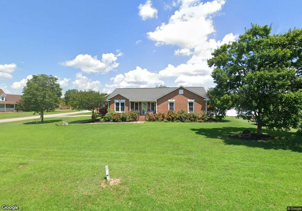
1234 New Hope Rd Anderson, SC 29625
Estimated Value: $340,000 - $444,000
3
Beds
--
Bath
1,417
Sq Ft
$288/Sq Ft
Est. Value
About This Home
This home is located at 1234 New Hope Rd, Anderson, SC 29625 and is currently estimated at $408,521, approximately $288 per square foot. 1234 New Hope Rd is a home located in Anderson County with nearby schools including New Prospect Elementary School, Robert Anderson Middle School, and Westside High School.
Ownership History
Date
Name
Owned For
Owner Type
Purchase Details
Closed on
Nov 4, 2022
Sold by
Mitchum John W
Bought by
Jedrey Richard A and Jedrey Doreen T
Current Estimated Value
Home Financials for this Owner
Home Financials are based on the most recent Mortgage that was taken out on this home.
Original Mortgage
$370,500
Outstanding Balance
$358,948
Interest Rate
6.92%
Mortgage Type
New Conventional
Estimated Equity
$49,573
Purchase Details
Closed on
Jun 21, 2019
Sold by
Mullinax Rick and Mullinax Libby
Bought by
Mitchum John W
Home Financials for this Owner
Home Financials are based on the most recent Mortgage that was taken out on this home.
Original Mortgage
$230,000
Interest Rate
4.1%
Mortgage Type
New Conventional
Create a Home Valuation Report for This Property
The Home Valuation Report is an in-depth analysis detailing your home's value as well as a comparison with similar homes in the area
Home Values in the Area
Average Home Value in this Area
Purchase History
| Date | Buyer | Sale Price | Title Company |
|---|---|---|---|
| Jedrey Richard A | $390,000 | -- | |
| Mitchum John W | $260,000 | None Available | |
| Mullinax Rick | $225,000 | None Available |
Source: Public Records
Mortgage History
| Date | Status | Borrower | Loan Amount |
|---|---|---|---|
| Open | Jedrey Richard A | $370,500 | |
| Previous Owner | Mitchum John W | $230,000 |
Source: Public Records
Tax History Compared to Growth
Tax History
| Year | Tax Paid | Tax Assessment Tax Assessment Total Assessment is a certain percentage of the fair market value that is determined by local assessors to be the total taxable value of land and additions on the property. | Land | Improvement |
|---|---|---|---|---|
| 2024 | $1,853 | $15,650 | $900 | $14,750 |
| 2023 | $1,853 | $15,650 | $900 | $14,750 |
| 2022 | $1,434 | $13,360 | $900 | $12,460 |
| 2021 | $1,277 | $10,580 | $640 | $9,940 |
| 2020 | $1,265 | $10,580 | $640 | $9,940 |
| 2019 | $905 | $7,800 | $640 | $7,160 |
| 2018 | $3,577 | $11,700 | $960 | $10,740 |
| 2017 | -- | $11,700 | $960 | $10,740 |
| 2016 | $3,126 | $11,350 | $930 | $10,420 |
| 2015 | $3,156 | $11,350 | $930 | $10,420 |
| 2014 | $3,105 | $11,350 | $930 | $10,420 |
Source: Public Records
Map
Nearby Homes
- 201 Knollwood Dr
- 924 Axmann Dr
- 110 Peartree Ln
- 114 Peartree Ln
- 347 Knollwood Dr
- 144 Old Asbury Rd
- 4123 Old Portman Rd
- 108 Lakewood Ln
- 4082 Old Portman Rd
- 215 Spruce Creek
- 202 Highway 187 S
- 1511 Cherokee Cir
- 4450 Highway 24 Hwy
- 424 Shore Line Dr
- 129 Saddle Brook
- 118 Pritchards Dr
- 101 Victorian Dr
- 433 Shore Line Dr
- 303 Elm Ave
- 302 Elm Ave
- 500 Noel Ct
- 1232 New Hope Rd
- 502 Noel Ct
- 501 Noel Ct
- 1230 New Hope Rd
- 503 Noel Ct
- 504 Noel Ct
- Lot 22 Noel Ct Unit Barrington Place Sub
- 103 Grayson Ct
- 101 Grayson Ct
- 506 Noel Ct
- 505 Noel Ct
- 105 Grayson Ct
- 507 Noel Ct
- 508 Noel Ct
- 1223 New Hope Rd
- 2710 Whitehall Rd
- 100 Grayson Ct
- 2704 Whitehall Rd
- 2702 Whitehall Rd