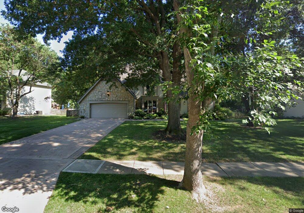
12341 High Dr Leawood, KS 66209
Estimated Value: $638,000 - $721,000
4
Beds
4
Baths
2,770
Sq Ft
$240/Sq Ft
Est. Value
About This Home
This home is located at 12341 High Dr, Leawood, KS 66209 and is currently estimated at $666,078, approximately $240 per square foot. 12341 High Dr is a home located in Johnson County with nearby schools including Leawood Elementary School, Leawood Middle School, and Blue Valley North High School.
Ownership History
Date
Name
Owned For
Owner Type
Purchase Details
Closed on
Aug 10, 2009
Sold by
Hedlund Victoria A
Bought by
Hedlund Larry K and Hedlund Victoria A
Current Estimated Value
Purchase Details
Closed on
Jul 21, 2003
Sold by
Lewin Michael L and Lewin Janet E
Bought by
Hedlund Victoria and Hedlund Larry K
Home Financials for this Owner
Home Financials are based on the most recent Mortgage that was taken out on this home.
Original Mortgage
$220,000
Interest Rate
4.57%
Mortgage Type
Purchase Money Mortgage
Create a Home Valuation Report for This Property
The Home Valuation Report is an in-depth analysis detailing your home's value as well as a comparison with similar homes in the area
Home Values in the Area
Average Home Value in this Area
Purchase History
| Date | Buyer | Sale Price | Title Company |
|---|---|---|---|
| Hedlund Larry K | -- | None Available | |
| Hedlund Victoria | -- | Security Land Title Company |
Source: Public Records
Mortgage History
| Date | Status | Borrower | Loan Amount |
|---|---|---|---|
| Closed | Hedlund Victoria | $220,000 |
Source: Public Records
Tax History Compared to Growth
Tax History
| Year | Tax Paid | Tax Assessment Tax Assessment Total Assessment is a certain percentage of the fair market value that is determined by local assessors to be the total taxable value of land and additions on the property. | Land | Improvement |
|---|---|---|---|---|
| 2024 | $6,714 | $60,559 | $12,434 | $48,125 |
| 2023 | $6,391 | $56,810 | $12,434 | $44,376 |
| 2022 | $6,172 | $53,694 | $12,434 | $41,260 |
| 2021 | $5,585 | $46,368 | $11,302 | $35,066 |
| 2020 | $5,363 | $43,642 | $12,322 | $31,320 |
| 2019 | $5,231 | $41,814 | $12,322 | $29,492 |
| 2018 | $4,733 | $37,191 | $11,201 | $25,990 |
| 2017 | $4,593 | $35,500 | $9,331 | $26,169 |
| 2016 | $4,623 | $35,765 | $7,780 | $27,985 |
| 2015 | $4,547 | $34,753 | $6,483 | $28,270 |
| 2013 | -- | $32,902 | $6,483 | $26,419 |
Source: Public Records
Map
Nearby Homes
- 2401 W 123rd Terrace
- 12501 Sagamore Rd
- 12605 Overbrook Rd
- 12601 Overbrook Rd
- 2313 W 127th St
- 2213 W 122nd St
- 1985 W 123rd Place
- 12500 Overbrook Rd
- 12402 Overbrook Rd
- 2200 W 121st St
- 1013 W Santa fe Trail
- 12616 Pawnee Ln
- 12763 Overbrook Rd
- 12768 Overbrook Rd
- 905 W 122nd Terrace
- 12380 Summit St
- 12725 High Dr
- 2229 Condolea Terrace
- 12606 Mohawk Ln
- 11900 Overbrook Rd