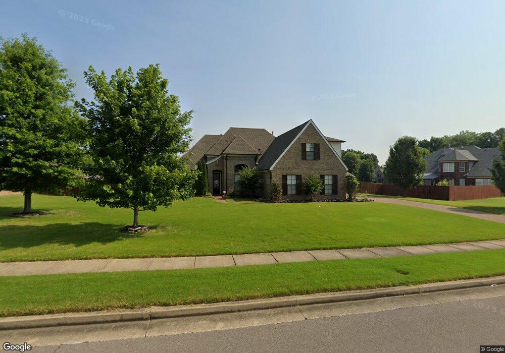
12344 Dusty Field Rd Arlington, TN 38002
Estimated Value: $453,577 - $501,000
5
Beds
3
Baths
2,823
Sq Ft
$170/Sq Ft
Est. Value
About This Home
This home is located at 12344 Dusty Field Rd, Arlington, TN 38002 and is currently estimated at $479,394, approximately $169 per square foot. 12344 Dusty Field Rd is a home located in Shelby County with nearby schools including Arlington Elementary School, Arlington Middle School, and Arlington High School.
Ownership History
Date
Name
Owned For
Owner Type
Purchase Details
Closed on
Sep 29, 2011
Sold by
Regency Homebuilders Llc
Bought by
Kopp Raymond and Kopp Lisa Marie
Current Estimated Value
Home Financials for this Owner
Home Financials are based on the most recent Mortgage that was taken out on this home.
Original Mortgage
$199,219
Outstanding Balance
$137,179
Interest Rate
4.3%
Mortgage Type
New Conventional
Estimated Equity
$342,215
Purchase Details
Closed on
Jun 3, 2011
Sold by
J Moore & Associates
Bought by
Regency Homebuilders Llc
Create a Home Valuation Report for This Property
The Home Valuation Report is an in-depth analysis detailing your home's value as well as a comparison with similar homes in the area
Home Values in the Area
Average Home Value in this Area
Purchase History
| Date | Buyer | Sale Price | Title Company |
|---|---|---|---|
| Kopp Raymond | $249,024 | Multiple | |
| Regency Homebuilders Llc | $165,000 | Memphis Title Company |
Source: Public Records
Mortgage History
| Date | Status | Borrower | Loan Amount |
|---|---|---|---|
| Open | Kopp Raymond | $199,219 |
Source: Public Records
Tax History Compared to Growth
Tax History
| Year | Tax Paid | Tax Assessment Tax Assessment Total Assessment is a certain percentage of the fair market value that is determined by local assessors to be the total taxable value of land and additions on the property. | Land | Improvement |
|---|---|---|---|---|
| 2025 | $1,183 | $111,000 | $24,800 | $86,200 |
| 2024 | $1,380 | $81,425 | $17,475 | $63,950 |
| 2023 | $3,803 | $81,425 | $17,475 | $63,950 |
| 2022 | $3,803 | $81,425 | $17,475 | $63,950 |
| 2021 | $3,851 | $81,425 | $17,475 | $63,950 |
| 2020 | $3,630 | $66,975 | $14,325 | $52,650 |
| 2019 | $2,712 | $66,975 | $14,325 | $52,650 |
| 2018 | $3,483 | $66,975 | $14,325 | $52,650 |
| 2017 | $3,523 | $66,975 | $14,325 | $52,650 |
| 2016 | $3,552 | $64,350 | $0 | $0 |
| 2014 | $2,812 | $64,350 | $0 | $0 |
Source: Public Records
Map
Nearby Homes
- 5011 Jon Oak Cove
- 5030 Jon Oak Cove
- 5046 Jon Oak Cove
- 5056 Jon Oak Cove
- 5796 Milton Wilson Blvd
- 12260 Afton Place
- 0 Milton Wilson Blvd Unit 10206588
- 0 Milton Wilson Blvd Unit 10186845
- 12262 Kathleen Cove
- 5896 Milton Wilson Blvd
- 5886 Milton Wilson Blvd
- 5876 Milton Wilson Blvd
- 12179 S Shady Tree Ln
- 5712 Chester St
- 5860 Golden Bell Dr
- 5860 Golden Bell Dr W
- 12150 Osborne Grove Dr
- 6284 Bevan Lake Dr
- Albany Plan at White Oak
- Emerson 55+ Plan at White Oak - 55+
- 12330 Dusty Field Rd
- 12345 Oil Field Ln
- 6039 Aubrey Ranch Dr
- 12343 Dusty Field Rd
- 12335 Oil Field Ln
- 12355 Oil Field Ln
- 12353 Dusty Field Rd
- 12331 Dusty Field Rd
- 12320 Dusty Field Rd
- 12325 Oil Field Ln
- 12363 Dusty Field Rd
- 6038 Aubrey Ranch Dr
- 12321 Dusty Field Rd
- 12350 Longhorn Dr
- 6065 Aubrey Ranch Dr
- 12310 Dusty Field Rd
- 12362 Longhorn Dr
- 12330 Oil Field Ln
- 6048 Aubrey Ranch Dr
- 12315 Oil Field Ln