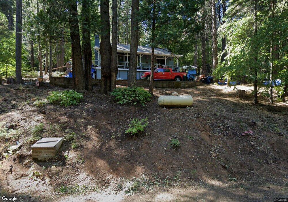
1235 Laurel Cir Arnold, CA 95223
Estimated Value: $270,655 - $292,000
2
Beds
1
Bath
1,040
Sq Ft
$269/Sq Ft
Est. Value
About This Home
This home is located at 1235 Laurel Cir, Arnold, CA 95223 and is currently estimated at $279,664, approximately $268 per square foot. 1235 Laurel Cir is a home with nearby schools including Bret Harte Union High School.
Ownership History
Date
Name
Owned For
Owner Type
Purchase Details
Closed on
May 3, 2022
Sold by
Minnie Correa
Bought by
Correa Minnie and Correa Barney Esequiel
Current Estimated Value
Home Financials for this Owner
Home Financials are based on the most recent Mortgage that was taken out on this home.
Original Mortgage
$155,500
Interest Rate
4.72%
Mortgage Type
New Conventional
Purchase Details
Closed on
Feb 2, 2005
Sold by
Correa Barney
Bought by
Correa Minnie
Home Financials for this Owner
Home Financials are based on the most recent Mortgage that was taken out on this home.
Original Mortgage
$135,000
Interest Rate
5.81%
Mortgage Type
Stand Alone Refi Refinance Of Original Loan
Create a Home Valuation Report for This Property
The Home Valuation Report is an in-depth analysis detailing your home's value as well as a comparison with similar homes in the area
Home Values in the Area
Average Home Value in this Area
Purchase History
| Date | Buyer | Sale Price | Title Company |
|---|---|---|---|
| Correa Minnie | -- | None Listed On Document | |
| Correa Minnie | -- | First American Title Company |
Source: Public Records
Mortgage History
| Date | Status | Borrower | Loan Amount |
|---|---|---|---|
| Previous Owner | Correa Minnie | $155,500 | |
| Previous Owner | Correa Minnie | $135,000 |
Source: Public Records
Tax History
| Year | Tax Paid | Tax Assessment Tax Assessment Total Assessment is a certain percentage of the fair market value that is determined by local assessors to be the total taxable value of land and additions on the property. | Land | Improvement |
|---|---|---|---|---|
| 2025 | $1,759 | $109,611 | $23,240 | $86,371 |
| 2023 | $1,711 | $105,357 | $22,339 | $83,018 |
| 2022 | $1,555 | $103,292 | $21,901 | $81,391 |
| 2021 | $1,545 | $101,268 | $21,472 | $79,796 |
| 2020 | $1,526 | $100,230 | $21,252 | $78,978 |
| 2019 | $1,507 | $98,266 | $20,836 | $77,430 |
| 2018 | $1,345 | $96,340 | $20,428 | $75,912 |
| 2017 | $1,315 | $94,452 | $20,028 | $74,424 |
| 2016 | $1,312 | $92,601 | $19,636 | $72,965 |
| 2015 | -- | $91,211 | $19,342 | $71,869 |
| 2014 | -- | $89,426 | $18,964 | $70,462 |
Source: Public Records
Map
Nearby Homes
- 791 Highway 4
- 845 Honey Ct
- 1111 California 4
- 1413 Gertrude Way
- 1578 Gloria Dr
- 1100-+ California 4
- 1002 Manuel Rd
- 2081 Jerrilynn Dr
- 15 Mill Creek Cir
- 31 Splash Dam Loop
- 2393 Stephanie Dr
- 1641 Meadowview Rd
- 1462 Pine Dr
- 1536 Meadowview Rd
- 646 Dean Way
- 729 Dawyn Dr
- 1567 2nd St
- 459 Dean Way
- 1660 Pine Dr
- 1648 2nd St
- 960 Ponderosa Way
- 1255 Laurel Cir
- 1281 Laurel Cir
- 880 Ponderosa Way
- 988 Ponderosa Way
- 1215 Laurel Cir
- 1012 Ponderosa Way
- 800 Ponderosa Way
- 1291 Laurel Cir
- 997 Ponderosa Way
- 1183 Laurel Cir
- 725 Ponderosa Way
- 796 Ponderosa Way
- 1171 Laurel Cir
- 1290 Laurel Cir
- 1313 Laurel Cir
- 1152 Laurel Cir
- 764 Ponderosa Way
- 709 Ponderosa Way
- 748 Ponderosa Way
Your Personal Tour Guide
Ask me questions while you tour the home.