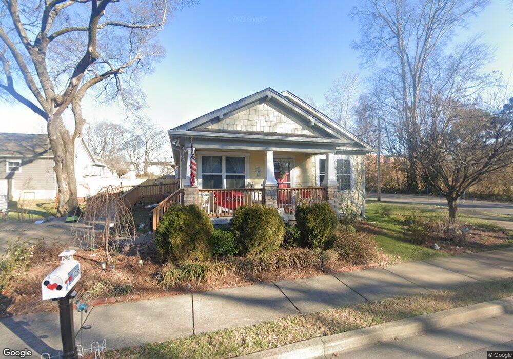
1235 Mulberry St Franklin, TN 37064
Central Franklin NeighborhoodEstimated Value: $391,000 - $517,000
--
Bed
--
Bath
1,091
Sq Ft
$422/Sq Ft
Est. Value
About This Home
This home is located at 1235 Mulberry St, Franklin, TN 37064 and is currently estimated at $459,996, approximately $421 per square foot. 1235 Mulberry St is a home with nearby schools including Johnson Elementary School, Freedom Intermediate School, and Freedom Middle School.
Ownership History
Date
Name
Owned For
Owner Type
Purchase Details
Closed on
Apr 1, 2010
Sold by
Habitat For Humanity Of Williamson Count
Bought by
Risser Anne M
Current Estimated Value
Home Financials for this Owner
Home Financials are based on the most recent Mortgage that was taken out on this home.
Original Mortgage
$120,000
Outstanding Balance
$79,805
Interest Rate
4.97%
Mortgage Type
Seller Take Back
Estimated Equity
$380,191
Create a Home Valuation Report for This Property
The Home Valuation Report is an in-depth analysis detailing your home's value as well as a comparison with similar homes in the area
Home Values in the Area
Average Home Value in this Area
Purchase History
| Date | Buyer | Sale Price | Title Company |
|---|---|---|---|
| Risser Anne M | $170,000 | None Available |
Source: Public Records
Mortgage History
| Date | Status | Borrower | Loan Amount |
|---|---|---|---|
| Open | Risser Anne M | $120,000 |
Source: Public Records
Tax History Compared to Growth
Tax History
| Year | Tax Paid | Tax Assessment Tax Assessment Total Assessment is a certain percentage of the fair market value that is determined by local assessors to be the total taxable value of land and additions on the property. | Land | Improvement |
|---|---|---|---|---|
| 2024 | $1,450 | $58,950 | $21,875 | $37,075 |
| 2023 | $1,385 | $58,950 | $21,875 | $37,075 |
| 2022 | $1,385 | $58,950 | $21,875 | $37,075 |
| 2021 | $1,385 | $58,950 | $21,875 | $37,075 |
| 2020 | $1,297 | $41,750 | $12,500 | $29,250 |
| 2019 | $1,297 | $41,750 | $12,500 | $29,250 |
| 2018 | $1,297 | $41,750 | $12,500 | $29,250 |
| 2017 | $1,297 | $41,750 | $12,500 | $29,250 |
| 2016 | $1,292 | $41,750 | $12,500 | $29,250 |
| 2015 | -- | $33,400 | $8,750 | $24,650 |
| 2014 | -- | $33,400 | $8,750 | $24,650 |
Source: Public Records
Map
Nearby Homes
- 180 Strahl St
- 6065 Stone Cliff Ln
- 6057 Stone Cliff Ln
- 305 Natchez St
- 300 Natchez St
- 254 Natchez St
- 107 Brilliantine Cir
- 102 Battlefield Dr
- 113 Bizerte Ct
- 1319 W Main St Unit 108
- 411 Forrest St
- 221 Adams Ct
- 1051 W Main St
- 416 Battle Ave
- 311 Ledgelawn Ct
- 1324 Adams St
- 1224 Adams St
- 422 Battle Ave
- 153 Generals Retreat Place Unit 153
- 1204 Brookwood Ave
- 1233 Mulberry St
- 318 Granbury St
- 1234 Carter St
- 1232 Carter St
- 1227 Mulberry St
- 320 Granbury St
- 0 Jameson Dr
- 1 Mulberry St
- 1230 Carter St
- 2090 Carter St
- 322 Granbury St
- 1228 Carter St
- 324 Granbury St
- 1226 Carter St
- 1224 Carter St
- 325 Granbury St
- 327 Granbury St Unit 327
- 327 Granbury St
- 329 Granbury St Unit 329
- 329 Granbury St Unit 327