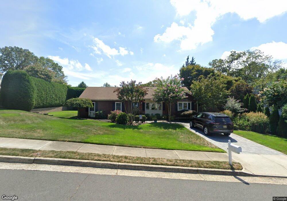
1235 Nan St Manasquan, NJ 08736
Estimated Value: $806,356 - $937,000
3
Beds
1
Bath
1,724
Sq Ft
$511/Sq Ft
Est. Value
About This Home
This home is located at 1235 Nan St, Manasquan, NJ 08736 and is currently estimated at $881,089, approximately $511 per square foot. 1235 Nan St is a home located in Monmouth County with nearby schools including Wall High School and The Brookside School.
Ownership History
Date
Name
Owned For
Owner Type
Purchase Details
Closed on
Aug 1, 2007
Sold by
Mcgrady William M and Mcgrady Suzanne
Bought by
Goss Mary
Current Estimated Value
Home Financials for this Owner
Home Financials are based on the most recent Mortgage that was taken out on this home.
Original Mortgage
$195,000
Outstanding Balance
$123,905
Interest Rate
6.73%
Mortgage Type
Purchase Money Mortgage
Estimated Equity
$757,184
Create a Home Valuation Report for This Property
The Home Valuation Report is an in-depth analysis detailing your home's value as well as a comparison with similar homes in the area
Home Values in the Area
Average Home Value in this Area
Purchase History
| Date | Buyer | Sale Price | Title Company |
|---|---|---|---|
| Goss Mary | $509,650 | Transnation Title Ins Co |
Source: Public Records
Mortgage History
| Date | Status | Borrower | Loan Amount |
|---|---|---|---|
| Open | Goss Mary | $195,000 |
Source: Public Records
Tax History
| Year | Tax Paid | Tax Assessment Tax Assessment Total Assessment is a certain percentage of the fair market value that is determined by local assessors to be the total taxable value of land and additions on the property. | Land | Improvement |
|---|---|---|---|---|
| 2025 | $8,792 | $416,700 | $250,000 | $166,700 |
| 2024 | $8,530 | $416,700 | $250,000 | $166,700 |
| 2023 | $8,530 | $416,700 | $250,000 | $166,700 |
| 2022 | $8,322 | $416,700 | $250,000 | $166,700 |
| 2021 | $8,322 | $416,700 | $250,000 | $166,700 |
| 2020 | $8,221 | $416,700 | $250,000 | $166,700 |
| 2019 | $8,121 | $416,700 | $250,000 | $166,700 |
| 2018 | $8,051 | $416,700 | $250,000 | $166,700 |
| 2017 | $7,892 | $416,700 | $250,000 | $166,700 |
| 2016 | $7,726 | $416,700 | $250,000 | $166,700 |
| 2015 | $7,502 | $254,300 | $133,900 | $120,400 |
| 2014 | $7,222 | $250,400 | $130,000 | $120,400 |
Source: Public Records
Map
Nearby Homes
- 432 Oval Rd
- 504 Old Bridge Rd
- 1041 Oval Rd Unit 5
- 14 Lebanon Dr
- 308 South St
- 816 Rathjen Rd
- 642 Rankin Rd
- 2513 Morningstar Rd
- 1533 Harvest Ln
- 2526 Morningstar Rd
- 846 William Dr
- 1544 Harvest Ln
- 2455 Dovetail Ct
- 2409 Robin Way
- 612 Union Ave
- 1215 Church St
- 1551 Holly Blvd
- 607 Cherokee Ln
- 130 Union Ave
- 2530 Ramshorn Dr
- 1233 Nan St
- 1237 Nan St
- 1306 Lenape Trail
- 2558 Stearns Dr
- 1308 Lenape Trail
- 2559 Constance Dr
- 1239 Nan St
- 1231 Nan St
- 1302 Lenape Trail
- 1238 Nan St
- 1310 Lenape Trail
- 2556 Stearns Dr
- 1307 Lenape Trail
- 1305 Lenape Trail
- 2557 Constance Dr
- 2581 Summit Rd
- 1300 Lenape Trail
- 2560 Constance Dr
- 2555 Stearns Dr
- 1303 Lenape Trail
Your Personal Tour Guide
Ask me questions while you tour the home.