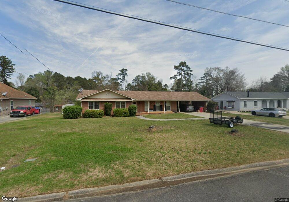
1235 Normandy Rd Macon, GA 31210
Estimated Value: $159,000 - $248,221
3
Beds
3
Baths
1,720
Sq Ft
$117/Sq Ft
Est. Value
About This Home
This home is located at 1235 Normandy Rd, Macon, GA 31210 and is currently estimated at $201,805, approximately $117 per square foot. 1235 Normandy Rd is a home located in Bibb County with nearby schools including Lane Elementary School, Howard Middle School, and Howard High School.
Ownership History
Date
Name
Owned For
Owner Type
Purchase Details
Closed on
Sep 26, 2022
Sold by
Flewellyn Robert Joseph
Bought by
Flewellyn Robert Blake
Current Estimated Value
Home Financials for this Owner
Home Financials are based on the most recent Mortgage that was taken out on this home.
Original Mortgage
$198,056
Outstanding Balance
$190,092
Interest Rate
6.02%
Mortgage Type
FHA
Estimated Equity
$11,713
Purchase Details
Closed on
Nov 23, 2021
Sold by
Slocumb Sherry N and Dillon Catherine N
Bought by
Flewellyn Robert Joseph
Purchase Details
Closed on
Sep 27, 2004
Bought by
Sparrow Morris D Life Est
Create a Home Valuation Report for This Property
The Home Valuation Report is an in-depth analysis detailing your home's value as well as a comparison with similar homes in the area
Home Values in the Area
Average Home Value in this Area
Purchase History
| Date | Buyer | Sale Price | Title Company |
|---|---|---|---|
| Flewellyn Robert Blake | $229,000 | -- | |
| Flewellyn Robert Joseph | $100,000 | None Available | |
| Sparrow Morris D Life Est | -- | -- |
Source: Public Records
Mortgage History
| Date | Status | Borrower | Loan Amount |
|---|---|---|---|
| Open | Flewellyn Robert Blake | $198,056 |
Source: Public Records
Tax History Compared to Growth
Tax History
| Year | Tax Paid | Tax Assessment Tax Assessment Total Assessment is a certain percentage of the fair market value that is determined by local assessors to be the total taxable value of land and additions on the property. | Land | Improvement |
|---|---|---|---|---|
| 2025 | $1,615 | $65,733 | $10,250 | $55,483 |
| 2024 | $1,669 | $65,733 | $10,250 | $55,483 |
| 2023 | $1,252 | $49,298 | $8,200 | $41,098 |
| 2022 | $1,966 | $56,790 | $7,821 | $48,969 |
| 2021 | $1,351 | $49,418 | $6,570 | $42,848 |
| 2020 | $1,331 | $48,129 | $6,570 | $41,559 |
| 2019 | $1,139 | $42,974 | $6,570 | $36,404 |
| 2018 | $1,692 | $39,127 | $5,944 | $33,183 |
| 2017 | $851 | $36,884 | $6,278 | $30,606 |
| 2016 | $720 | $35,273 | $6,278 | $28,995 |
| 2015 | $1,025 | $35,273 | $6,278 | $28,995 |
| 2014 | $1,397 | $37,581 | $6,976 | $30,606 |
Source: Public Records
Map
Nearby Homes
- 1209 Normandy Rd
- 1161 Ousley Place
- 870 Glen Hill Ct
- 3678 Northside Dr
- 3640 Northside Dr
- 859 Forest Lake Dr S
- 3622 Northside Dr
- 3602 Northside Dr
- 1197 Matthews Place
- 825 Forest Lake Dr S
- 1246 Newport Rd
- 1270 Lake Valley Rd
- 1344 Lake Valley Rd
- 3500 Northside Dr
- 753 Lokchapee Dr
- 4070 Carrie Ct
- 731 Lokchapee Dr
- 1224 Timberlane Dr
- 4015 Elnora Dr
- 636 Lokchapee Ridge
- 1227 Normandy Rd
- 1247 Normandy Rd
- 1037 Ousley Place
- 1047 Ousley Place
- 1219 Normandy Rd
- 1253 Normandy Rd
- 1236 Normandy Rd
- 1029 Ousley Place
- 1061 Ousley Place
- 1244 Normandy Rd
- 1244 Normandy Rd Unit H11
- 1228 Normandy Rd
- 1252 Normandy Rd
- 1259 Normandy Rd
- 1220 Normandy Rd
- 1019 Ousley Place
- 1071 Ousley Place
- 1258 Normandy Rd
- 1210 Normandy Rd
- 1210 Normandy Rd Unit 7