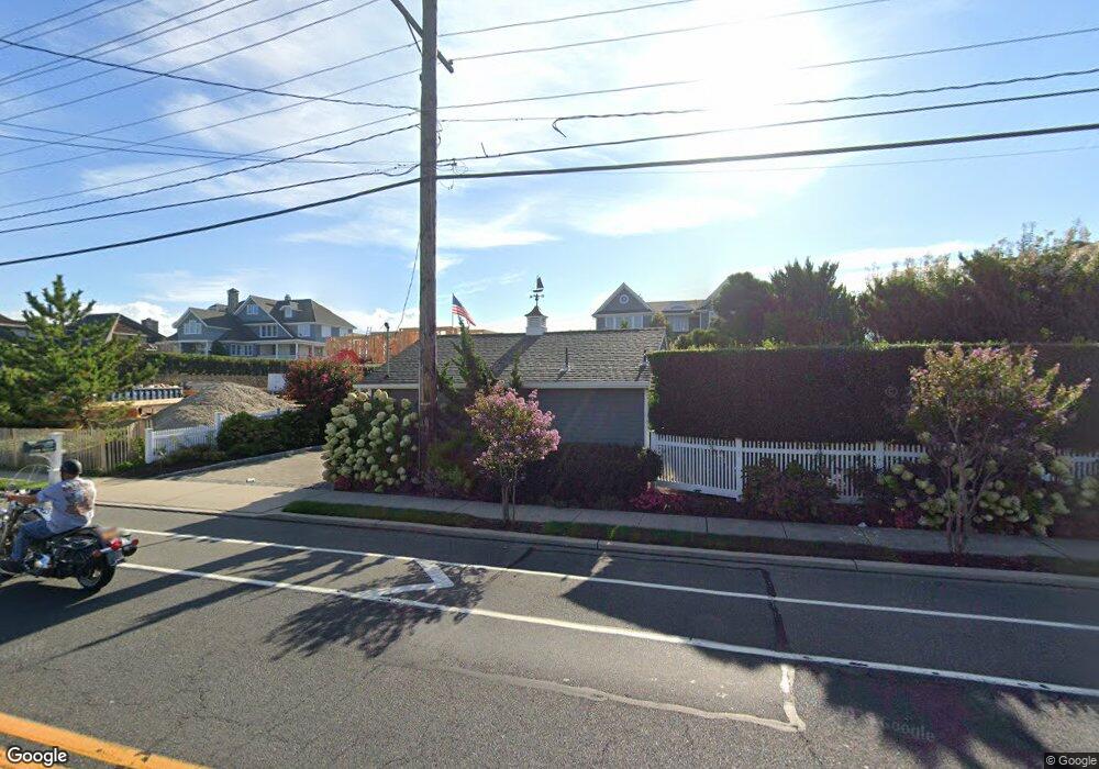
1235 Ocean Ave Mantoloking, NJ 08738
Estimated Value: $4,219,000 - $6,885,000
7
Beds
7
Baths
3,116
Sq Ft
$1,730/Sq Ft
Est. Value
About This Home
This home is located at 1235 Ocean Ave, Mantoloking, NJ 08738 and is currently estimated at $5,389,798, approximately $1,729 per square foot. 1235 Ocean Ave is a home located in Ocean County with nearby schools including G Harold Antrim Elementary School, Point Pleasant Beach High School, and St. Peter School.
Ownership History
Date
Name
Owned For
Owner Type
Purchase Details
Closed on
Aug 20, 2024
Sold by
Murray William J and Murray Joan M
Bought by
Joans Beach Llc
Current Estimated Value
Purchase Details
Closed on
Mar 22, 2011
Sold by
Murray William J and Murray Joan M
Bought by
Murray William J and Murray Joan M
Purchase Details
Closed on
Oct 1, 2002
Create a Home Valuation Report for This Property
The Home Valuation Report is an in-depth analysis detailing your home's value as well as a comparison with similar homes in the area
Home Values in the Area
Average Home Value in this Area
Purchase History
| Date | Buyer | Sale Price | Title Company |
|---|---|---|---|
| Joans Beach Llc | -- | First Jersey Title Services | |
| Joans Beach Llc | -- | First Jersey Title Services | |
| Murray William J | -- | None Available | |
| -- | $5,200,000 | -- |
Source: Public Records
Tax History
| Year | Tax Paid | Tax Assessment Tax Assessment Total Assessment is a certain percentage of the fair market value that is determined by local assessors to be the total taxable value of land and additions on the property. | Land | Improvement |
|---|---|---|---|---|
| 2025 | $44,984 | $4,932,500 | $2,945,300 | $1,987,200 |
| 2024 | $40,249 | $4,932,500 | $2,945,300 | $1,987,200 |
| 2023 | $34,528 | $4,932,500 | $2,945,300 | $1,987,200 |
| 2022 | $34,528 | $4,932,500 | $2,945,300 | $1,987,200 |
| 2021 | $34,725 | $4,932,500 | $2,945,300 | $1,987,200 |
| 2020 | $35,119 | $4,932,500 | $2,945,300 | $1,987,200 |
| 2019 | $34,626 | $4,932,500 | $2,945,300 | $1,987,200 |
| 2018 | $34,133 | $4,932,500 | $2,945,300 | $1,987,200 |
| 2017 | $24,041 | $3,449,200 | $2,945,300 | $503,900 |
| 2016 | $23,937 | $3,449,200 | $2,945,300 | $503,900 |
| 2015 | $23,558 | $3,449,200 | $2,945,300 | $503,900 |
| 2014 | $21,626 | $3,449,200 | $2,945,300 | $503,900 |
Source: Public Records
Map
Nearby Homes
- 1318 Ocean Ave
- 1207 Ocean Ave
- 1201 Ocean Ave
- 1107 Barnegat Ln
- 1501 Ocean Ave
- 1521 Ocean Ave
- 1519 Runyon Ln
- 1581 Ocean Ave
- 1063 Ocean Ave
- 122 Squan Beach Dr
- 233 Curtis Point Dr
- 150 Sunset Ln
- 1027 Ocean Ave
- 275 Curtis Point Dr
- 181 Squan Beach Dr
- 954 Barnegat Ln
- 948 Lagoon Ln S
- 940 Barnegat Ln
- 923 Barnegat Ln
- 311 Brigantine Ln
- 1237 Ocean Ave
- 1229 Ocean Ave
- 1238 Ocean Ave
- 1234 Ocean Ave
- 1228 Ocean Ave
- 1225 Ocean Ave
- 209 Downer Ave Unit 1e
- 209 Downer Ave Unit 2 W
- 1224 Ocean Ave
- 1300 Ocean Ave
- 1221 Ocean Ave
- 1301 Ocean Ave
- 201 Downer Ave
- 1220 Ocean Ave
- 1231 Bay Ave
- 1235 Bay Ave
- 1229 Bay Ave
- 1306 Ocean Ave
- 1217 Ocean Ave
- 1307 Ocean Ave
Your Personal Tour Guide
Ask me questions while you tour the home.