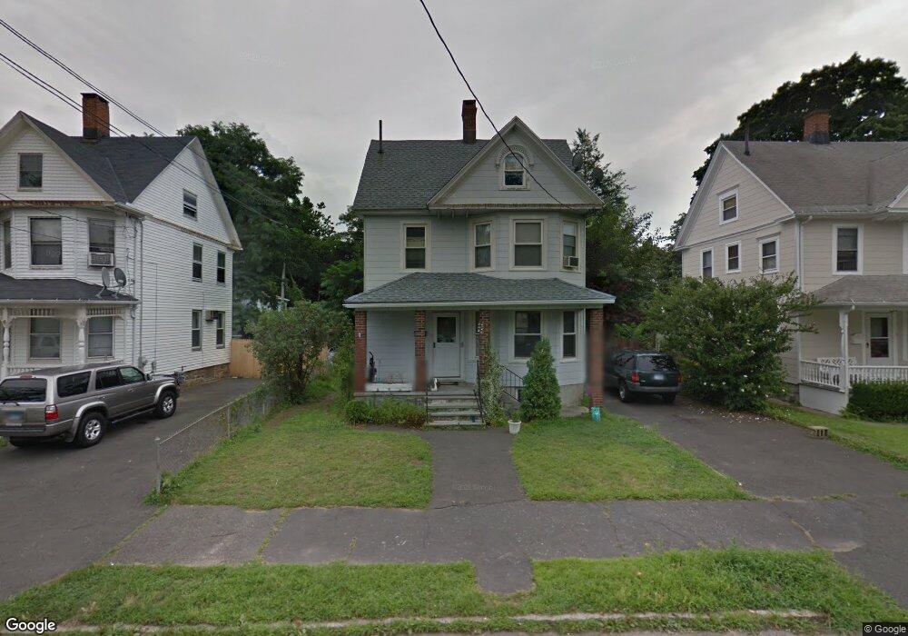
1235 Wood Ave Bridgeport, CT 06604
Brooklawn-Saint Vincent NeighborhoodEstimated Value: $322,000 - $489,054
3
Beds
2
Baths
1,280
Sq Ft
$294/Sq Ft
Est. Value
About This Home
This home is located at 1235 Wood Ave, Bridgeport, CT 06604 and is currently estimated at $376,764, approximately $294 per square foot. 1235 Wood Ave is a home located in Fairfield County with nearby schools including Blackham School, Central High School, and Assumption Catholic School.
Ownership History
Date
Name
Owned For
Owner Type
Purchase Details
Closed on
Oct 13, 2011
Sold by
Hsbc Bank Usa Na
Bought by
Fernandez Robert
Current Estimated Value
Purchase Details
Closed on
Nov 8, 2006
Sold by
Carne Douglas and Carne Robert
Bought by
Rodas Santiago
Home Financials for this Owner
Home Financials are based on the most recent Mortgage that was taken out on this home.
Original Mortgage
$176,000
Interest Rate
6.31%
Create a Home Valuation Report for This Property
The Home Valuation Report is an in-depth analysis detailing your home's value as well as a comparison with similar homes in the area
Home Values in the Area
Average Home Value in this Area
Purchase History
| Date | Buyer | Sale Price | Title Company |
|---|---|---|---|
| Fernandez Robert | $62,500 | -- | |
| Fernandez Robert | $62,500 | -- | |
| Rodas Santiago | $220,000 | -- | |
| Rodas Santiago | $220,000 | -- |
Source: Public Records
Mortgage History
| Date | Status | Borrower | Loan Amount |
|---|---|---|---|
| Previous Owner | Rodas Santiago | $176,000 | |
| Previous Owner | Rodas Santiago | $33,000 |
Source: Public Records
Tax History Compared to Growth
Tax History
| Year | Tax Paid | Tax Assessment Tax Assessment Total Assessment is a certain percentage of the fair market value that is determined by local assessors to be the total taxable value of land and additions on the property. | Land | Improvement |
|---|---|---|---|---|
| 2025 | $5,897 | $135,728 | $42,398 | $93,330 |
| 2024 | $5,897 | $135,728 | $42,398 | $93,330 |
| 2023 | $5,897 | $135,728 | $42,398 | $93,330 |
| 2022 | $5,897 | $135,728 | $42,398 | $93,330 |
| 2021 | $5,897 | $135,728 | $42,398 | $93,330 |
| 2020 | $4,687 | $86,810 | $25,700 | $61,110 |
| 2019 | $4,687 | $86,810 | $25,700 | $61,110 |
| 2018 | $4,720 | $86,810 | $25,700 | $61,110 |
| 2017 | $4,720 | $86,810 | $25,700 | $61,110 |
| 2016 | $4,720 | $86,810 | $25,700 | $61,110 |
| 2015 | $4,605 | $109,120 | $28,480 | $80,640 |
| 2014 | $4,605 | $109,120 | $28,480 | $80,640 |
Source: Public Records
Map
Nearby Homes
- 1213 Wood Ave
- 605 Brooklawn Ave
- 665 W Taft Ave
- 1480 Capitol Ave Unit 811
- 1473 Wood Ave
- 2445 Park Ave Unit 23
- 2345 Park Ave
- 1275 Capitol Ave
- 356 Taft Ave
- 2625 Park Ave Unit 12L
- 2625 Park Ave Unit 5S
- 2625 Park Ave Unit 5N
- 184 Pacific St
- 2675 Park Ave Unit 3
- 2675 Park Ave Unit 22
- 860 Briarwood Ave
- 687 Wood Ave
- 1872 North Ave Unit 1874
- 201 High Ridge Dr
- 2370 North Ave Unit 4C
- 1233 Wood Ave
- 791 Cleveland Ave
- 40 Arcadia Ave
- 60 Arcadia Ave
- 771 Cleveland Ave
- 769 Cleveland Ave
- 809 Cleveland Ave
- 795 Cleveland Ave
- 779 Cleveland Ave
- 70 Arcadia Ave
- 12 Arcadia Ave
- 1223 Wood Ave
- 751 Cleveland Ave
- 10 Arcadia Ave
- 82 Arcadia Ave
- 1209 Wood Ave
- 1231 Wood Ave
- 780 Cleveland Ave
- 811 Cleveland Ave
- 741 Cleveland Ave