Estimated Value: $353,000 - $420,000
--
Bed
3
Baths
1,556
Sq Ft
$243/Sq Ft
Est. Value
About This Home
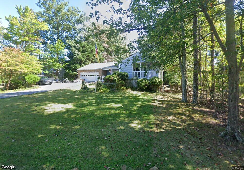
This home is located at 12352 Silver Rock Cir, Lusby, MD 20657 and is currently estimated at $377,817, approximately $242 per square foot. 12352 Silver Rock Cir is a home located in Calvert County with nearby schools including Patuxent Appeal Elementary Campus, Mill Creek Middle School, and Patuxent High School.
Ownership History
Date
Name
Owned For
Owner Type
Purchase Details
Closed on
Nov 1, 2023
Sold by
Baker Everett
Bought by
Baker Everett and Leins Baker Susan
Current Estimated Value
Purchase Details
Closed on
Aug 1, 1986
Sold by
Schucker James P and Schucker Linda V
Bought by
Baker Everett and Baker Kathy L
Home Financials for this Owner
Home Financials are based on the most recent Mortgage that was taken out on this home.
Original Mortgage
$90,000
Interest Rate
10.4%
Purchase Details
Closed on
Nov 7, 1984
Sold by
Velonis John A and Velonis Judy L
Bought by
Schucker James P and Schucker Linda
Create a Home Valuation Report for This Property
The Home Valuation Report is an in-depth analysis detailing your home's value as well as a comparison with similar homes in the area
Home Values in the Area
Average Home Value in this Area
Purchase History
| Date | Buyer | Sale Price | Title Company |
|---|---|---|---|
| Baker Everett | -- | None Listed On Document | |
| Baker Everett | -- | None Listed On Document | |
| Baker Everett | $100,000 | -- | |
| Schucker James P | $77,600 | -- |
Source: Public Records
Mortgage History
| Date | Status | Borrower | Loan Amount |
|---|---|---|---|
| Previous Owner | Baker Everett | $90,000 |
Source: Public Records
Tax History Compared to Growth
Tax History
| Year | Tax Paid | Tax Assessment Tax Assessment Total Assessment is a certain percentage of the fair market value that is determined by local assessors to be the total taxable value of land and additions on the property. | Land | Improvement |
|---|---|---|---|---|
| 2025 | $432 | $336,567 | $0 | $0 |
| 2024 | $432 | $306,733 | $0 | $0 |
| 2023 | $154 | $276,900 | $55,200 | $221,700 |
| 2022 | $2,710 | $260,867 | $0 | $0 |
| 2021 | $852 | $244,833 | $0 | $0 |
| 2020 | $2,809 | $228,800 | $55,200 | $173,600 |
| 2019 | $2,400 | $228,800 | $55,200 | $173,600 |
| 2018 | $2,400 | $228,800 | $55,200 | $173,600 |
| 2017 | $2,894 | $236,900 | $0 | $0 |
| 2016 | -- | $236,900 | $0 | $0 |
| 2015 | $3,356 | $236,900 | $0 | $0 |
| 2014 | $3,356 | $240,200 | $0 | $0 |
Source: Public Records
Map
Nearby Homes
- 650 Silver Rock Rd
- 11616 Deadwood Dr
- 645 Red Rock Trail
- 634 Silver Rock Rd
- 11609 Deadwood Dr
- 12446 Dalton Trail
- 370 Thunderbird Dr
- 389 Thunderbird Dr
- 360 Thunderbird Dr
- 646 White Rock Rd
- 383 Red Cloud Rd
- 11561 Senora Ln
- 735 Lazy River Rd
- 513 Cody Trail
- 12284 Bandera Ln
- 12407 Tahoe Ct
- 630 Palo Alto Ct
- 316 Thunderbird Dr
- 12115 Long Wolf Ln
- 12476 Catalina Dr
- 12358 Silver Rock Cir
- 12328 Silver Rock Cir
- 12386 Silver Rock Cir
- 12390 Silver Rock Cir
- 12380 Silver Rock Cir
- 12300 Silver Rock Cir
- 12339 Silver Rock Cir
- 12359 Silver Rock Cir
- 12347 Silver Rock Cir
- 12343 Silver Rock Cir
- 12335 Silver Rock Cir
- 12361 Silver Rock Cir
- 12355 Silver Rock Cir
- 12351 Silver Rock Cir
- 12310 Silver Rock Cir
- 12363 Silver Rock Cir
- 12331 Silver Rock Cir
- 12327 Silver Rock Cir
- 12367 Silver Rock Cir
- 12383 Silver Rock Cir