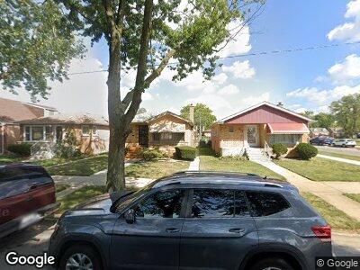
12355 S Loomis St Calumet Park, IL 60827
Calumet Park NeighborhoodEstimated Value: $178,155 - $214,000
3
Beds
2
Baths
1,136
Sq Ft
$173/Sq Ft
Est. Value
About This Home
This home is located at 12355 S Loomis St, Calumet Park, IL 60827 and is currently estimated at $196,289, approximately $172 per square foot. 12355 S Loomis St is a home located in Cook County with nearby schools including Burr Oak Academy, Calumet Middle School, and Harold L. Richards High School.
Ownership History
Date
Name
Owned For
Owner Type
Purchase Details
Closed on
Sep 7, 2005
Sold by
Chicago Title Land Trust Co
Bought by
Davis John C
Current Estimated Value
Home Financials for this Owner
Home Financials are based on the most recent Mortgage that was taken out on this home.
Original Mortgage
$145,713
Interest Rate
5.93%
Mortgage Type
FHA
Purchase Details
Closed on
Dec 2, 1999
Sold by
Wilson Kater and Wilson Carlene
Bought by
Old Kent Bank and Trust #16500
Create a Home Valuation Report for This Property
The Home Valuation Report is an in-depth analysis detailing your home's value as well as a comparison with similar homes in the area
Home Values in the Area
Average Home Value in this Area
Purchase History
| Date | Buyer | Sale Price | Title Company |
|---|---|---|---|
| Davis John C | $148,000 | Ticor Title | |
| Old Kent Bank | -- | -- |
Source: Public Records
Mortgage History
| Date | Status | Borrower | Loan Amount |
|---|---|---|---|
| Open | Davis John C | $147,898 | |
| Closed | Davis John C | $145,713 |
Source: Public Records
Tax History Compared to Growth
Tax History
| Year | Tax Paid | Tax Assessment Tax Assessment Total Assessment is a certain percentage of the fair market value that is determined by local assessors to be the total taxable value of land and additions on the property. | Land | Improvement |
|---|---|---|---|---|
| 2024 | $1,008 | $12,906 | $2,625 | $10,281 |
| 2023 | $1,008 | $12,906 | $2,625 | $10,281 |
| 2022 | $1,008 | $7,727 | $2,297 | $5,430 |
| 2021 | $216 | $7,725 | $2,296 | $5,429 |
| 2020 | $198 | $7,725 | $2,296 | $5,429 |
| 2019 | $205 | $8,258 | $2,078 | $6,180 |
| 2018 | $209 | $9,417 | $2,078 | $7,339 |
| 2017 | $2,473 | $10,496 | $2,078 | $8,418 |
| 2016 | $1,763 | $7,584 | $1,859 | $5,725 |
| 2015 | $2,039 | $8,482 | $1,859 | $6,623 |
| 2014 | $3,238 | $10,659 | $1,859 | $8,800 |
| 2013 | $3,207 | $11,692 | $1,859 | $9,833 |
Source: Public Records
Map
Nearby Homes
- 1415 W 123rd St
- 1301 W 123rd St
- 12231 S Loomis St
- 12509 S Bishop St
- 12512 S Loomis St
- 12529 S Loomis St
- 12310 S Racine Ave
- 12226 S Elizabeth St
- 12509 S Justine St
- 12153 S Loomis St
- 1541 W Asher St Unit 10D
- 12312 S May St
- 12426 S May St
- 12613 S Bishop St
- 12411 S May St
- 12128 S Bishop St
- 12538 S Justine St
- 12629 S Throop St
- 12537 S Marshfield Ave
- 12239 S Aberdeen St
- 12355 S Loomis St
- 12361 S Loomis St
- 12353 S Loomis St
- 12351 S Loomis St
- 12349 S Loomis St
- 12354 S Ada St
- 12345 S Loomis St
- 12360 S Ada St
- 12352 S Ada St
- 12350 S Ada St
- 12348 S Ada St
- 12341 S Loomis St
- 12400 S Ada St
- 12354 S Loomis St
- 12352 S Loomis St
- 12360 S Loomis St
- 12344 S Ada St
- 12350 S Loomis St
- 12337 S Loomis St
- 12344 S Loomis St