Estimated Value: $648,000 - $765,000
4
Beds
2
Baths
1,241
Sq Ft
$579/Sq Ft
Est. Value
About This Home
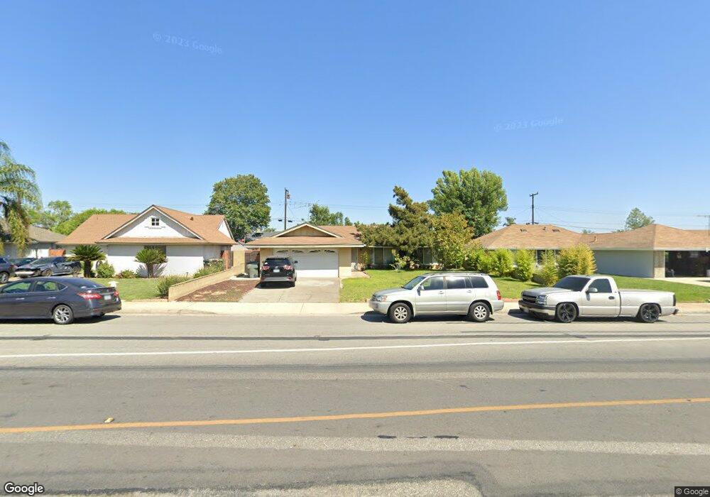
This home is located at 12365 Benson Ave, Chino, CA 91710 and is currently estimated at $718,749, approximately $579 per square foot. 12365 Benson Ave is a home located in San Bernardino County with nearby schools including Walnut Avenue Elementary, Magnolia Junior High, and Chino High School.
Ownership History
Date
Name
Owned For
Owner Type
Purchase Details
Closed on
May 10, 2016
Sold by
Reguindin Anthony and Reguindin Marissa
Bought by
Anthony Cabanban Reguindin and Anthony Marissa Sen
Current Estimated Value
Purchase Details
Closed on
Apr 27, 2004
Sold by
Thompson Donald L
Bought by
Reguindin Anthony and Reguindin Marissa
Home Financials for this Owner
Home Financials are based on the most recent Mortgage that was taken out on this home.
Original Mortgage
$271,600
Interest Rate
5.99%
Mortgage Type
Purchase Money Mortgage
Purchase Details
Closed on
Jul 16, 2003
Sold by
Thompson Donald L
Bought by
Thompson Donald L and Donald L Thompson Trust
Create a Home Valuation Report for This Property
The Home Valuation Report is an in-depth analysis detailing your home's value as well as a comparison with similar homes in the area
Home Values in the Area
Average Home Value in this Area
Purchase History
| Date | Buyer | Sale Price | Title Company |
|---|---|---|---|
| Anthony Cabanban Reguindin | -- | None Available | |
| Reguindin Anthony | $340,000 | Fidelity National Title Co | |
| Thompson Donald L | -- | -- |
Source: Public Records
Mortgage History
| Date | Status | Borrower | Loan Amount |
|---|---|---|---|
| Previous Owner | Reguindin Anthony | $271,600 |
Source: Public Records
Tax History Compared to Growth
Tax History
| Year | Tax Paid | Tax Assessment Tax Assessment Total Assessment is a certain percentage of the fair market value that is determined by local assessors to be the total taxable value of land and additions on the property. | Land | Improvement |
|---|---|---|---|---|
| 2025 | $5,287 | $494,133 | $168,946 | $325,187 |
| 2024 | $5,287 | $484,444 | $165,633 | $318,811 |
| 2023 | $5,140 | $474,945 | $162,385 | $312,560 |
| 2022 | $5,108 | $465,632 | $159,201 | $306,431 |
| 2021 | $5,007 | $456,502 | $156,079 | $300,423 |
| 2020 | $4,941 | $451,822 | $154,479 | $297,343 |
| 2019 | $4,853 | $442,963 | $151,450 | $291,513 |
| 2018 | $4,388 | $401,900 | $141,100 | $260,800 |
| 2017 | $4,085 | $373,900 | $131,300 | $242,600 |
| 2016 | $3,705 | $356,000 | $125,000 | $231,000 |
| 2015 | $3,508 | $339,000 | $119,000 | $220,000 |
| 2014 | $3,601 | $348,000 | $122,000 | $226,000 |
Source: Public Records
Map
Nearby Homes
- 12351 Twin Gables Dr
- 5610 Guardian Way
- 12524 Ross Ave
- 12321 Gardenia Place
- 2321 S Magnolia Ave Unit 6E
- 12796 17th St
- 12811 Oaks Ave
- 5640 Riverside Dr Unit 119
- 5382 Park Place
- 12836 12th St Unit 27
- 12635 Franklin Ct Unit 8b
- 12951 Red Cedar Way
- 5925 Riverside Dr Unit 12
- 11782 Vernon Ave
- 12951 Benson Ave Unit 118
- 926 W Philadelphia St Unit 49
- 926 W Philadelphia St Unit R99
- 926 W Philadelphia St Unit 10
- 5500 Francis Ave
- 6031 Rosa Ct
- 12355 Benson Ave
- 12375 Benson Ave
- 12366 Cedar Ave
- 12345 Benson Ave
- 12385 Benson Ave
- 12356 Cedar Ave
- 12376 Cedar Ave
- 12386 Cedar Ave
- 12346 Cedar Ave
- 12335 Benson Ave
- 12395 Benson Ave
- 5688 Guardian Way
- 12355 Twin Gables Dr
- 12336 Cedar Ave
- 12396 Cedar Ave
- 12343 Twin Gables Dr
- 5680 Guardian Way
- 12405 Benson Ave
- 5671 Buckthorn Ct
- 5671 Beechtree Ave