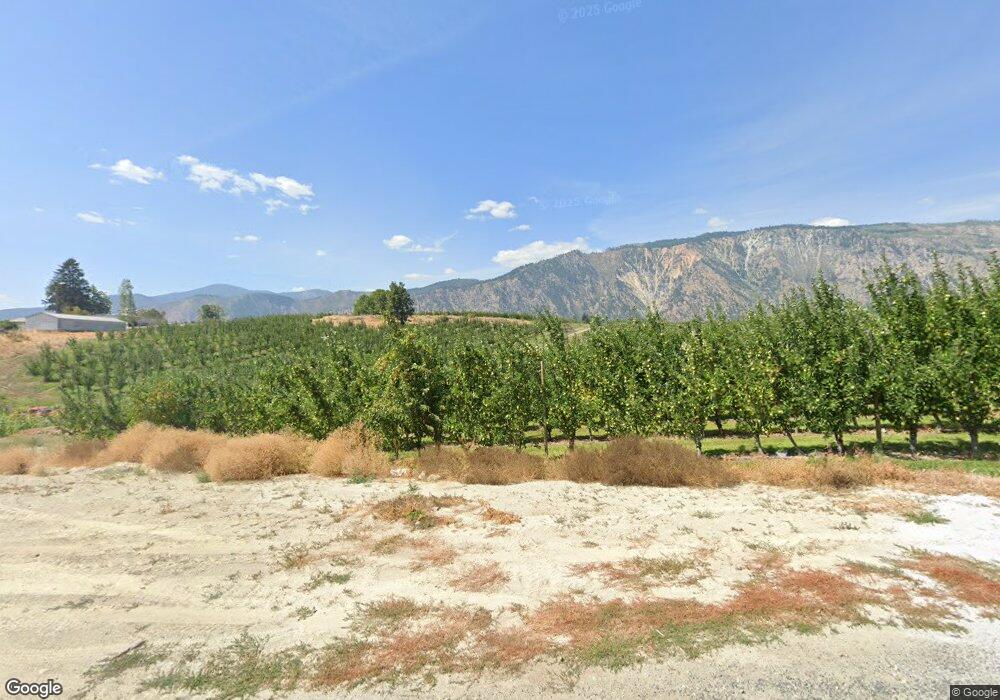
1237 Dry Lake Rd Manson, WA 98831
Estimated Value: $739,000 - $1,657,963
--
Bed
--
Bath
1,840
Sq Ft
$678/Sq Ft
Est. Value
About This Home
This home is located at 1237 Dry Lake Rd, Manson, WA 98831 and is currently estimated at $1,247,988, approximately $678 per square foot. 1237 Dry Lake Rd is a home located in Chelan County with nearby schools including Manson Elementary School and Manson High School.
Ownership History
Date
Name
Owned For
Owner Type
Purchase Details
Closed on
Jul 9, 2013
Sold by
England Lesa Lynn and England Jeffrey
Bought by
England Jeffrey and England Aleasha M
Current Estimated Value
Purchase Details
Closed on
Apr 29, 2011
Sold by
England Len
Bought by
England Jeffrey
Purchase Details
Closed on
Jul 8, 2010
Sold by
North Columbia Properties Llc
Bought by
England Len and England Lesa Lynn
Purchase Details
Closed on
Apr 30, 2008
Sold by
North Columbia Properties Llc
Bought by
England Len and England Lisa Lynn
Create a Home Valuation Report for This Property
The Home Valuation Report is an in-depth analysis detailing your home's value as well as a comparison with similar homes in the area
Home Values in the Area
Average Home Value in this Area
Purchase History
| Date | Buyer | Sale Price | Title Company |
|---|---|---|---|
| England Jeffrey | -- | None Available | |
| England Jeffrey | -- | None Available | |
| England Len | $240,000 | None Available | |
| England Len | $240,000 | Transnation Title Insurance |
Source: Public Records
Tax History Compared to Growth
Tax History
| Year | Tax Paid | Tax Assessment Tax Assessment Total Assessment is a certain percentage of the fair market value that is determined by local assessors to be the total taxable value of land and additions on the property. | Land | Improvement |
|---|---|---|---|---|
| 2021 | $8,690 | $1,006,025 | $256,285 | $749,740 |
| 2020 | $6,191 | $758,685 | $205,804 | $552,881 |
| 2019 | $5,315 | $645,213 | $178,623 | $466,590 |
| 2018 | $6,088 | $548,195 | $188,330 | $359,865 |
| 2017 | $5,120 | $598,804 | $126,201 | $472,603 |
| 2016 | $1,468 | $545,792 | $130,084 | $415,708 |
| 2015 | $1,468 | $456,737 | $124,259 | $332,478 |
| 2013 | $1,468 | $133,714 | $116,493 | $17,221 |
Source: Public Records
Map
Nearby Homes
- 0 Lower Joe Creek Rd Unit NWM2441658
- 75 Lewman Hubbard Ln Parcel A
- 75 Lewman Hubbard Ln Parcel B
- 157 Lainey Ln
- 149 Lainey Ln
- 115 Lainey Ln
- 0 Lainey Ln Unit NWM2355054
- 142 Lainey Ln
- 116 Lainey Ln
- 0 Loop Ave
- 700 E Wapato Lake Rd
- 555 Loop Ave
- 2975 Manson Blvd
- 431 Glory View Ln
- 900 Lower Joe Creek Rd
- 0 xxx Summit Blvd
- 0 Glory View Ln Unit Lot 3 NWM2389629
- 0 Glory View Ln Unit Lot 2 NWM2389627
- 0 Glory View Ln Unit Lot 1 NWM2389628
- 0 Glory View Ln Unit Lot 4 NWM2388419
- 95 Apricot Ln
- 95 Apricot Ln
- 1115 Dry Lake Rd
- 1011 Dry Lake Rd
- 1139 Dry Lake Rd
- 10 Wine Garden Ln
- 4720 Wapato Lake Rd
- 4750 Wapato Lake Rd
- 40 Fishermen Place
- 40 Sunset Place
- 56 Fishermen Place
- 22 Fishermen Place
- 74 Sunset Place
- 74 Fishermen Place
- 80 Fishermen Place
- 80 Sunset Place
- 75 Kamei Place
- 92 Fishermen Place
- 4560 Wapato Lake Rd
- 47 Kamei Place
