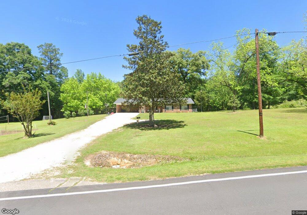
1237 Lower Myrick Rd Laurel, MS 39443
Estimated Value: $158,000 - $214,000
Studio
--
Bath
1,428
Sq Ft
$127/Sq Ft
Est. Value
About This Home
This home is located at 1237 Lower Myrick Rd, Laurel, MS 39443 and is currently estimated at $181,228, approximately $126 per square foot. 1237 Lower Myrick Rd is a home located in Jones County with nearby schools including East Jones Elementary School.
Ownership History
Date
Name
Owned For
Owner Type
Purchase Details
Closed on
Jun 2, 2020
Sold by
Ishee Seth Michael
Bought by
Herrington Casey C and Herrington Melanie L
Current Estimated Value
Purchase Details
Closed on
Nov 13, 2014
Sold by
Not Provided
Bought by
Herrington Casey C and Herrington Melanie L
Home Financials for this Owner
Home Financials are based on the most recent Mortgage that was taken out on this home.
Original Mortgage
$11,272,000
Interest Rate
4%
Mortgage Type
Purchase Money Mortgage
Create a Home Valuation Report for This Property
The Home Valuation Report is an in-depth analysis detailing your home's value as well as a comparison with similar homes in the area
Purchase History
| Date | Buyer | Sale Price | Title Company |
|---|---|---|---|
| Herrington Casey C | -- | -- | |
| Herrington Casey C | -- | -- |
Source: Public Records
Mortgage History
| Date | Status | Borrower | Loan Amount |
|---|---|---|---|
| Previous Owner | Herrington Casey C | $11,272,000 |
Source: Public Records
Tax History
| Year | Tax Paid | Tax Assessment Tax Assessment Total Assessment is a certain percentage of the fair market value that is determined by local assessors to be the total taxable value of land and additions on the property. | Land | Improvement |
|---|---|---|---|---|
| 2025 | $633 | $7,747 | $0 | $0 |
| 2024 | $654 | $7,540 | $0 | $0 |
| 2023 | $654 | $7,520 | $0 | $0 |
| 2022 | $673 | $7,522 | $0 | $0 |
| 2021 | $678 | $7,525 | $0 | $0 |
| 2020 | $703 | $7,583 | $0 | $0 |
| 2019 | $713 | $7,631 | $0 | $0 |
| 2018 | $713 | $7,631 | $0 | $0 |
| 2017 | $711 | $7,626 | $0 | $0 |
| 2016 | $634 | $7,115 | $0 | $0 |
| 2015 | -- | $7,082 | $0 | $0 |
Source: Public Records
Map
Nearby Homes
- 0 Walt Culpepper Rd
- 215 Church Dr
- 582 Antioch Dr
- 7 G Morgan Rd
- 73 Pine Dr
- 310 Antioch Dr
- 0 Pine Dr
- 302 Freedom Rd
- 10 Shadow Ridge Dr
- 16 Shadow Ridge Dr
- 17 Shadow Ridge Dr
- 12 Timber Ridge
- 19 Shadow Ridge Dr
- 22 Shadow Ridge Dr
- 30 Shadow Ridge Dr
- 00 Timber Ridge Dr
- 8 Shadow Ridge Dr
- 00 N Forrest Road 205
- 135 Gatlin Jordan Rd
- 664 Township Rd
- 1237 Lower Myrick Rd
- 1242 Lower Myrick Rd
- 1264 Lower Myrick Rd
- 1276 Lower Myrick Rd
- 26 Mollie Boutwell Rd
- 1279 Lower Myrick Rd
- 32 Mollie Boutwell Rd
- 1202 Lower Myrick Rd
- 9 Mollie Boutwell Rd
- 23 Mollie Boutwell Rd
- 1195 Lower Myrick Rd
- 7 Malone Rd
- 17 Mollie Boutwell Rd
- 1196 Lower Myrick Rd
- 33 Mollie Boutwell Rd
- 46 Mollie Boutwell Rd
- 1296 Lower Myrick Rd
- 68 Mollie Boutwell Rd
- 14 Clark Cemetery Rd
- 1187 Lower Myrick Rd
Your Personal Tour Guide
Ask me questions while you tour the home.