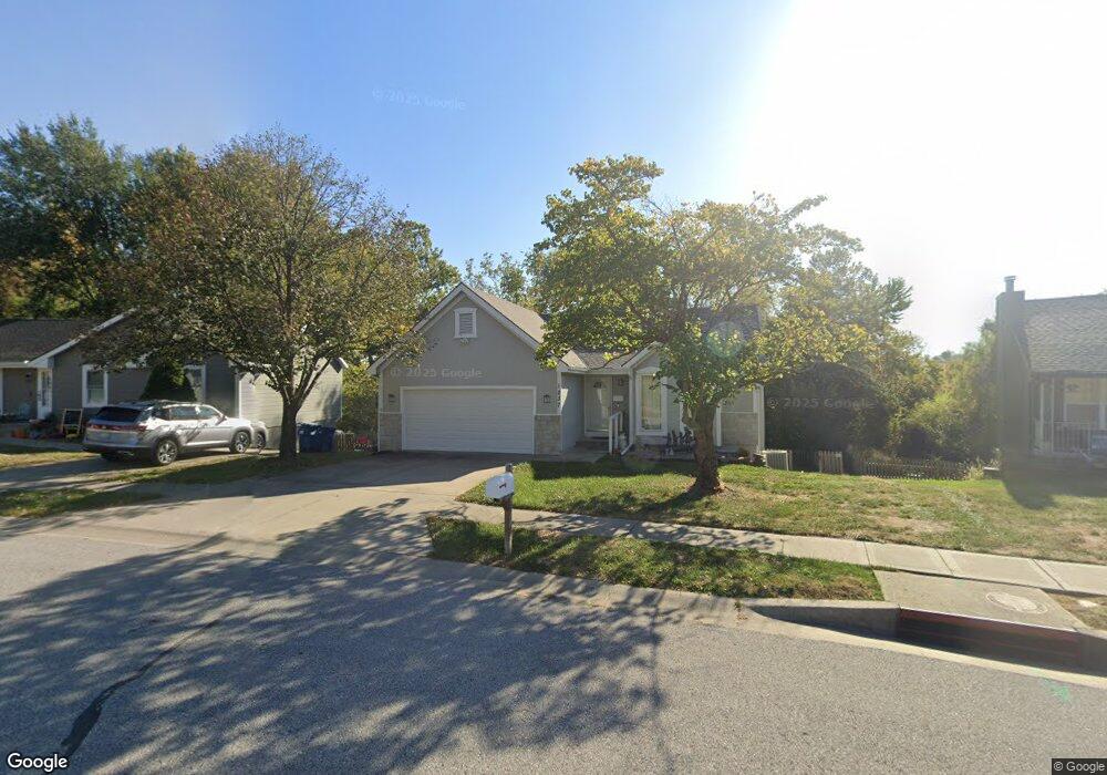
1237 Pheasant Ct Liberty, MO 64068
Estimated Value: $275,000 - $312,000
3
Beds
3
Baths
1,018
Sq Ft
$292/Sq Ft
Est. Value
About This Home
This home is located at 1237 Pheasant Ct, Liberty, MO 64068 and is currently estimated at $297,626, approximately $292 per square foot. 1237 Pheasant Ct is a home located in Clay County with nearby schools including Lillian Schumacher Elementary School, Liberty Middle School, and Liberty High School.
Ownership History
Date
Name
Owned For
Owner Type
Purchase Details
Closed on
Dec 4, 2025
Sold by
Gunther Regina
Bought by
Gunther Sophia
Current Estimated Value
Purchase Details
Closed on
Jan 24, 2006
Sold by
Chrietzberg Carla S and Chrietzberg William G
Bought by
Gunther Regina L
Home Financials for this Owner
Home Financials are based on the most recent Mortgage that was taken out on this home.
Original Mortgage
$112,000
Interest Rate
6.22%
Mortgage Type
Fannie Mae Freddie Mac
Purchase Details
Closed on
Jan 19, 2006
Sold by
Chrietzberg William G
Bought by
Chrietzberg Carla S
Home Financials for this Owner
Home Financials are based on the most recent Mortgage that was taken out on this home.
Original Mortgage
$112,000
Interest Rate
6.22%
Mortgage Type
Fannie Mae Freddie Mac
Purchase Details
Closed on
May 16, 2002
Sold by
Tuttle David L and Tuttle Carol A
Bought by
Chrietzberg William G and Chrietzberg Carla S
Home Financials for this Owner
Home Financials are based on the most recent Mortgage that was taken out on this home.
Original Mortgage
$120,600
Interest Rate
7.1%
Create a Home Valuation Report for This Property
The Home Valuation Report is an in-depth analysis detailing your home's value as well as a comparison with similar homes in the area
Purchase History
| Date | Buyer | Sale Price | Title Company |
|---|---|---|---|
| Gunther Sophia | -- | None Listed On Document | |
| Gunther Regina L | -- | Thomson Title Corporation | |
| Chrietzberg Carla S | -- | None Available | |
| Chrietzberg William G | -- | Thomson Title Corp |
Source: Public Records
Mortgage History
| Date | Status | Borrower | Loan Amount |
|---|---|---|---|
| Previous Owner | Gunther Regina L | $112,000 | |
| Previous Owner | Chrietzberg William G | $120,600 |
Source: Public Records
Tax History
| Year | Tax Paid | Tax Assessment Tax Assessment Total Assessment is a certain percentage of the fair market value that is determined by local assessors to be the total taxable value of land and additions on the property. | Land | Improvement |
|---|---|---|---|---|
| 2025 | $2,770 | $41,400 | -- | -- |
| 2024 | $2,770 | $36,020 | -- | -- |
| 2023 | $2,817 | $36,020 | $0 | $0 |
| 2022 | $2,587 | $32,660 | $0 | $0 |
| 2021 | $2,567 | $32,661 | $6,650 | $26,011 |
| 2020 | $2,297 | $27,440 | $0 | $0 |
| 2019 | $2,296 | $27,440 | $0 | $0 |
| 2018 | $2,116 | $24,830 | $0 | $0 |
| 2017 | $2,097 | $24,830 | $3,990 | $20,840 |
| 2016 | $2,097 | $24,830 | $3,990 | $20,840 |
| 2015 | $2,097 | $24,830 | $3,990 | $20,840 |
| 2014 | $2,046 | $24,030 | $3,990 | $20,040 |
Source: Public Records
Map
Nearby Homes
- 1846 Mallard Dr
- 1205 Robin Cir
- 939 Goldfinch Ln
- 1877 Chickadee Dr
- 900 Shiloh Ct
- 2218 Liberty Landing Rd
- 1200 Silverleaf Ct
- 2600 Magnolia Ave
- 822 Sherrill Ave
- 1059 Fir Ln
- 1022 Jasmine Dr
- 1026 Jasmine Dr
- 1027 Fir Ln
- 1007 Poplar Ln
- 1015 Poplar Ln
- 988 Poplar Ln
- 1012 Poplar Ln
- 1015 Fir Ln
- 904 Paw Ln
- 709 Red Maple Dr
- 1233 Pheasant Ct
- 1241 Pheasant Ct
- 1229 Pheasant Ct
- 1236 Pheasant Ct
- 1228 Pheasant Ct
- 1232 Pheasant Ct
- 1909 Pheasant Ln
- 1224 Pheasant Ct
- 1913 Pheasant Ln
- 1241 Mockingbird Ln
- 1874 Claywoods Pkwy
- 1237 Mockingbird Ln
- 1917 Pheasant Ln
- 1225 Pheasant Ct
- 1220 Pheasant Ct
- 1233 Mockingbird Ln
- 1868 Claywoods Pkwy
- 1229 Mockingbird Ln
- 1221 Pheasant Ct
- 1245 Mockingbird Ln
Your Personal Tour Guide
Ask me questions while you tour the home.