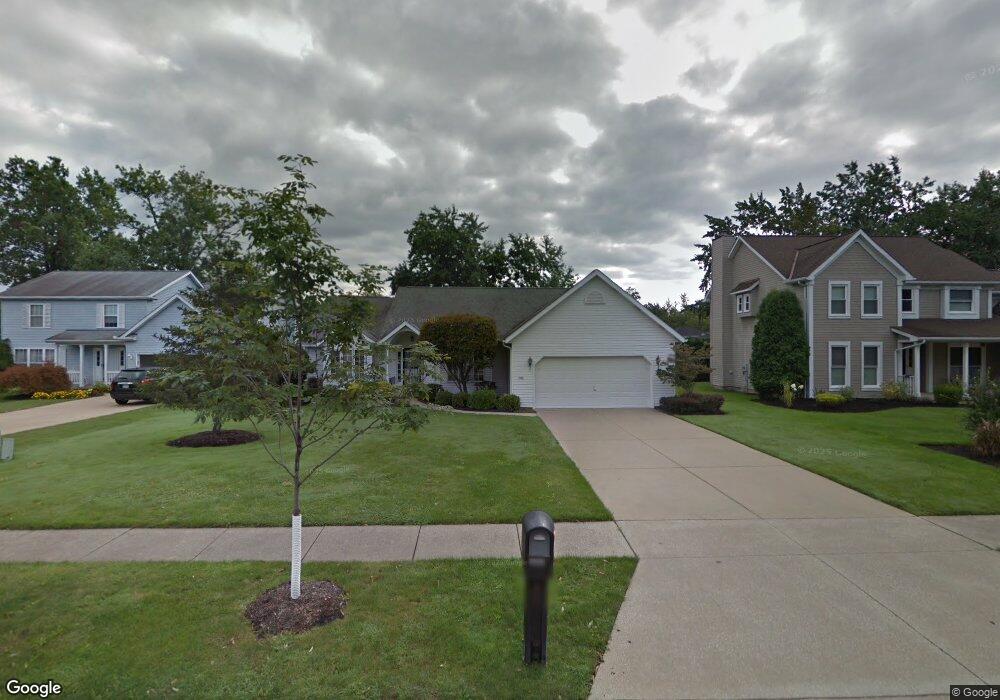
1237 Rae Rd Cleveland, OH 44124
Estimated Value: $283,000 - $363,000
3
Beds
2
Baths
1,714
Sq Ft
$184/Sq Ft
Est. Value
About This Home
This home is located at 1237 Rae Rd, Cleveland, OH 44124 and is currently estimated at $315,636, approximately $184 per square foot. 1237 Rae Rd is a home located in Cuyahoga County with nearby schools including Sunview Elementary School, Greenview Upper Elementary School, and Memorial Junior High School.
Ownership History
Date
Name
Owned For
Owner Type
Purchase Details
Closed on
Jan 28, 2002
Sold by
Hacker Shirley M
Bought by
Sones William M and Sones Barbara J
Current Estimated Value
Home Financials for this Owner
Home Financials are based on the most recent Mortgage that was taken out on this home.
Original Mortgage
$160,000
Outstanding Balance
$67,092
Interest Rate
7.26%
Estimated Equity
$248,544
Purchase Details
Closed on
Oct 20, 2000
Sold by
Hacker Shirely M
Bought by
Hacker Shirley M and Shirley M Hacker Trust
Purchase Details
Closed on
Apr 30, 1993
Bought by
Hacker John H
Purchase Details
Closed on
Nov 4, 1992
Bought by
Orwell Homes, Inc.
Purchase Details
Closed on
Jan 1, 1991
Bought by
C M Investment Corp
Create a Home Valuation Report for This Property
The Home Valuation Report is an in-depth analysis detailing your home's value as well as a comparison with similar homes in the area
Home Values in the Area
Average Home Value in this Area
Purchase History
| Date | Buyer | Sale Price | Title Company |
|---|---|---|---|
| Sones William M | $210,000 | Quality Title Agency Inc | |
| Hacker Shirley M | -- | -- | |
| Hacker John H | $170,900 | -- | |
| Orwell Homes, Inc. | $55,000 | -- | |
| C M Investment Corp | -- | -- |
Source: Public Records
Mortgage History
| Date | Status | Borrower | Loan Amount |
|---|---|---|---|
| Open | Sones William M | $160,000 |
Source: Public Records
Tax History Compared to Growth
Tax History
| Year | Tax Paid | Tax Assessment Tax Assessment Total Assessment is a certain percentage of the fair market value that is determined by local assessors to be the total taxable value of land and additions on the property. | Land | Improvement |
|---|---|---|---|---|
| 2024 | $7,019 | $111,265 | $19,390 | $91,875 |
| 2023 | $8,386 | $107,560 | $22,580 | $84,980 |
| 2022 | $8,371 | $107,560 | $22,580 | $84,980 |
| 2021 | $8,298 | $107,560 | $22,580 | $84,980 |
| 2020 | $7,623 | $88,170 | $18,520 | $69,650 |
| 2019 | $6,872 | $251,900 | $52,900 | $199,000 |
| 2018 | $6,835 | $88,170 | $18,520 | $69,650 |
| 2017 | $5,315 | $65,030 | $14,770 | $50,260 |
| 2016 | $5,273 | $65,030 | $14,770 | $50,260 |
| 2015 | $5,355 | $65,030 | $14,770 | $50,260 |
| 2014 | $5,355 | $66,370 | $15,090 | $51,280 |
Source: Public Records
Map
Nearby Homes
- 1194 Croyden Rd
- 1213 Eastwood Ave
- 1218 Summit Dr
- 1151 Croyden Rd
- 1146 Iroquois Ave
- 1151 Brainard Rd
- 1126 Iroquois Ave
- 1120 Croyden Rd
- 1391 Iroquois Ave
- 1284 Haverston Rd
- 1399 Haverston Rd
- 1193 Mayfield Ridge Rd
- 1430 Belrose Rd
- 1192 Blanchester Rd
- 1328 Elmwood Rd
- 1187 Gordon Rd
- 1019 Rose Blvd
- 1337 Elmwood Rd
- 1062 Belwood Dr
- 1066 Eastlawn Dr