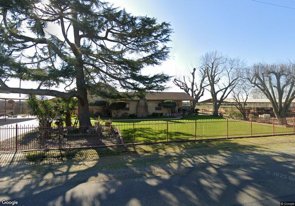
12383 Flint Ave Hanford, CA 93230
Estimated Value: $443,000 - $572,782
4
Beds
3
Baths
1,870
Sq Ft
$272/Sq Ft
Est. Value
About This Home
This home is located at 12383 Flint Ave, Hanford, CA 93230 and is currently estimated at $508,696, approximately $272 per square foot. 12383 Flint Ave is a home located in Kings County with nearby schools including Sierra Pacific High School, Frontier Elementary School, and Pioneer Elementary School.
Ownership History
Date
Name
Owned For
Owner Type
Purchase Details
Closed on
Nov 19, 2014
Sold by
Durham Terri L
Bought by
The Michael & Terri Durham Living Trust
Current Estimated Value
Purchase Details
Closed on
Jun 7, 2012
Sold by
Durham Terri L
Bought by
Durham Michael J and Durham Terri L
Purchase Details
Closed on
Oct 5, 2010
Sold by
Durham Terri L and Durham Michael J
Bought by
Durham Michael J and Durham Terri L
Purchase Details
Closed on
Dec 29, 2005
Sold by
Azevedo Terri L and Durham Terri L
Bought by
Durham Michael J and Durham Terri L
Purchase Details
Closed on
Nov 2, 1998
Sold by
Azevedo Lisa
Bought by
Azevedo Anthony S
Purchase Details
Closed on
Dec 15, 1997
Sold by
Azevedo Anthony S and Azevedo Anthony
Bought by
Azevedo Anthony S
Create a Home Valuation Report for This Property
The Home Valuation Report is an in-depth analysis detailing your home's value as well as a comparison with similar homes in the area
Home Values in the Area
Average Home Value in this Area
Purchase History
| Date | Buyer | Sale Price | Title Company |
|---|---|---|---|
| The Michael & Terri Durham Living Trust | -- | None Available | |
| Durham Terri L | -- | None Available | |
| Durham Michael J | -- | None Available | |
| Durham Terri L | -- | None Available | |
| Durham Michael J | -- | None Available | |
| Durham Michael J | -- | -- | |
| Azevedo Anthony S | -- | Chicago Title Co | |
| Azevedo Anthony S | -- | Kings County Title Company | |
| Azevedo Terri Lynne | -- | -- |
Source: Public Records
Tax History Compared to Growth
Tax History
| Year | Tax Paid | Tax Assessment Tax Assessment Total Assessment is a certain percentage of the fair market value that is determined by local assessors to be the total taxable value of land and additions on the property. | Land | Improvement |
|---|---|---|---|---|
| 2025 | $1,577 | $153,724 | $16,804 | $136,920 |
| 2023 | $1,577 | $147,756 | $16,152 | $131,604 |
| 2022 | $1,525 | $144,860 | $15,836 | $129,024 |
| 2021 | $1,496 | $142,021 | $15,526 | $126,495 |
| 2020 | $1,499 | $140,565 | $15,367 | $125,198 |
| 2019 | $1,474 | $137,809 | $15,066 | $122,743 |
| 2018 | $1,464 | $135,107 | $14,771 | $120,336 |
| 2017 | $1,437 | $132,457 | $14,481 | $117,976 |
| 2016 | $1,358 | $129,860 | $14,197 | $115,663 |
| 2015 | $1,315 | $127,910 | $13,984 | $113,926 |
| 2014 | $1,324 | $125,404 | $13,710 | $111,694 |
Source: Public Records
Map
Nearby Homes
- 2463 Madeline Dr
- 2439 Madeline Dr
- 1109 W Cinnamon Ave
- 2341 W Ambassador Way
- 1172 W Pepper Dr
- 2390 Chardonnay Place
- 1010 W Quail Rock Way
- 1744 Dali Way
- 3060 Zion Way
- 1938 W Van Gogh St
- 2328 Madeline Dr
- 1674 Castoro Way
- 1674 W Castoro Way
- 1795 W Van Gogh
- 2435 Vintage Place
- 927 W Saffron St
- 1128 W Orange St
- 2821 Stonecrest Way
- 2516 Cortner St