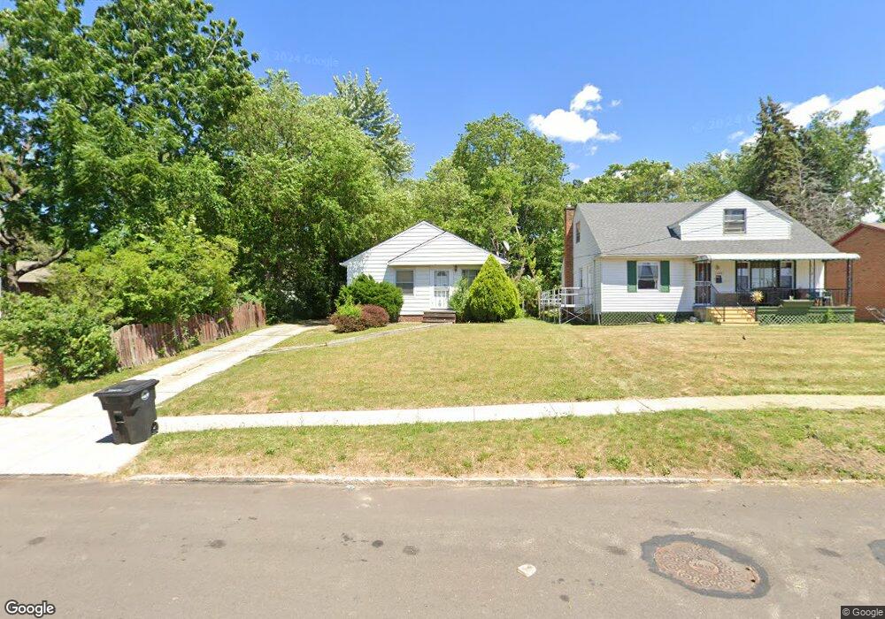
1239 E 187th St Cleveland, OH 44110
South Collinwood NeighborhoodEstimated Value: $85,000 - $133,000
3
Beds
1
Bath
962
Sq Ft
$104/Sq Ft
Est. Value
About This Home
This home is located at 1239 E 187th St, Cleveland, OH 44110 and is currently estimated at $100,014, approximately $103 per square foot. 1239 E 187th St is a home located in Cuyahoga County with nearby schools including Bolton, Andrew J. Rickoff School, and Anton Grdina School.
Ownership History
Date
Name
Owned For
Owner Type
Purchase Details
Closed on
Sep 27, 2002
Sold by
Pavlik Dean C
Bought by
Meredith Crystal M
Current Estimated Value
Home Financials for this Owner
Home Financials are based on the most recent Mortgage that was taken out on this home.
Original Mortgage
$72,100
Outstanding Balance
$30,581
Interest Rate
6.32%
Estimated Equity
$69,433
Purchase Details
Closed on
Jul 26, 1993
Sold by
Pavlik Ann
Bought by
Pavlik Dean C
Purchase Details
Closed on
Jan 1, 1975
Bought by
Pavlik Ann
Create a Home Valuation Report for This Property
The Home Valuation Report is an in-depth analysis detailing your home's value as well as a comparison with similar homes in the area
Home Values in the Area
Average Home Value in this Area
Purchase History
| Date | Buyer | Sale Price | Title Company |
|---|---|---|---|
| Meredith Crystal M | $78,000 | Executive Title | |
| Pavlik Dean C | -- | -- | |
| Pavlik Ann | -- | -- |
Source: Public Records
Mortgage History
| Date | Status | Borrower | Loan Amount |
|---|---|---|---|
| Open | Meredith Crystal M | $72,100 |
Source: Public Records
Tax History Compared to Growth
Tax History
| Year | Tax Paid | Tax Assessment Tax Assessment Total Assessment is a certain percentage of the fair market value that is determined by local assessors to be the total taxable value of land and additions on the property. | Land | Improvement |
|---|---|---|---|---|
| 2024 | $1,618 | $24,675 | $5,145 | $19,530 |
| 2023 | $1,232 | $16,240 | $3,500 | $12,740 |
| 2022 | $1,225 | $16,240 | $3,500 | $12,740 |
| 2021 | $1,212 | $16,240 | $3,500 | $12,740 |
| 2020 | $1,231 | $14,250 | $3,080 | $11,170 |
| 2019 | $1,138 | $40,700 | $8,800 | $31,900 |
| 2018 | $1,154 | $14,250 | $3,080 | $11,170 |
| 2017 | $1,184 | $14,360 | $3,400 | $10,960 |
| 2016 | $1,175 | $14,360 | $3,400 | $10,960 |
| 2015 | $1,340 | $14,360 | $3,400 | $10,960 |
| 2014 | $1,340 | $16,320 | $3,890 | $12,430 |
Source: Public Records
Map
Nearby Homes
- 1362 E 187th St
- 1363 Clearaire Rd
- 1383 Clearaire Rd
- 19613 Shelton Dr
- 19520 Shelton Dr
- 17817 Grovewood Ave
- 1443 Larchmont Rd
- 1113 E 177th St
- 17620 Saint Clair Ave
- 1166 E 176th St
- 1563 Clermont Rd
- 1068 E 177th St
- 1230 E 173rd St
- 983 E 179th St
- 17216 Grovewood Ave
- 17702 Nottingham Rd
- 1561 E 204th St
- 1556 Dille Rd
- 1040 E 177th St
- 1477 E 195th St
- 1245 E 187th St
- 18702 Saint Clair Ave
- 1249 E 187th St
- 18614 Saint Clair Ave
- 18614 18616 Saint Clair Ave
- 18906 Nottingham Rd
- 1259 E 187th St
- 18604 Saint Clair Ave
- 1263 E 187th St
- 18908 Nottingham Rd
- 18621 Saint Clair Ave
- 18719 Ironwood Ave
- 18717 Ironwood Ave
- 18727 Ironwood Ave
- 1265 E 187th St
- 18613 Saint Clair Ave
- 18914 Nottingham Rd
- 18733 Ironwood Ave
- 1268 E 187th St
- 1274 E 187th St