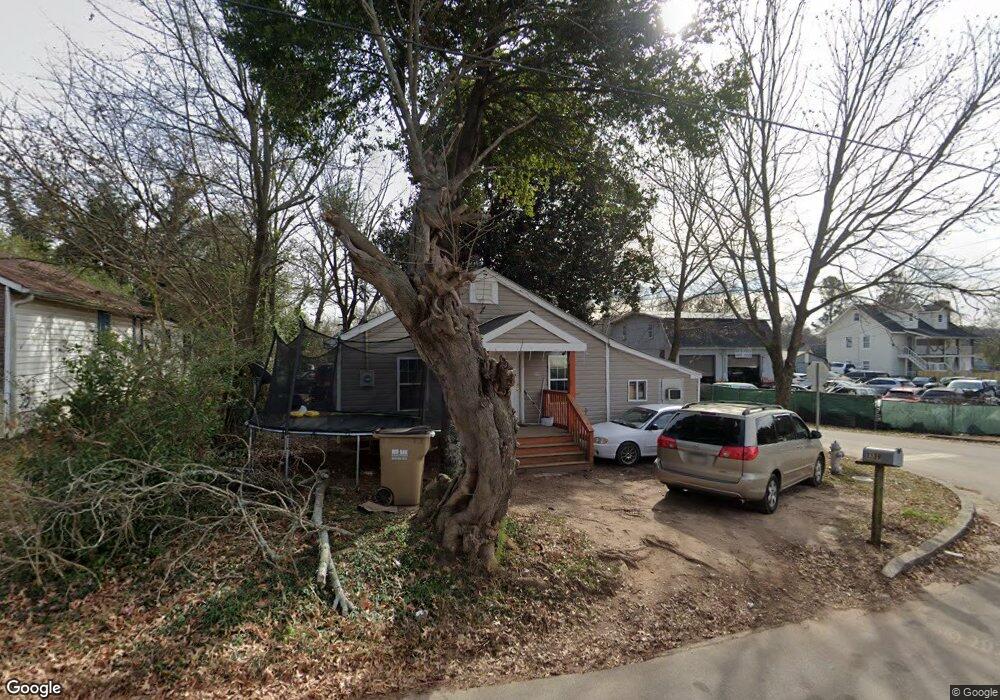
1239 Myrtle St Gainesville, GA 30501
West Side NeighborhoodEstimated Value: $161,000 - $263,000
3
Beds
1
Bath
750
Sq Ft
$259/Sq Ft
Est. Value
About This Home
This home is located at 1239 Myrtle St, Gainesville, GA 30501 and is currently estimated at $194,318, approximately $259 per square foot. 1239 Myrtle St is a home located in Hall County with nearby schools including Lyman Hall Elementary School, West Hall Middle School, and West Hall High School.
Ownership History
Date
Name
Owned For
Owner Type
Purchase Details
Closed on
Nov 27, 2012
Sold by
Phillip Forrester Enterpri
Bought by
Forrester Enterprises Lllp
Current Estimated Value
Purchase Details
Closed on
Dec 30, 1993
Sold by
Smith Judy A
Bought by
Laim Chau Ngoc
Home Financials for this Owner
Home Financials are based on the most recent Mortgage that was taken out on this home.
Original Mortgage
$32,500
Interest Rate
7.09%
Create a Home Valuation Report for This Property
The Home Valuation Report is an in-depth analysis detailing your home's value as well as a comparison with similar homes in the area
Home Values in the Area
Average Home Value in this Area
Purchase History
| Date | Buyer | Sale Price | Title Company |
|---|---|---|---|
| Forrester Enterprises Lllp | -- | -- | |
| Laim Chau Ngoc | $38,000 | -- |
Source: Public Records
Mortgage History
| Date | Status | Borrower | Loan Amount |
|---|---|---|---|
| Previous Owner | Laim Chau Ngoc | $32,500 |
Source: Public Records
Tax History Compared to Growth
Tax History
| Year | Tax Paid | Tax Assessment Tax Assessment Total Assessment is a certain percentage of the fair market value that is determined by local assessors to be the total taxable value of land and additions on the property. | Land | Improvement |
|---|---|---|---|---|
| 2024 | $986 | $36,920 | $8,160 | $28,760 |
| 2023 | $1,031 | $38,760 | $8,160 | $30,600 |
| 2022 | $787 | $27,680 | $7,120 | $20,560 |
| 2021 | $684 | $23,240 | $3,760 | $19,480 |
| 2020 | $673 | $22,160 | $3,760 | $18,400 |
| 2019 | $576 | $18,400 | $3,760 | $14,640 |
| 2018 | $521 | $15,840 | $3,280 | $12,560 |
| 2017 | $486 | $14,760 | $3,280 | $11,480 |
| 2016 | $449 | $13,773 | $3,280 | $10,493 |
| 2015 | $435 | $13,133 | $2,640 | $10,493 |
| 2014 | $435 | $13,133 | $2,640 | $10,493 |
Source: Public Records
Map
Nearby Homes
- 593 Shallowford Rd NW
- 474 Martin Alley
- 0 Hilton Dr Unit 7585721
- 0 Hilton Dr Unit 10529633
- 720 Bradford St SW
- 724 Bradford St SW
- 110 Summit St SE
- 2054 Spring Rd
- 105 Dogwood Cir
- 43 Dean St
- 775 Ridgewood Ave
- 2129 Dixie Dr
- 1220 Harmony St
- 652 Wilshire Place
- 2340 Ridgeway Dr
- 650 Blueridge Ave
- 601 Ridgewood Ave
- 1636 Atlanta Hwy
- 1229 Myrtle St
- 1233 Myrtle St
- 1231 Myrtle St
- 1024 Airport Dr
- 1230 Myrtle St SW
- 1227 Myrtle St
- 1228 Myrtle St SW
- 1026 Airport Dr
- 1030 Airport Dr
- 1028 Airport Dr
- 1028 Airport Dr
- 1226 Myrtle St SW
- 1029 Airport Dr
- 1031 Airport Dr
- 1165 Myrtle St SW
- 38 Highland Ave
- 1032 Airport Dr
- 1317 Ralston St
- 40 Highland Ave
- 653 Highland Ave