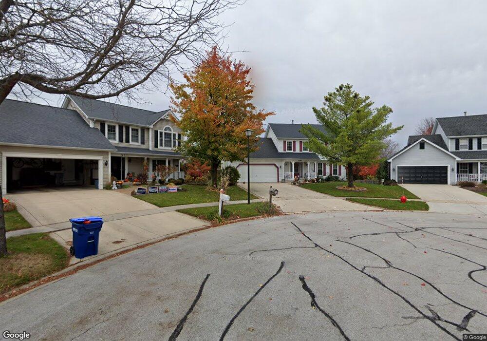
1239 Shoop Cir Geneva, IL 60134
Southwest Geneva NeighborhoodEstimated Value: $451,000 - $470,335
3
Beds
3
Baths
1,890
Sq Ft
$244/Sq Ft
Est. Value
About This Home
This home is located at 1239 Shoop Cir, Geneva, IL 60134 and is currently estimated at $461,334, approximately $244 per square foot. 1239 Shoop Cir is a home located in Kane County with nearby schools including Williamsburg Elementary School, Geneva Community High School, and St. Peter School.
Ownership History
Date
Name
Owned For
Owner Type
Purchase Details
Closed on
Jun 7, 2023
Sold by
Helmer Nicolas H
Bought by
Helmer Nicolas Margaret
Current Estimated Value
Purchase Details
Closed on
Jun 30, 2021
Sold by
Callaghan Rose Marie
Bought by
Helmer Nicholas
Home Financials for this Owner
Home Financials are based on the most recent Mortgage that was taken out on this home.
Original Mortgage
$326,000
Interest Rate
2.9%
Mortgage Type
New Conventional
Purchase Details
Closed on
Aug 19, 2005
Sold by
Riske Richard S and Riske Edith S
Bought by
Callaghan Rose Marie
Purchase Details
Closed on
May 31, 1996
Sold by
Oden Larry Wayne and Oden Dixie Carolyn
Bought by
Riske Richard S and Riske Edith S
Home Financials for this Owner
Home Financials are based on the most recent Mortgage that was taken out on this home.
Original Mortgage
$125,000
Interest Rate
8.05%
Create a Home Valuation Report for This Property
The Home Valuation Report is an in-depth analysis detailing your home's value as well as a comparison with similar homes in the area
Home Values in the Area
Average Home Value in this Area
Purchase History
| Date | Buyer | Sale Price | Title Company |
|---|---|---|---|
| Helmer Nicolas Margaret | -- | None Listed On Document | |
| Helmer Nicholas | $344,000 | Chicago Title Insurance Co | |
| Callaghan Rose Marie | $315,000 | Multiple | |
| Riske Richard S | $209,000 | Chicago Title Insurance Co |
Source: Public Records
Mortgage History
| Date | Status | Borrower | Loan Amount |
|---|---|---|---|
| Previous Owner | Helmer Nicholas | $326,000 | |
| Previous Owner | Riske Richard S | $125,000 |
Source: Public Records
Tax History
| Year | Tax Paid | Tax Assessment Tax Assessment Total Assessment is a certain percentage of the fair market value that is determined by local assessors to be the total taxable value of land and additions on the property. | Land | Improvement |
|---|---|---|---|---|
| 2024 | $9,549 | $132,534 | $33,506 | $99,028 |
| 2023 | $9,278 | $120,485 | $30,460 | $90,025 |
| 2022 | $8,893 | $111,954 | $28,303 | $83,651 |
| 2021 | $8,205 | $107,793 | $27,251 | $80,542 |
| 2020 | $8,101 | $106,148 | $26,835 | $79,313 |
| 2019 | $8,070 | $104,138 | $26,327 | $77,811 |
| 2018 | $8,251 | $101,388 | $26,327 | $75,061 |
| 2017 | $8,157 | $98,684 | $25,625 | $73,059 |
| 2016 | $7,900 | $94,055 | $25,279 | $68,776 |
| 2015 | -- | $89,423 | $24,034 | $65,389 |
| 2014 | -- | $87,384 | $24,034 | $63,350 |
| 2013 | -- | $87,384 | $24,034 | $63,350 |
Source: Public Records
Map
Nearby Homes
- Unit 8A Prairie Grove Dr
- Unit 6A Prairie Grove Dr
- Unit 4B Prairie Grove Dr
- Unit 5B Prairie Grove Dr
- Unit 8B Prairie Grove Dr
- Unit 9A Prairie Grove Dr
- Unit 4A Prairie Grove Dr
- Unit 5A Prairie Grove Dr
- Unit 7A Prairie Grove Dr
- Unit 6C Prairie Grove Dr
- Unit 5C Prairie Grove Dr
- Unit 6B Prairie Grove Dr
- Unit 4C Prairie Grove Dr
- Unit 7C Prairie Grove Dr
- 2782 Miller Rd
- 2685 Cedar Ave
- 3408 Wild Prairie Ln
- 839 S Randall Rd
- 2546 Heritage Ct Unit 2
- 948 Bluestem Dr
- 1231 Shoop Cir Unit 3
- 1241 Shoop Cir
- 1276 Herrington Rd
- 1256 Herrington Rd
- 1246 Herrington Rd
- 1286 Herrington Rd Unit 3
- 1251 Shoop Cir
- 1221 Shoop Cir
- 1236 Herrington Rd Unit 3
- 1292 Herrington Rd
- 1216 Herrington Rd
- 1296 Herrington Rd
- 1206 Herrington Rd
- 1298 Herrington Rd
- 1200 Herrington Rd Unit 3
- 1300 Herrington Rd Unit 3
- 1240 Shoop Dr
- 1230 Shoop Dr
- 1263 Herrington Rd
- 1250 Shoop Dr
Your Personal Tour Guide
Ask me questions while you tour the home.