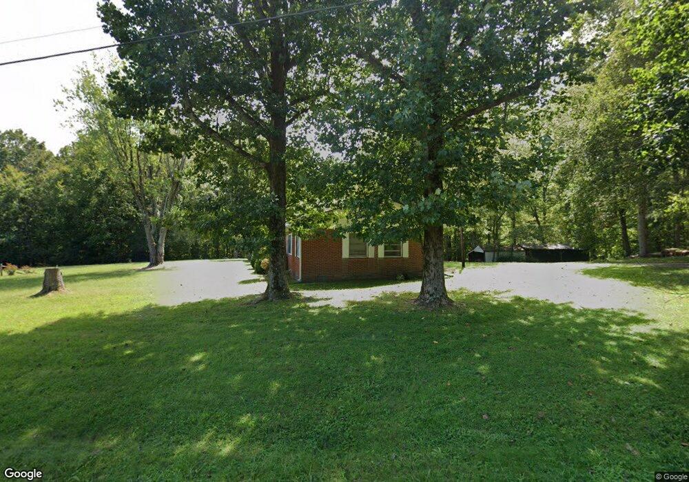
124 Cabin Dr Linden, TN 37096
Estimated Value: $199,977 - $230,000
--
Bed
2
Baths
1,752
Sq Ft
$122/Sq Ft
Est. Value
About This Home
This home is located at 124 Cabin Dr, Linden, TN 37096 and is currently estimated at $212,992, approximately $121 per square foot. 124 Cabin Dr is a home located in Perry County.
Ownership History
Date
Name
Owned For
Owner Type
Purchase Details
Closed on
Nov 21, 2005
Sold by
Tiller Jessie Ruth
Bought by
Tiller Billy P
Current Estimated Value
Purchase Details
Closed on
Feb 11, 2005
Sold by
Not Provided
Bought by
Tiller Jessie Ruth and Tiller Billy P
Purchase Details
Closed on
Oct 30, 1964
Bought by
Tiller Billie P and Jessie Ruth
Purchase Details
Closed on
Oct 27, 1959
Bought by
Tiller Jessie Ruth
Create a Home Valuation Report for This Property
The Home Valuation Report is an in-depth analysis detailing your home's value as well as a comparison with similar homes in the area
Home Values in the Area
Average Home Value in this Area
Purchase History
| Date | Buyer | Sale Price | Title Company |
|---|---|---|---|
| Tiller Billy P | -- | -- | |
| Tiller Jessie Ruth | -- | -- | |
| Tiller Billie P | -- | -- | |
| Tiller Jessie Ruth | -- | -- |
Source: Public Records
Tax History Compared to Growth
Tax History
| Year | Tax Paid | Tax Assessment Tax Assessment Total Assessment is a certain percentage of the fair market value that is determined by local assessors to be the total taxable value of land and additions on the property. | Land | Improvement |
|---|---|---|---|---|
| 2025 | $1,018 | $36,350 | $0 | $0 |
| 2024 | $1,018 | $36,350 | $11,400 | $24,950 |
| 2023 | $835 | $36,350 | $11,400 | $24,950 |
| 2022 | $1,018 | $36,350 | $11,400 | $24,950 |
| 2021 | $1,018 | $36,350 | $11,400 | $24,950 |
| 2020 | $835 | $36,350 | $11,400 | $24,950 |
| 2019 | $1,061 | $35,550 | $12,350 | $23,200 |
| 2018 | $1,061 | $35,550 | $12,350 | $23,200 |
| 2017 | $1,050 | $35,550 | $12,350 | $23,200 |
| 2016 | $1,050 | $35,550 | $12,350 | $23,200 |
| 2015 | $1,033 | $35,550 | $12,350 | $23,200 |
| 2014 | $1,033 | $35,550 | $12,350 | $23,200 |
| 2013 | $1,031 | $35,538 | $0 | $0 |
Source: Public Records
Map
Nearby Homes
- 218 Cedar Ave
- 122 Shelton St
- 2017 Airport Ridge Rd
- 2082 Airport Ridge Rd
- 141 Maple St
- 130 Elm Ln
- 245 S Mill St
- 0 Church St
- 117 Wyatt Ln
- 0 Treadwell Prong Unit RTC2707562
- 628 Starlight Dr
- 8884 U S Highway 412
- 8072 Old Hohenwald Rd
- 5681 Old Hohenwald Rd
- 4439 Old Hohenwald Rd
- 7696 Old Hohenwald Rd
- 6004 Old Hohenwald Rd
- 5608 Old Hohenwald Rd
- 107 Possum Trot Ln
- 2172 Airport Ridge Rd
- 129 Cabin Dr
- 127 Cabin Dr
- 121 Cabin Dr
- 52 Tennessee 13
- 236 Southwood Dr
- 119 Cabin Dr
- 0 Tennessee 13
- 0 Tennessee 13
- 13S Tennessee 13
- 230 Southwood Dr
- 226 Southwood Dr
- 237 Southwood Dr
- 222 Southwood Dr
- 233 Southwood Dr
- 229 Southwood Dr
- 214 Southwood Dr
- 223 Southwood Dr
- 231 Cedar Ave
- 230 Cedar Ave
- 4850 Cedar Ave