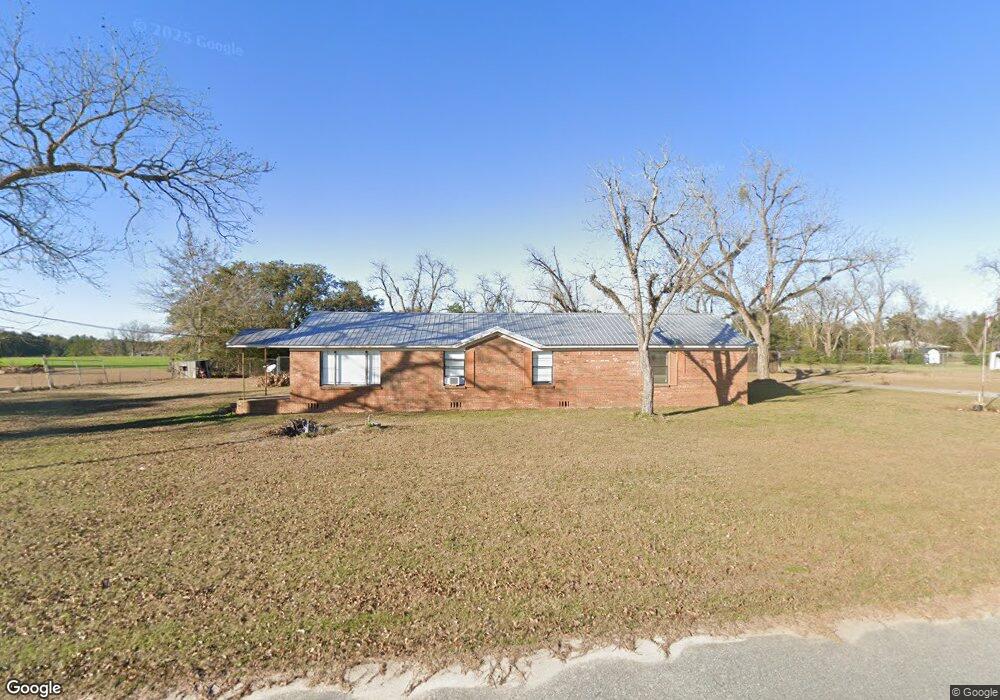
124 Cook Womack Rd Colquitt, GA 39837
Estimated Value: $159,000 - $256,000
2
Beds
1
Bath
1,004
Sq Ft
$193/Sq Ft
Est. Value
About This Home
This home is located at 124 Cook Womack Rd, Colquitt, GA 39837 and is currently estimated at $193,487, approximately $192 per square foot. 124 Cook Womack Rd is a home located in Decatur County with nearby schools including Bainbridge High School.
Ownership History
Date
Name
Owned For
Owner Type
Purchase Details
Closed on
Apr 2, 2024
Sold by
Strauss Theodore B
Bought by
Carolina Carports Inc
Current Estimated Value
Purchase Details
Closed on
Jan 17, 2007
Sold by
Smith Archie
Bought by
Strauss Theodore B
Home Financials for this Owner
Home Financials are based on the most recent Mortgage that was taken out on this home.
Original Mortgage
$350,000
Interest Rate
6.07%
Mortgage Type
New Conventional
Create a Home Valuation Report for This Property
The Home Valuation Report is an in-depth analysis detailing your home's value as well as a comparison with similar homes in the area
Home Values in the Area
Average Home Value in this Area
Purchase History
| Date | Buyer | Sale Price | Title Company |
|---|---|---|---|
| Carolina Carports Inc | $225,000 | -- | |
| Strauss Theodore B | $375,000 | -- |
Source: Public Records
Mortgage History
| Date | Status | Borrower | Loan Amount |
|---|---|---|---|
| Previous Owner | Strauss Theodore B | $350,000 |
Source: Public Records
Tax History Compared to Growth
Tax History
| Year | Tax Paid | Tax Assessment Tax Assessment Total Assessment is a certain percentage of the fair market value that is determined by local assessors to be the total taxable value of land and additions on the property. | Land | Improvement |
|---|---|---|---|---|
| 2024 | $1,243 | $41,285 | $952 | $40,333 |
| 2023 | $1,243 | $41,285 | $952 | $40,333 |
| 2022 | $1,160 | $39,871 | $952 | $38,919 |
| 2021 | $1,113 | $37,529 | $952 | $36,577 |
| 2020 | $1,033 | $33,065 | $952 | $32,113 |
| 2019 | $974 | $30,046 | $952 | $29,094 |
| 2018 | $962 | $30,046 | $952 | $29,094 |
| 2017 | $943 | $30,046 | $952 | $29,094 |
| 2016 | $943 | $30,044 | $950 | $29,094 |
| 2015 | $956 | $30,044 | $950 | $29,094 |
| 2014 | $834 | $30,044 | $950 | $29,094 |
| 2013 | -- | $30,044 | $950 | $29,094 |
Source: Public Records
Map
Nearby Homes
- Brinson Airbase Rd
- 160 Manhole Rd
- 2137 Pondtown Rd
- 00 Manhole Rd
- 0 Brinson Airbase Rd
- 0 Newton Rd
- 994 Hornsby Rd
- 135 Heritage Cr
- 3327 Dothan Rd
- 533 Flint River Heights Rd
- 757 Manhole Rd
- 116 Flint River Heights Rd
- 125 John Sam Rd
- 1019 Zorn Rd
- 851 Colquitt Hwy
- 104 Brock St
- 186 Aryola Dr
- 424 Grassy Flats Rd
- 1203 Bellview Rd
- 721 E Crawford St
- 136 Cook Womack Rd
- 1239 Old Eldorendo Rd
- 1239 Old Eldorendo Rd
- 1259 Old Eldorendo Rd
- 1262 Old Eldorendo Rd
- 1265 Old Eldorendo Rd
- 1228 Old Eldorendo Rd
- 1229 Old Eldorendo Rd
- 1271 E Eldorendo Rd
- 2459 Colquitt Hwy
- 2383 Colquitt Hwy
- 2371 Colquitt Hwy
- 1218 Old Eldorendo Rd
- 1221 Old Eldorendo Rd
- 121 Ralph Duke Rd
- 2413 N Colquitt Hwy
- 1315 Old Eldorendo Rd
- 2493 Colquitt Hwy
- 2399 Colquitt Hwy
- 2413 Colquitt Hwy