Estimated Value: $484,000 - $502,000
2
Beds
2
Baths
1,144
Sq Ft
$429/Sq Ft
Est. Value
About This Home
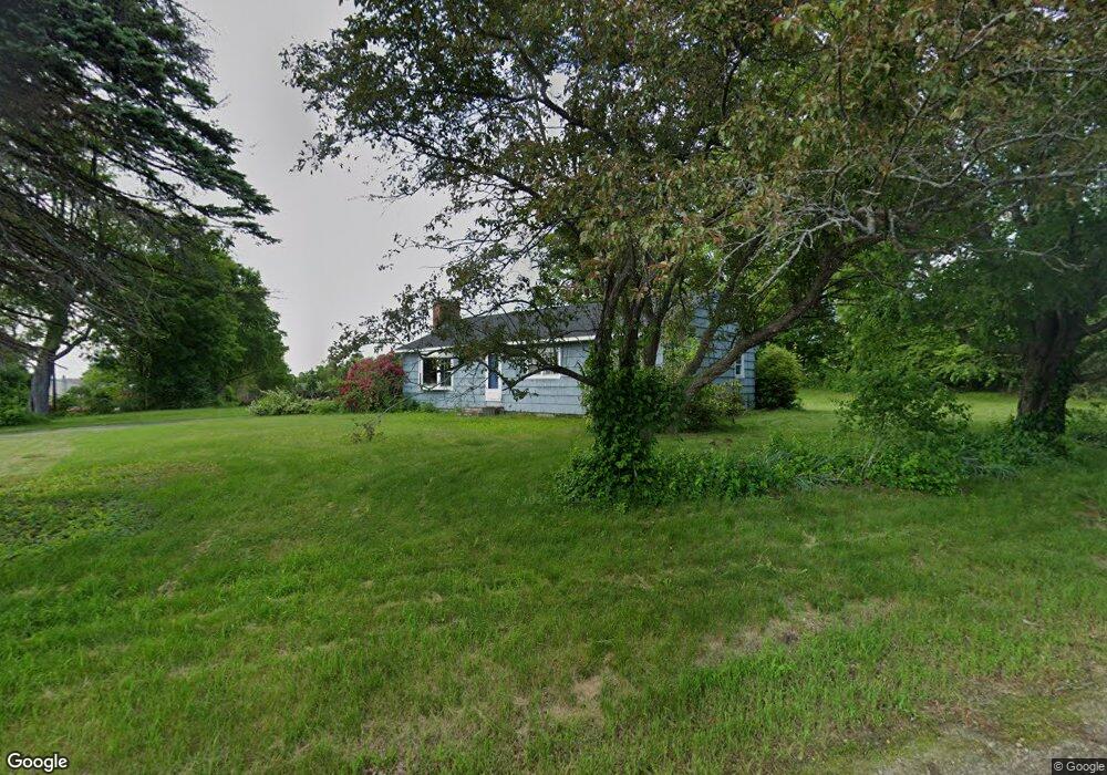
This home is located at 124 Hampstead Rd, Derry, NH 03038 and is currently estimated at $491,186, approximately $429 per square foot. 124 Hampstead Rd is a home with nearby schools including East Derry Memorial Elementary School, Gilbert H. Hood Middle School, and Pinkerton Academy.
Ownership History
Date
Name
Owned For
Owner Type
Purchase Details
Closed on
Jun 23, 2023
Sold by
Scott Gloria C Est and Scott
Bought by
Scott Justin K
Current Estimated Value
Home Financials for this Owner
Home Financials are based on the most recent Mortgage that was taken out on this home.
Original Mortgage
$297,000
Outstanding Balance
$287,389
Interest Rate
6.35%
Mortgage Type
Purchase Money Mortgage
Estimated Equity
$203,797
Create a Home Valuation Report for This Property
The Home Valuation Report is an in-depth analysis detailing your home's value as well as a comparison with similar homes in the area
Home Values in the Area
Average Home Value in this Area
Purchase History
| Date | Buyer | Sale Price | Title Company |
|---|---|---|---|
| Scott Justin K | $397,000 | None Available | |
| Scott Justin K | $397,000 | None Available |
Source: Public Records
Mortgage History
| Date | Status | Borrower | Loan Amount |
|---|---|---|---|
| Open | Scott Justin K | $297,000 | |
| Closed | Scott Justin K | $297,000 |
Source: Public Records
Tax History
| Year | Tax Paid | Tax Assessment Tax Assessment Total Assessment is a certain percentage of the fair market value that is determined by local assessors to be the total taxable value of land and additions on the property. | Land | Improvement |
|---|---|---|---|---|
| 2025 | $8,130 | $428,100 | $234,900 | $193,200 |
| 2024 | $8,001 | $428,100 | $234,900 | $193,200 |
| 2023 | $7,656 | $370,200 | $199,700 | $170,500 |
| 2022 | $7,049 | $370,200 | $199,700 | $170,500 |
| 2021 | $7,287 | $294,300 | $159,600 | $134,700 |
| 2020 | $4,876 | $294,300 | $159,600 | $134,700 |
| 2019 | $6,540 | $250,400 | $130,000 | $120,400 |
| 2018 | $6,281 | $250,400 | $130,000 | $120,400 |
| 2017 | $5,607 | $228,700 | $123,000 | $105,700 |
| 2016 | $6,189 | $228,700 | $123,000 | $105,700 |
| 2015 | $6,401 | $219,000 | $123,000 | $96,000 |
| 2014 | $6,443 | $219,000 | $123,000 | $96,000 |
| 2013 | $6,307 | $200,300 | $113,000 | $87,300 |
Source: Public Records
Map
Nearby Homes
- 15 Bonnie Ln Unit R
- 47 Drew Woods Dr
- 3 Pine Bluff
- 12 Halls Village Rd
- 89 Lane Rd
- 211 Hampstead Rd
- 5 Stone Fence Dr
- 18 N Shore Rd
- 4C Pine Isle Dr Unit B
- 1 Grandview Ave
- 32 Chester Rd
- 76 Tsienneto Rd
- 7 Chester Rd Unit 212
- 4 Pembroke Dr Unit 22
- 144 Rockingham Rd
- 5 Nesmith St
- 139 Rockingham Rd Unit 21
- 7 Birchwood Dr
- 9 Barkland Dr
- 22 Birchwood Dr
- 137 Hampstead Rd
- 2 Adams Pond Rd
- 135 Hampstead Rd
- 4 Adams Pond Rd
- 126 Hampstead Rd
- 6 Adams Pond Rd
- 4 Blake Farm Rd
- 133 Hampstead Rd
- 8 Adams Pond Rd
- 6 Blake Farm Rd
- 2 Floyd Rd
- 131 Hampstead Rd
- 1 Floyd Rd
- 130 Hampstead Rd
- 122 Hampstead Rd Unit R
- 122 Hampstead Rd Unit L
- 122 Hampstead Rd Unit 122
- 122 Hampstead Rd
- 10 Adams Pond Rd Unit L
- 10 Adams Pond Rd Unit R
Your Personal Tour Guide
Ask me questions while you tour the home.