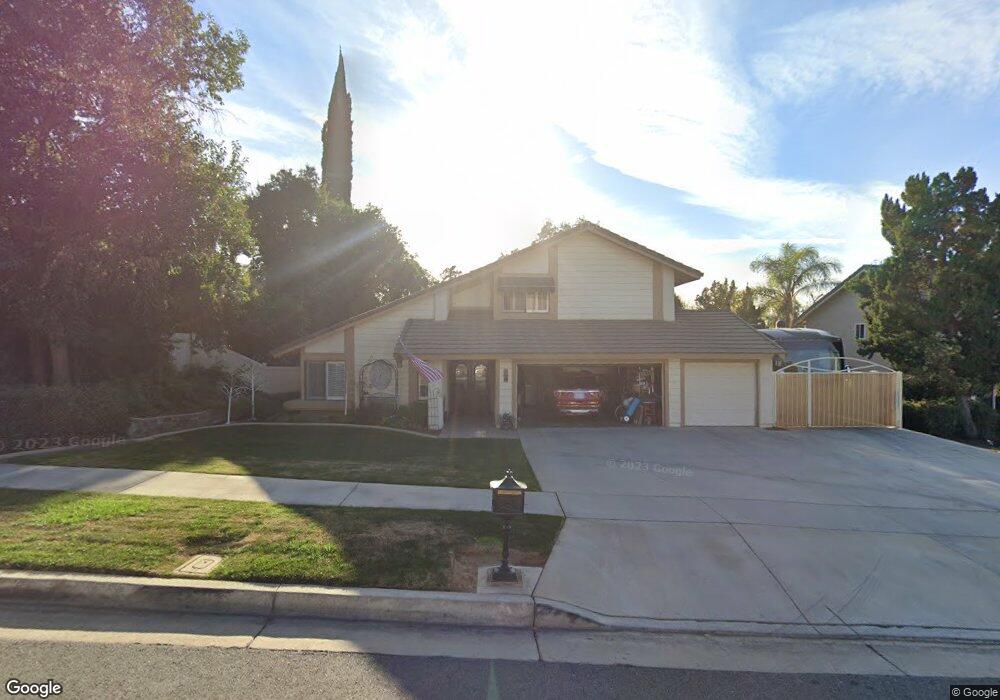
124 Jennifer St Redlands, CA 92373
South Redlands NeighborhoodEstimated Value: $762,000 - $833,000
4
Beds
3
Baths
1,987
Sq Ft
$402/Sq Ft
Est. Value
About This Home
This home is located at 124 Jennifer St, Redlands, CA 92373 and is currently estimated at $799,123, approximately $402 per square foot. 124 Jennifer St is a home located in San Bernardino County with nearby schools including McKinley Elementary School, Cope Middle School, and Redlands Senior High School.
Ownership History
Date
Name
Owned For
Owner Type
Purchase Details
Closed on
Mar 8, 2023
Sold by
Phillips Bobby R and Phillips Linda L
Bought by
Phillips Trust
Current Estimated Value
Purchase Details
Closed on
Dec 6, 2005
Sold by
Kolar Paul and Kolar Lena
Bought by
Phillips Bobby R and Phillips Linda L
Home Financials for this Owner
Home Financials are based on the most recent Mortgage that was taken out on this home.
Original Mortgage
$333,000
Interest Rate
6.27%
Mortgage Type
Fannie Mae Freddie Mac
Purchase Details
Closed on
Dec 10, 2003
Sold by
Porterfield Stephen C
Bought by
Kolar Paul and Kolar Lena
Home Financials for this Owner
Home Financials are based on the most recent Mortgage that was taken out on this home.
Original Mortgage
$284,000
Interest Rate
5.81%
Mortgage Type
Purchase Money Mortgage
Create a Home Valuation Report for This Property
The Home Valuation Report is an in-depth analysis detailing your home's value as well as a comparison with similar homes in the area
Home Values in the Area
Average Home Value in this Area
Purchase History
| Date | Buyer | Sale Price | Title Company |
|---|---|---|---|
| Phillips Trust | -- | -- | |
| Phillips Bobby R | $533,000 | United Title | |
| Kolar Paul | $355,000 | Orange Coast Title |
Source: Public Records
Mortgage History
| Date | Status | Borrower | Loan Amount |
|---|---|---|---|
| Previous Owner | Phillips Bobby R | $333,000 | |
| Previous Owner | Kolar Paul | $284,000 | |
| Closed | Kolar Paul | $71,000 |
Source: Public Records
Tax History
| Year | Tax Paid | Tax Assessment Tax Assessment Total Assessment is a certain percentage of the fair market value that is determined by local assessors to be the total taxable value of land and additions on the property. | Land | Improvement |
|---|---|---|---|---|
| 2025 | $8,950 | $728,393 | $218,518 | $509,875 |
| 2024 | $8,434 | $714,110 | $214,233 | $499,877 |
| 2023 | $8,341 | $700,107 | $210,032 | $490,075 |
| 2022 | $7,792 | $651,000 | $195,000 | $456,000 |
| 2021 | $7,318 | $589,000 | $177,000 | $412,000 |
| 2020 | $6,683 | $540,700 | $161,700 | $379,000 |
| 2019 | $6,430 | $525,000 | $157,000 | $368,000 |
| 2018 | $5,867 | $482,000 | $144,700 | $337,300 |
| 2017 | $5,731 | $465,700 | $139,800 | $325,900 |
| 2016 | $5,399 | $435,300 | $130,700 | $304,600 |
| 2015 | $5,033 | $403,000 | $121,000 | $282,000 |
| 2014 | $5,254 | $420,000 | $126,000 | $294,000 |
Source: Public Records
Map
Nearby Homes
- 215 San Rafael St
- 171 Bellevue Ave
- 1324 W Fern Ave
- 1522 Blossom Ct
- 975 Brookside Ave
- 93 Kansas St Unit 802
- 1235 W Cypress Ave
- 1510 Orange Ave Unit 902
- 122 Tamarisk St
- 608 Linda Place
- 616 Monterey St
- 11891 San Timoteo Canyon Rd
- 726 Robinhood Ln
- 979 Kevin Ave
- 48 N Center St
- 108 S Buena Vista St
- 571 Wooden Bridge Ln
- 163 N Center St
- 167 N Center St
- 1033 W Palm Ave
Your Personal Tour Guide
Ask me questions while you tour the home.