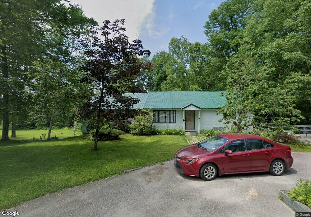
124 Lewis Hill Rd Bethlehem, NH 03574
Estimated Value: $383,312 - $413,000
3
Beds
2
Baths
1,512
Sq Ft
$262/Sq Ft
Est. Value
About This Home
This home is located at 124 Lewis Hill Rd, Bethlehem, NH 03574 and is currently estimated at $395,828, approximately $261 per square foot. 124 Lewis Hill Rd is a home located in Grafton County with nearby schools including Bethlehem Elementary School, Profile Junior High School, and Profile Senior High School.
Ownership History
Date
Name
Owned For
Owner Type
Purchase Details
Closed on
Jun 16, 2000
Sold by
Brown Norman L and Brown Teri-Ann
Bought by
Degroat John G and Degroat Karen A
Current Estimated Value
Home Financials for this Owner
Home Financials are based on the most recent Mortgage that was taken out on this home.
Original Mortgage
$93,000
Interest Rate
8.24%
Create a Home Valuation Report for This Property
The Home Valuation Report is an in-depth analysis detailing your home's value as well as a comparison with similar homes in the area
Home Values in the Area
Average Home Value in this Area
Purchase History
| Date | Buyer | Sale Price | Title Company |
|---|---|---|---|
| Degroat John G | $123,000 | -- |
Source: Public Records
Mortgage History
| Date | Status | Borrower | Loan Amount |
|---|---|---|---|
| Open | Degroat John G | $113,000 | |
| Closed | Degroat John G | $93,000 |
Source: Public Records
Tax History Compared to Growth
Tax History
| Year | Tax Paid | Tax Assessment Tax Assessment Total Assessment is a certain percentage of the fair market value that is determined by local assessors to be the total taxable value of land and additions on the property. | Land | Improvement |
|---|---|---|---|---|
| 2024 | $5,128 | $298,500 | $59,500 | $239,000 |
| 2023 | $4,606 | $298,500 | $59,500 | $239,000 |
| 2022 | $3,951 | $165,400 | $28,100 | $137,300 |
| 2021 | $4,157 | $167,700 | $28,100 | $139,600 |
| 2020 | $0 | $167,700 | $28,100 | $139,600 |
| 2019 | $4,483 | $167,700 | $28,100 | $139,600 |
| 2018 | $4,355 | $167,700 | $28,100 | $139,600 |
| 2017 | $4,666 | $151,900 | $31,000 | $120,900 |
| 2016 | $4,171 | $151,900 | $31,000 | $120,900 |
| 2015 | $4,499 | $151,900 | $31,000 | $120,900 |
| 2013 | $4,337 | $151,900 | $31,000 | $120,900 |
Source: Public Records
Map
Nearby Homes
- 206 Lewis Hill Rd
- Map 202-Lot 39 Parker Rd
- 105 Alpenhof Rd
- 28 Jodo Way
- 42 Maple St
- 2254 Main St
- 576 Agassiz St
- 95 Noyes St
- 14 Reid Cir
- 15 Okane Ave
- 16 3rd St
- O Main St
- 757 Maple St
- 00 Shepards Run
- 000 Shepards Run Unit 12
- 0 Shepards Run Unit 4 5054579
- 80 Guider Ln
- 00 Guider Ln Unit 24
- 00 Swazey Ln Unit 14
- 000 Ridge Rd
- 128 Lewis Hill Rd
- 125 Lewis Hill Rd
- 99 Lewis Hill Rd
- 162 Lewis Hill Rd
- 135 Lewis Hill Rd
- 84 Lewis Hill Rd
- 87 Lewis Hill Rd
- 60 Lewis Hill Rd
- 213 Lewis Hill Rd
- 0 South Rd
- 0 South Rd Unit 4996737
- 0 South Rd Unit 4257392
- 0 South Rd Unit 4678335
- 0 South Rd Unit 4678334
- 1796 Main St
- 1796 Main St Unit 4
- 49 Lewis Hill Rd
- 1700 Main St
- 65 Lewis Hill Rd
- 220 Lewis Hill Rd