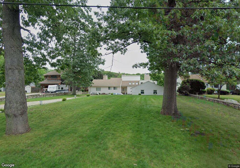
124 Macarthur Dr Millbury, MA 01527
Estimated Value: $682,000 - $785,308
3
Beds
2
Baths
1,934
Sq Ft
$376/Sq Ft
Est. Value
About This Home
This home is located at 124 Macarthur Dr, Millbury, MA 01527 and is currently estimated at $727,577, approximately $376 per square foot. 124 Macarthur Dr is a home located in Worcester County with nearby schools including Elmwood Street Elementary School, Raymond E. Shaw Elementary School, and Millbury Junior/Senior High School.
Ownership History
Date
Name
Owned For
Owner Type
Purchase Details
Closed on
Aug 30, 2018
Sold by
Us Bank Na Tr
Bought by
Thomas Edward
Current Estimated Value
Purchase Details
Closed on
Mar 17, 2017
Sold by
Berry 2Nd Edwin D and Us Bank Na
Bought by
Us Bank Na Tr
Purchase Details
Closed on
Aug 5, 1987
Sold by
Fontaine Wilfred J
Bought by
Berry E D
Create a Home Valuation Report for This Property
The Home Valuation Report is an in-depth analysis detailing your home's value as well as a comparison with similar homes in the area
Home Values in the Area
Average Home Value in this Area
Purchase History
| Date | Buyer | Sale Price | Title Company |
|---|---|---|---|
| Thomas Edward | $389,550 | -- | |
| Thomas Edward | $389,550 | -- | |
| Us Bank Na Tr | $369,738 | -- | |
| Us Bank Na Tr | $369,738 | -- | |
| Berry E D | $50,000 | -- |
Source: Public Records
Mortgage History
| Date | Status | Borrower | Loan Amount |
|---|---|---|---|
| Previous Owner | Berry E D | $75,000 |
Source: Public Records
Tax History
| Year | Tax Paid | Tax Assessment Tax Assessment Total Assessment is a certain percentage of the fair market value that is determined by local assessors to be the total taxable value of land and additions on the property. | Land | Improvement |
|---|---|---|---|---|
| 2025 | $10,628 | $793,738 | $372,238 | $421,500 |
| 2024 | $9,727 | $735,252 | $344,152 | $391,100 |
| 2023 | $7,289 | $504,449 | $178,449 | $326,000 |
| 2022 | $7,336 | $489,049 | $178,449 | $310,600 |
| 2021 | $3,457 | $450,549 | $178,449 | $272,100 |
| 2020 | $7,840 | $415,600 | $148,600 | $267,000 |
| 2019 | $6,229 | $393,000 | $135,200 | $257,800 |
| 2018 | $5,917 | $362,100 | $135,200 | $226,900 |
| 2017 | $5,483 | $333,700 | $135,200 | $198,500 |
| 2016 | $5,346 | $324,800 | $135,200 | $189,600 |
| 2015 | $5,310 | $322,600 | $143,500 | $179,100 |
| 2014 | $4,933 | $288,500 | $104,100 | $184,400 |
Source: Public Records
Map
Nearby Homes
- 2 Diane St
- 25 Upton St
- 2 Riverlin Pkwy
- 2 Wilson Rd Unit B
- 2 Wilson Rd Unit A
- 12 Irene Ct
- 300 Millbury Ave
- 5 Ann Dr Unit 5
- 4 John Dr
- 5 Lincoln Ln Unit 5
- 46 Lexington Rd
- 11 Maplewood Rd
- 1459 Grafton Rd
- 8 Lincoln Ave
- 18 Lincoln Ave
- 17 Lincoln Ave
- 10 Logan's Run Unit 10
- 75 Main St
- Lot 1 Cooper Rd
- 7 Canal St
- 126 Macarthur Dr
- 120 Macarthur Dr
- 118 Macarthur Dr
- 128 Macarthur Dr
- 132 Macarthur Dr
- 116 Macarthur Dr
- 117 Macarthur Dr
- 127 Macarthur Dr
- 112 Macarthur Dr
- 111 Macarthur Dr
- 85 Macarthur Dr
- 87 Macarthur Dr
- 131 Macarthur Dr
- 108 Macarthur Dr
- 91 Macarthur Dr
- 77 Macarthur Dr
- 104 Macarthur Dr
- 135 Macarthur Dr
- 11 Montgomery Dr
- 75 Macarthur Dr
Your Personal Tour Guide
Ask me questions while you tour the home.