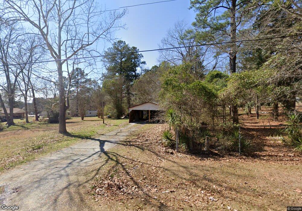
124 Maynard Dr Lincolnton, GA 30817
Estimated Value: $51,506 - $149,000
2
Beds
1
Bath
777
Sq Ft
$140/Sq Ft
Est. Value
About This Home
This home is located at 124 Maynard Dr, Lincolnton, GA 30817 and is currently estimated at $109,127, approximately $140 per square foot. 124 Maynard Dr is a home located in Lincoln County with nearby schools including Lincoln County Elementary School, Lincoln County Middle School, and Lincoln County High School.
Ownership History
Date
Name
Owned For
Owner Type
Purchase Details
Closed on
May 1, 2023
Sold by
Collins Dorothy White
Bought by
Real May Holdings Llc
Current Estimated Value
Purchase Details
Closed on
May 9, 1990
Sold by
White Ruby
Bought by
Collins Dorothy W Alvarez
Purchase Details
Closed on
May 7, 1990
Sold by
White Buford
Bought by
White Ruby
Purchase Details
Closed on
Nov 24, 1964
Sold by
White Buford and White Albert
Bought by
White Buford
Purchase Details
Closed on
Jan 1, 1964
Sold by
Elam G M & L P
Bought by
White Buford and White Albert
Create a Home Valuation Report for This Property
The Home Valuation Report is an in-depth analysis detailing your home's value as well as a comparison with similar homes in the area
Purchase History
We collect this data history from publicly available records. To have your information removed, we recommend requesting removal directly through your county’s website.
| Date | Buyer | Sale Price | Title Company |
|---|---|---|---|
| Real May Holdings Llc | $30,000 | -- | |
| Collins Dorothy W Alvarez | -- | -- | |
| White Ruby | -- | -- | |
| White Buford | -- | -- | |
| White Buford | -- | -- |
Source: Public Records
Tax History
| Year | Tax Paid | Tax Assessment Tax Assessment Total Assessment is a certain percentage of the fair market value that is determined by local assessors to be the total taxable value of land and additions on the property. | Land | Improvement |
|---|---|---|---|---|
| 2025 | $750 | $24,200 | $6,160 | $18,040 |
| 2024 | $395 | $22,760 | $6,160 | $16,600 |
| 2023 | $546 | $20,760 | $6,160 | $14,600 |
| 2022 | $503 | $20,200 | $6,160 | $14,040 |
| 2021 | $520 | $18,880 | $6,160 | $12,720 |
| 2020 | $526 | $16,360 | $6,160 | $10,200 |
| 2019 | $528 | $16,360 | $6,160 | $10,200 |
| 2018 | $625 | $16,360 | $6,160 | $10,200 |
| 2017 | $515 | $13,497 | $6,160 | $7,337 |
| 2016 | $421 | $13,497 | $6,160 | $7,337 |
| 2015 | -- | $13,497 | $6,160 | $7,337 |
| 2014 | -- | $13,497 | $6,160 | $7,337 |
| 2013 | -- | $13,497 | $6,160 | $7,337 |
Source: Public Records
Map
Nearby Homes
- 125 Elm St
- 213 Lumber St
- 1018 Sadie Ln
- Lot 32 Eagle Point
- 111 Humphrey St
- 125 Goshen St
- 0 Watson St Unit 98224888
- 28 Kelly St
- 0 Kelly St Unit 98254474
- Na Metasville Rd
- 570 Wallace-Wells Cir
- 198 Cathy Way
- Na Rowland-York Dr
- Lot 3a Elberton Hwy
- 00A Elberton Hwy
- 32 Eagle Pointe
- 00 C E Norman Rd
- 1905 Augusta Hwy
- 0 Mercier Rd Unit 98254717
- 0 Mariners Way Unit 98254821
- 150 Elam Heights
- 132 Elam Heights
- 141 Willingham Dr
- 109 Maynard Dr
- 149 Elam Heights
- 110 Circle Ct
- 133 Elam Heights
- 256 May Ave
- 173 Elam Heights
- 300 May Ave
- 11 Southpoint Cir
- 193 Elam Heights
- 236 May Ave
- 120 Circle Dr
- 120 Circle Ct
- 215 Elam Heights
- 200 Elam Heights
- 179 White Rock Rd
- 350 May Ave
- 233 Elam Heights
Your Personal Tour Guide
Ask me questions while you tour the home.