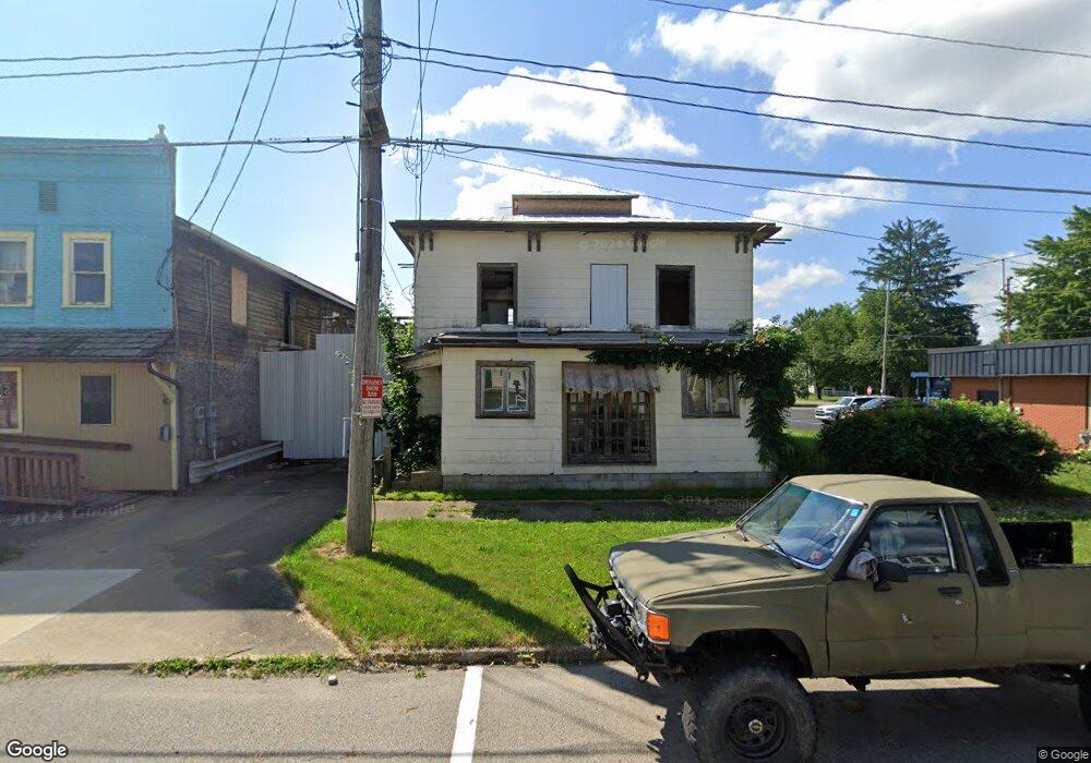
124 N Bridge St Perrysville, OH 44864
--
Bed
--
Bath
3,744
Sq Ft
5,227
Sq Ft Lot
About This Home
This home is located at 124 N Bridge St, Perrysville, OH 44864. 124 N Bridge St is a home located in Ashland County with nearby schools including Budd Elementary School, McMullen Elementary School, and Loudonville High School.
Ownership History
Date
Name
Owned For
Owner Type
Purchase Details
Closed on
Feb 15, 2022
Sold by
Sherf Of Ashland County
Bought by
Gallagher Ronald C
Purchase Details
Closed on
Jul 1, 2013
Sold by
Dewitt Darin R
Bought by
Gallagher Ronald C
Home Financials for this Owner
Home Financials are based on the most recent Mortgage that was taken out on this home.
Original Mortgage
$36,500
Interest Rate
3.52%
Mortgage Type
New Conventional
Purchase Details
Closed on
Jul 25, 1996
Sold by
Petty Mary Catherine
Bought by
Dewitt Vance W
Purchase Details
Closed on
Aug 15, 1983
Bought by
Petty Mary Catherine
Create a Home Valuation Report for This Property
The Home Valuation Report is an in-depth analysis detailing your home's value as well as a comparison with similar homes in the area
Home Values in the Area
Average Home Value in this Area
Purchase History
| Date | Buyer | Sale Price | Title Company |
|---|---|---|---|
| Gallagher Ronald C | $6,000 | None Listed On Document | |
| Gallagher Ronald C | $75,000 | -- | |
| Dewitt Vance W | $50,000 | -- | |
| Petty Mary Catherine | $42,500 | -- |
Source: Public Records
Mortgage History
| Date | Status | Borrower | Loan Amount |
|---|---|---|---|
| Previous Owner | Gallagher Ronald C | $36,500 |
Source: Public Records
Tax History Compared to Growth
Tax History
| Year | Tax Paid | Tax Assessment Tax Assessment Total Assessment is a certain percentage of the fair market value that is determined by local assessors to be the total taxable value of land and additions on the property. | Land | Improvement |
|---|---|---|---|---|
| 2024 | $40 | $780 | $280 | $500 |
| 2023 | $40 | $10,950 | $1,480 | $9,470 |
| 2022 | $541 | $10,430 | $1,410 | $9,020 |
| 2021 | $544 | $10,430 | $1,410 | $9,020 |
| 2020 | $675 | $10,430 | $1,410 | $9,020 |
| 2019 | $582 | $11,160 | $1,300 | $9,860 |
| 2018 | $593 | $11,160 | $1,300 | $9,860 |
| 2017 | $597 | $11,160 | $1,300 | $9,860 |
| 2016 | $582 | $11,160 | $1,300 | $9,860 |
| 2015 | $577 | $11,160 | $1,300 | $9,860 |
| 2013 | $603 | $11,350 | $1,230 | $10,120 |
Source: Public Records
Map
Nearby Homes
- 136 Bridge St
- 0 Township Road 937
- 0 County Road 917
- 78 Forest Hill Rd
- 58 Edgewood Dr
- 0 Trumpower Rd
- 68.40 Acres Trumpower Rd
- 2401 State Route 511
- 919 Mill Rd
- 1406 Pearl Dr
- 723 Pearl Dr
- 410 N Spring St
- 204 N Spring St
- 2579 State Route 60
- 500 Stone Meadow Cir
- 524 N Union St
- 201 S Market St
- 2818 Township Road 2812
- 333 E Campbell St
- 526 E Campbell St