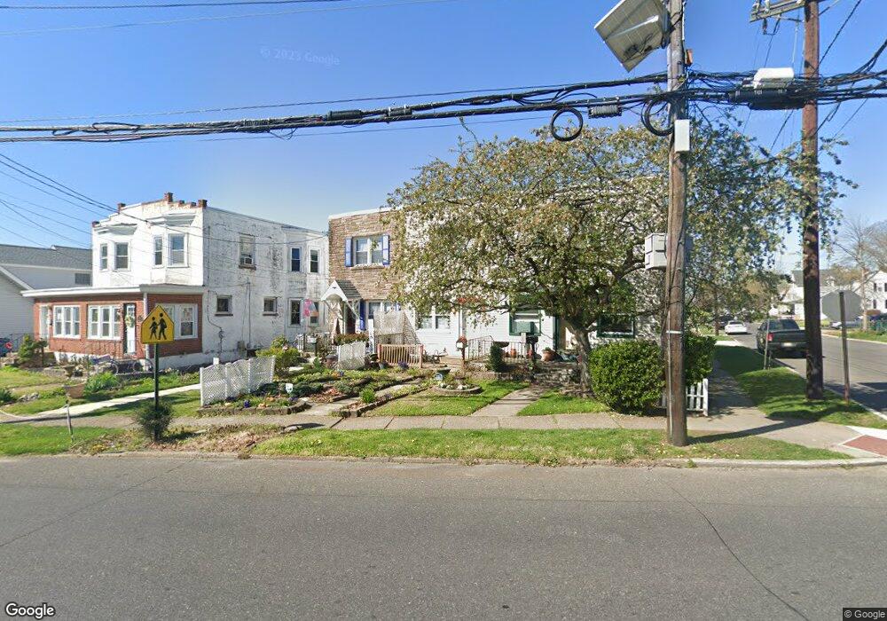
124 N Forklanding Rd Maple Shade, NJ 08052
Estimated Value: $207,000 - $258,000
2
Beds
1
Bath
1,120
Sq Ft
$219/Sq Ft
Est. Value
About This Home
This home is located at 124 N Forklanding Rd, Maple Shade, NJ 08052 and is currently estimated at $244,985, approximately $218 per square foot. 124 N Forklanding Rd is a home located in Burlington County with nearby schools including Ralph J Steinhauer Elementary School, Maude M. Wilkins Elementary School, and Howard R Yocum School.
Ownership History
Date
Name
Owned For
Owner Type
Purchase Details
Closed on
Nov 30, 2011
Sold by
Carey Robert L and Carey Linda I
Bought by
Basile Joanne
Current Estimated Value
Home Financials for this Owner
Home Financials are based on the most recent Mortgage that was taken out on this home.
Original Mortgage
$4,600
Interest Rate
4.01%
Mortgage Type
Stand Alone Second
Create a Home Valuation Report for This Property
The Home Valuation Report is an in-depth analysis detailing your home's value as well as a comparison with similar homes in the area
Home Values in the Area
Average Home Value in this Area
Purchase History
| Date | Buyer | Sale Price | Title Company |
|---|---|---|---|
| Basile Joanne | $118,000 | Weichert Title Agency |
Source: Public Records
Mortgage History
| Date | Status | Borrower | Loan Amount |
|---|---|---|---|
| Closed | Basile Joanne | $4,600 | |
| Open | Basile Joanne | $115,008 |
Source: Public Records
Tax History Compared to Growth
Tax History
| Year | Tax Paid | Tax Assessment Tax Assessment Total Assessment is a certain percentage of the fair market value that is determined by local assessors to be the total taxable value of land and additions on the property. | Land | Improvement |
|---|---|---|---|---|
| 2025 | $4,457 | $117,400 | $36,700 | $80,700 |
| 2024 | $4,327 | $117,400 | $36,700 | $80,700 |
| 2023 | $4,327 | $117,400 | $36,700 | $80,700 |
| 2022 | $4,260 | $117,400 | $36,700 | $80,700 |
| 2021 | $3,992 | $117,400 | $36,700 | $80,700 |
| 2020 | $4,231 | $117,400 | $36,700 | $80,700 |
| 2019 | $4,076 | $117,400 | $36,700 | $80,700 |
| 2018 | $4,006 | $117,400 | $36,700 | $80,700 |
| 2017 | $3,959 | $117,400 | $36,700 | $80,700 |
| 2016 | $3,900 | $117,400 | $36,700 | $80,700 |
| 2015 | $3,816 | $117,400 | $36,700 | $80,700 |
| 2014 | $3,699 | $117,400 | $36,700 | $80,700 |
Source: Public Records
Map
Nearby Homes
- 29 W Broadway
- 48 N Terrace Ave
- 22 Theodore Ave
- 301 N Coles Ave
- 26 N Poplar Ave
- 57 S Terrace Ave
- 480 W Front St
- 104 E Laurelton Ave
- 4 W Germantown Ave
- 2 Gainor Ave
- 112 S Maple Ave
- 12 Collins Ln
- 19 S Chestnut Ave
- 52 S Fellowship Rd
- 120 E Center Ave
- 5 Paul Rd
- 410 S Forklanding Rd
- 702 E Main St
- 44 S Pine Ave
- 8515 Bryn Mawr Ave
- 126 N Forklanding Rd
- 122 N Forklanding Rd
- 128 N Forklanding Rd
- 120 N Forklanding Rd
- 116 N Forklanding Rd
- 10 W Linwood Ave
- 112 N Forklanding Rd
- 14 W Linwood Ave
- 200 N Forklanding Rd
- 203 N Forklanding Rd
- 17 W Broadway
- 15 W Linwood Ave
- 108 N Forklanding Rd
- 18 W Linwood Ave
- 123 N Forklanding Rd
- 21 W Broadway
- 207 N Forklanding Rd
- 119 N Forklanding Rd
- 117 N Forklanding Rd
- 210 N Forklanding Rd