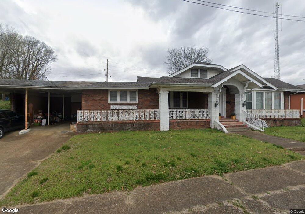
124 S Forrest Ave Camden, TN 38320
Estimated Value: $162,633 - $232,000
--
Bed
2
Baths
3,349
Sq Ft
$59/Sq Ft
Est. Value
About This Home
This home is located at 124 S Forrest Ave, Camden, TN 38320 and is currently estimated at $196,158, approximately $58 per square foot. 124 S Forrest Ave is a home located in Benton County with nearby schools including Camden Elementary School, Briarwood School, and Camden Junior High School.
Ownership History
Date
Name
Owned For
Owner Type
Purchase Details
Closed on
Apr 13, 2007
Sold by
Morar Manoj
Bought by
Holladay Lisa C
Current Estimated Value
Home Financials for this Owner
Home Financials are based on the most recent Mortgage that was taken out on this home.
Original Mortgage
$51,000
Outstanding Balance
$6,320
Interest Rate
6.1%
Mortgage Type
Cash
Estimated Equity
$189,838
Purchase Details
Closed on
Aug 7, 2003
Bought by
Morar Nilesh
Purchase Details
Closed on
Mar 24, 1995
Sold by
Johnson Michael David
Bought by
Johnson Richard A
Purchase Details
Closed on
Jan 12, 1993
Bought by
Johnson Michael David
Create a Home Valuation Report for This Property
The Home Valuation Report is an in-depth analysis detailing your home's value as well as a comparison with similar homes in the area
Home Values in the Area
Average Home Value in this Area
Purchase History
| Date | Buyer | Sale Price | Title Company |
|---|---|---|---|
| Holladay Lisa C | $73,000 | -- | |
| Morar Nilesh | $53,500 | -- | |
| Johnson Richard A | $43,000 | -- | |
| Johnson Michael David | $50,000 | -- |
Source: Public Records
Mortgage History
| Date | Status | Borrower | Loan Amount |
|---|---|---|---|
| Open | Johnson Michael David | $51,000 |
Source: Public Records
Tax History Compared to Growth
Tax History
| Year | Tax Paid | Tax Assessment Tax Assessment Total Assessment is a certain percentage of the fair market value that is determined by local assessors to be the total taxable value of land and additions on the property. | Land | Improvement |
|---|---|---|---|---|
| 2025 | $800 | $35,975 | $0 | $0 |
| 2024 | $800 | $21,825 | $5,000 | $16,825 |
| 2023 | $800 | $21,825 | $5,000 | $16,825 |
| 2022 | $800 | $21,825 | $5,000 | $16,825 |
| 2021 | $800 | $21,825 | $5,000 | $16,825 |
| 2020 | $801 | $21,825 | $5,000 | $16,825 |
| 2019 | $1,314 | $33,250 | $5,000 | $28,250 |
| 2018 | $1,314 | $33,250 | $5,000 | $28,250 |
| 2017 | $1,314 | $33,250 | $5,000 | $28,250 |
| 2016 | $1,314 | $33,250 | $5,000 | $28,250 |
| 2015 | $1,327 | $33,250 | $5,000 | $28,250 |
| 2014 | $1,175 | $33,250 | $5,000 | $28,250 |
| 2013 | $1,175 | $29,829 | $0 | $0 |
Source: Public Records
Map
Nearby Homes
- 129 S Forrest Ave
- 1 Maple Ave
- 122 W Lake St
- 000 Wyly St
- 116 N Church Ave
- 162 Factory St
- 121 Washington Ave
- 167 Cherokee Ave
- 134 N Church Ave
- 136 N Forrest Ave
- 0 Old Sawmill Road Lots 12 13
- 120 Magnolia St
- 172 W Main St
- 116 Magnolia St
- 170 N Forrest Ave
- 186 N Forrest Ave
- 197 Stigall St
- 121 Davidson St
- 0 Forrest Ave N
- 1762 Washington Ave
- 132 College Ave
- 134 College Ave
- 127 S Forrest Ave
- 20 E Main St
- 129 S Church Ave
- 125 S Church Ave
- 123 S Church Ave
- 121 S Church Ave
- 0 Higdon Ck Dr Unit RTC2690390
- 0 Higdon Ck Dr Unit 127769
- 131 S Church Ave
- 135 S Church Ave
- 138 College Ave S
- 118 Rowland St
- 118 W Main St
- 126 S Forrest Ave
- 139 S Church Ave
- 127 W Main St
- 7 N Church Ave
- 122 S Poplar St