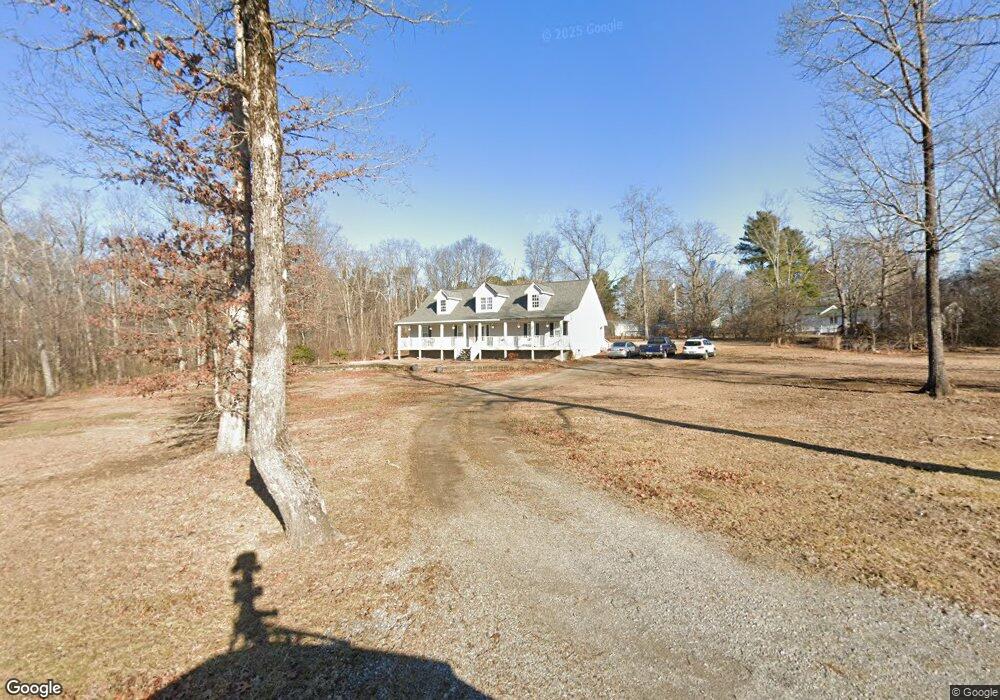
124 Scott Rd Signal Mountain, TN 37377
Estimated Value: $350,000 - $393,622
4
Beds
2
Baths
3,000
Sq Ft
$122/Sq Ft
Est. Value
About This Home
This home is located at 124 Scott Rd, Signal Mountain, TN 37377 and is currently estimated at $364,656, approximately $121 per square foot. 124 Scott Rd is a home located in Sequatchie County with nearby schools including Griffith Elementary School, Sequatchie County Middle School, and Sequatchie County High School.
Ownership History
Date
Name
Owned For
Owner Type
Purchase Details
Closed on
Sep 30, 2025
Sold by
Dodd Ayisha and Dodd Allen
Bought by
Mcdonald Rebekah and Mcdonald Kenneth
Current Estimated Value
Purchase Details
Closed on
Aug 17, 2018
Sold by
Wright Crystal G
Bought by
Dodd Allen and Dodd Ayisha
Home Financials for this Owner
Home Financials are based on the most recent Mortgage that was taken out on this home.
Original Mortgage
$234,491
Interest Rate
4.5%
Mortgage Type
VA
Purchase Details
Closed on
Mar 29, 2012
Sold by
Brown Donald Eugene
Bought by
Wright Keith A and Wright Crystal G
Home Financials for this Owner
Home Financials are based on the most recent Mortgage that was taken out on this home.
Original Mortgage
$136,451
Interest Rate
3.95%
Mortgage Type
FHA
Purchase Details
Closed on
Oct 2, 1998
Sold by
Nunley Randy L
Bought by
Brown Donald E
Purchase Details
Closed on
Jun 22, 1989
Bought by
Axmacher Mary L
Create a Home Valuation Report for This Property
The Home Valuation Report is an in-depth analysis detailing your home's value as well as a comparison with similar homes in the area
Home Values in the Area
Average Home Value in this Area
Purchase History
| Date | Buyer | Sale Price | Title Company |
|---|---|---|---|
| Mcdonald Rebekah | $350,000 | None Listed On Document | |
| Dodd Allen | $227,000 | Title Guaranty & Trust | |
| Wright Keith A | $140,000 | -- | |
| Brown Donald E | $9,900 | -- | |
| Axmacher Mary L | $6,000 | -- |
Source: Public Records
Mortgage History
| Date | Status | Borrower | Loan Amount |
|---|---|---|---|
| Previous Owner | Dodd Allen | $234,491 | |
| Previous Owner | Wright Keith A | $136,451 |
Source: Public Records
Tax History
| Year | Tax Paid | Tax Assessment Tax Assessment Total Assessment is a certain percentage of the fair market value that is determined by local assessors to be the total taxable value of land and additions on the property. | Land | Improvement |
|---|---|---|---|---|
| 2025 | $1,449 | $78,900 | $7,700 | $71,200 |
| 2024 | $1,449 | $78,900 | $7,700 | $71,200 |
| 2023 | $1,449 | $78,900 | $7,700 | $71,200 |
| 2022 | $1,175 | $48,100 | $6,125 | $41,975 |
| 2021 | $1,175 | $48,100 | $6,125 | $41,975 |
| 2020 | $1,175 | $48,100 | $6,125 | $41,975 |
| 2019 | $1,175 | $48,100 | $6,125 | $41,975 |
| 2018 | $991 | $40,575 | $6,125 | $34,450 |
| 2017 | $991 | $40,575 | $6,125 | $34,450 |
| 2016 | $1,002 | $39,000 | $6,125 | $32,875 |
| 2015 | $1,002 | $39,000 | $6,125 | $32,875 |
| 2014 | $1,002 | $39,000 | $6,125 | $32,875 |
Source: Public Records
Map
Nearby Homes
- 498 Hargis Rd
- 236 Hall Cemetery Rd
- 737 Miller Cove Rd
- 43 Miller Cove Cir
- 34 Miller Cove Cir
- 170 Miller Cove Cir
- 763 U S 127
- 280 Pine Ridge Dr
- 0 Dandy Rd Unit 1524756
- 471 Grayson Way
- 361 Pine Ridge Dr
- 844 Miller Rd
- 1908 Clear Brooks Dr
- 435 County Line Rd
- 28 Lynn Rd
- 3014 Edgewood Dr
- 2922 Kell Rd
- 2819 Signal Farms Ln
- 2435 Blue Mist Dr
- 4805 Taft Hwy
Your Personal Tour Guide
Ask me questions while you tour the home.