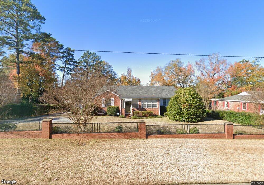
124 Ticknor Dr Columbus, GA 31903
Southern Columbus NeighborhoodEstimated Value: $84,000 - $124,000
3
Beds
2
Baths
1,458
Sq Ft
$73/Sq Ft
Est. Value
About This Home
This home is located at 124 Ticknor Dr, Columbus, GA 31903 and is currently estimated at $106,611, approximately $73 per square foot. 124 Ticknor Dr is a home located in Muscogee County with nearby schools including Dorothy Height Elementary School, Eddy Middle School, and Spencer High School.
Ownership History
Date
Name
Owned For
Owner Type
Purchase Details
Closed on
Jan 16, 2013
Sold by
Joyce Michael Edward
Bought by
Joyce William Joseph
Current Estimated Value
Home Financials for this Owner
Home Financials are based on the most recent Mortgage that was taken out on this home.
Original Mortgage
$58,000
Interest Rate
3.39%
Mortgage Type
New Conventional
Purchase Details
Closed on
Jan 15, 2013
Sold by
Joyce William Joseph
Bought by
Joyce Christine S
Home Financials for this Owner
Home Financials are based on the most recent Mortgage that was taken out on this home.
Original Mortgage
$58,000
Interest Rate
3.39%
Mortgage Type
New Conventional
Create a Home Valuation Report for This Property
The Home Valuation Report is an in-depth analysis detailing your home's value as well as a comparison with similar homes in the area
Home Values in the Area
Average Home Value in this Area
Purchase History
| Date | Buyer | Sale Price | Title Company |
|---|---|---|---|
| Joyce William Joseph | -- | -- | |
| Joyce Christine S | $58,000 | -- |
Source: Public Records
Mortgage History
| Date | Status | Borrower | Loan Amount |
|---|---|---|---|
| Closed | Joyce Christine S | $58,000 |
Source: Public Records
Tax History Compared to Growth
Tax History
| Year | Tax Paid | Tax Assessment Tax Assessment Total Assessment is a certain percentage of the fair market value that is determined by local assessors to be the total taxable value of land and additions on the property. | Land | Improvement |
|---|---|---|---|---|
| 2025 | $398 | $34,380 | $4,256 | $30,124 |
| 2024 | $397 | $40,064 | $3,696 | $36,368 |
| 2023 | $19 | $40,064 | $3,696 | $36,368 |
| 2022 | $413 | $30,944 | $3,696 | $27,248 |
| 2021 | $407 | $29,588 | $3,696 | $25,892 |
| 2020 | $407 | $29,588 | $3,696 | $25,892 |
| 2019 | $410 | $29,588 | $3,696 | $25,892 |
| 2018 | $410 | $29,588 | $3,696 | $25,892 |
| 2017 | $413 | $29,588 | $3,696 | $25,892 |
| 2016 | $416 | $23,349 | $2,626 | $20,723 |
| 2015 | $167 | $23,349 | $2,626 | $20,723 |
| 2014 | $167 | $23,349 | $2,626 | $20,723 |
| 2013 | -- | $23,349 | $2,626 | $20,723 |
Source: Public Records
Map
Nearby Homes
- 128 Ticknor Dr
- 110 Ticknor Dr
- 2164 Fort Benning Rd
- 130 Ticknor Dr
- 123 Ticknor Dr
- 121 Ticknor Dr
- 125 Ticknor Dr
- 132 Ticknor Dr
- 119 Ticknor Dr
- 2140 Fort Benning Rd
- 127 Ticknor Dr
- 117 Ticknor Dr
- 129 Ticknor Dr
- 115 Ticknor Dr
- 134 Ticknor Dr
- 113 Ticknor Dr
- 37 Douglas St
- 136 Ticknor Dr
- 111 Ticknor Dr
- 133 Ticknor Dr