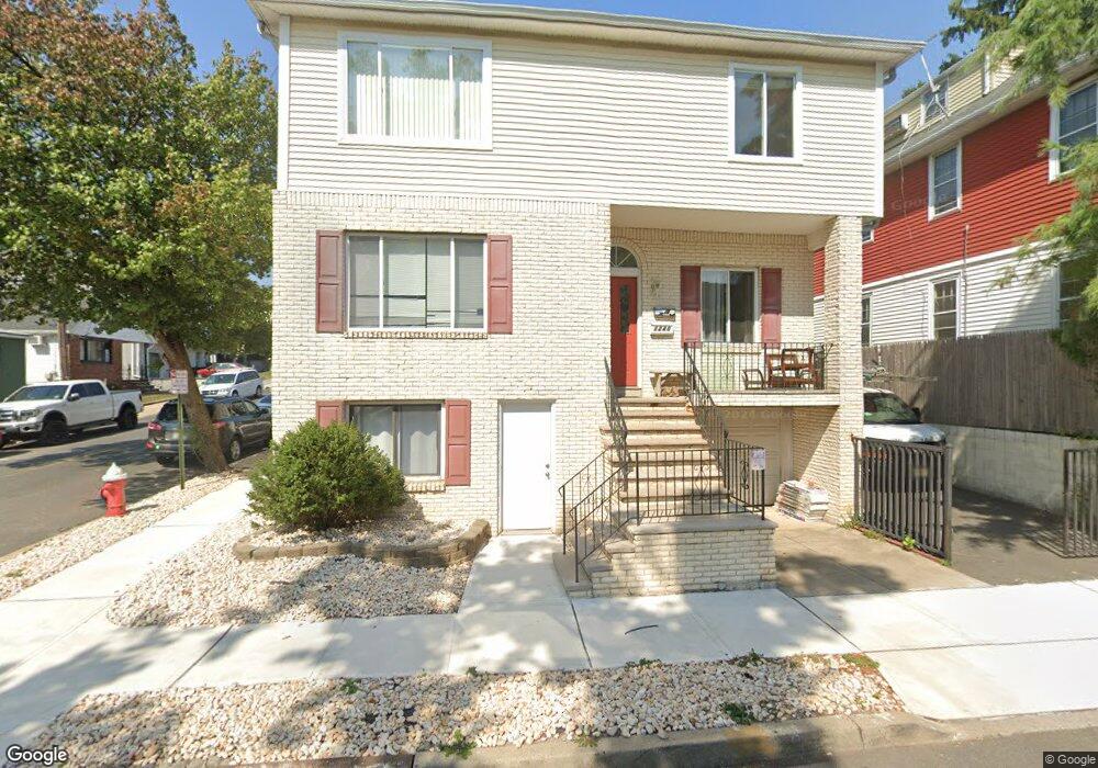
1240 Baker St Hillside, NJ 07205
Estimated Value: $739,063 - $873,000
--
Bed
--
Bath
3,976
Sq Ft
$201/Sq Ft
Est. Value
About This Home
This home is located at 1240 Baker St, Hillside, NJ 07205 and is currently estimated at $797,766, approximately $200 per square foot. 1240 Baker St is a home located in Union County with nearby schools including Abram P. Morris-Saybrook Elementary School, Hurden Looker School, and Ola Edwards Community School.
Ownership History
Date
Name
Owned For
Owner Type
Purchase Details
Closed on
Sep 29, 1998
Sold by
Rodrigues Jose A and Rodrigues Ana
Bought by
Machado Wesley B
Current Estimated Value
Home Financials for this Owner
Home Financials are based on the most recent Mortgage that was taken out on this home.
Original Mortgage
$204,250
Outstanding Balance
$44,796
Interest Rate
6.92%
Estimated Equity
$752,970
Create a Home Valuation Report for This Property
The Home Valuation Report is an in-depth analysis detailing your home's value as well as a comparison with similar homes in the area
Home Values in the Area
Average Home Value in this Area
Purchase History
| Date | Buyer | Sale Price | Title Company |
|---|---|---|---|
| Machado Wesley B | $215,000 | -- |
Source: Public Records
Mortgage History
| Date | Status | Borrower | Loan Amount |
|---|---|---|---|
| Open | Machado Wesley B | $204,250 |
Source: Public Records
Tax History Compared to Growth
Tax History
| Year | Tax Paid | Tax Assessment Tax Assessment Total Assessment is a certain percentage of the fair market value that is determined by local assessors to be the total taxable value of land and additions on the property. | Land | Improvement |
|---|---|---|---|---|
| 2025 | $14,897 | $180,500 | $49,800 | $130,700 |
| 2024 | $14,463 | $180,500 | $49,800 | $130,700 |
| 2023 | $14,463 | $180,500 | $49,800 | $130,700 |
| 2022 | $14,330 | $180,500 | $49,800 | $130,700 |
| 2021 | $14,236 | $180,500 | $49,800 | $130,700 |
| 2020 | $14,153 | $180,500 | $49,800 | $130,700 |
| 2019 | $13,879 | $180,500 | $49,800 | $130,700 |
| 2018 | $13,740 | $180,500 | $49,800 | $130,700 |
| 2017 | $13,657 | $180,500 | $49,800 | $130,700 |
| 2016 | $13,640 | $180,500 | $49,800 | $130,700 |
| 2015 | $13,519 | $180,500 | $49,800 | $130,700 |
| 2014 | $13,306 | $180,500 | $49,800 | $130,700 |
Source: Public Records
Map
Nearby Homes
- 149 Baltimore Ave
- 155 Silver Ave
- 1282 Baker St
- 167 Silver Ave
- 1090 Voorhees St
- 1048 Chester St
- 420 Hollywood Ave
- 257 Herbert Ave
- 383 Conant St
- 292 Crann St
- 628 Us Highway 22 and 3
- 221 Linwood Place
- 314 Fitzpatrick St
- 157 Virginia St Unit 9
- 386 Yale Ave
- 393 Harvard Ave
- 410 Rutgers Ave
- 1442 Highland Ave
- 1132 Church St
- 15 Hollywood Ave
- 1242 Baker St
- 139 Baltimore Ave
- 1241 Baker St
- 143 Baltimore Ave
- 1246 Baker St
- 136 Baltimore Ave
- 140 Boston Ave
- 138 Baltimore Ave
- 1243 Baker St
- 1231 Baker St
- 140 Baltimore Ave
- 145 Baltimore Ave
- 1229 Baker St
- 142 Boston Ave
- 1224 Baker St
- 1225 S State St
- 144 Boston Ave
- 128 Baltimore Ave
- 1222 Baker St
- 1227 Baker St