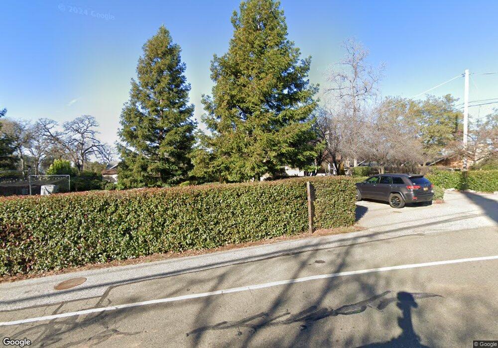
12405 New Airport Rd Auburn, CA 95603
Country Club Estates NeighborhoodEstimated Value: $640,000 - $772,806
5
Beds
2
Baths
2,538
Sq Ft
$287/Sq Ft
Est. Value
About This Home
This home is located at 12405 New Airport Rd, Auburn, CA 95603 and is currently estimated at $727,952, approximately $286 per square foot. 12405 New Airport Rd is a home located in Placer County with nearby schools including Auburn Elementary School, Placer High School, and EV Cain Middle.
Ownership History
Date
Name
Owned For
Owner Type
Purchase Details
Closed on
Mar 14, 2005
Sold by
Aroz Martin J and Aroz Joan M
Bought by
Aroz Peter E and Aroz Sara
Current Estimated Value
Purchase Details
Closed on
Dec 2, 1998
Sold by
Greenwell Adeline S
Bought by
Aroz Martin J and Aroz Joan M
Purchase Details
Closed on
Feb 17, 1994
Sold by
Greenwell Adeline S
Bought by
Greenwell Adeline S
Create a Home Valuation Report for This Property
The Home Valuation Report is an in-depth analysis detailing your home's value as well as a comparison with similar homes in the area
Home Values in the Area
Average Home Value in this Area
Purchase History
| Date | Buyer | Sale Price | Title Company |
|---|---|---|---|
| Aroz Peter E | -- | -- | |
| Aroz Martin J | $155,000 | Placer Title Company | |
| Greenwell Adeline S | -- | -- |
Source: Public Records
Tax History Compared to Growth
Tax History
| Year | Tax Paid | Tax Assessment Tax Assessment Total Assessment is a certain percentage of the fair market value that is determined by local assessors to be the total taxable value of land and additions on the property. | Land | Improvement |
|---|---|---|---|---|
| 2025 | $2,822 | $273,714 | $94,049 | $179,665 |
| 2023 | $2,822 | $263,088 | $90,398 | $172,690 |
| 2022 | $2,776 | $257,930 | $88,626 | $169,304 |
| 2021 | $2,677 | $252,874 | $86,889 | $165,985 |
| 2020 | $2,657 | $250,283 | $85,999 | $164,284 |
| 2019 | $2,608 | $245,376 | $84,313 | $161,063 |
| 2018 | $2,468 | $240,565 | $82,660 | $157,905 |
| 2017 | $2,423 | $235,849 | $81,040 | $154,809 |
| 2016 | $2,372 | $231,225 | $79,451 | $151,774 |
| 2015 | $2,315 | $227,753 | $78,258 | $149,495 |
| 2014 | $2,279 | $223,293 | $76,726 | $146,567 |
Source: Public Records
Map
Nearby Homes
- 2285 Indian Rock Ln
- 2540 Grass Valley Hwy Unit SP 12
- 2540 Grass Valley Hwy Unit 27
- 2540 Grass Valley Hwy Unit 75
- 2540 Grass Valley Hwy Unit 72
- 2540 Grass Valley Hwy Unit 112
- 2540 Grass Valley Hwy Unit 34
- 2540 Grass Valley Hwy Unit 133
- 2540 Grass Valley Hwy Unit 105
- 2540 Grass Valley Hwy Unit 55
- 12265 New Airport Rd
- 2667 Commons Place
- 2677 Commons Place
- 2445 Briar Meadow Cir
- 2415 Briar Meadow Cir
- 2435 Briar Meadow Cir
- 2425 Briar Meadow Cir
- 2650 Commons Place
- 2660 Commons Place
- 2825 Leeds Ct
- 12399 New Airport Rd
- 2405 Short Ln
- 2294 Indian Rock Ln
- 0 Indian Rock Ln
- 12365 Reba Rd Unit 1+2
- 12365 Reba Rd
- 12365 Reba Short
- 12400 New Airport Rd
- 12389 New Airport Rd
- 12410 New Airport Rd
- 2290 Indian Rock Ln
- 2427 Short Ln
- 12425 New Airport Rd
- 12355 Reba Rd
- 12380 New Airport Rd
- 2296 Indian Rock Ln
- 12420 New Airport Rd
- 2435 Short Ln
- 12379 New Airport Rd
- 2299 Indian Rock Ln
