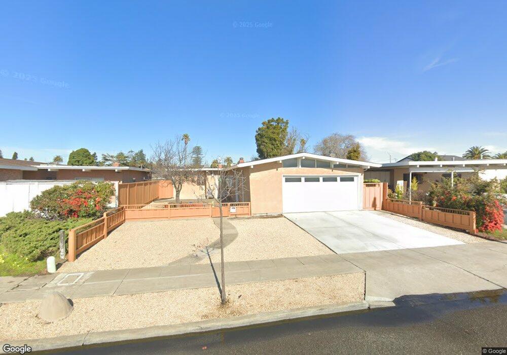
1241 Rosewood Way Alameda, CA 94501
South Shore NeighborhoodEstimated Value: $1,039,388 - $1,170,000
4
Beds
2
Baths
1,271
Sq Ft
$867/Sq Ft
Est. Value
About This Home
This home is located at 1241 Rosewood Way, Alameda, CA 94501 and is currently estimated at $1,101,597, approximately $866 per square foot. 1241 Rosewood Way is a home located in Alameda County with nearby schools including William G. Paden Elementary School, Will C. Wood Middle School, and Encinal Junior/Senior High.
Ownership History
Date
Name
Owned For
Owner Type
Purchase Details
Closed on
Mar 29, 2013
Sold by
Lowe Noel F and Noel & Cornelia Lowe Living Tr
Bought by
Lowe Michael J and Measor Sarah Jane
Current Estimated Value
Home Financials for this Owner
Home Financials are based on the most recent Mortgage that was taken out on this home.
Original Mortgage
$316,000
Outstanding Balance
$223,457
Interest Rate
3.51%
Mortgage Type
New Conventional
Estimated Equity
$878,140
Create a Home Valuation Report for This Property
The Home Valuation Report is an in-depth analysis detailing your home's value as well as a comparison with similar homes in the area
Home Values in the Area
Average Home Value in this Area
Purchase History
| Date | Buyer | Sale Price | Title Company |
|---|---|---|---|
| Lowe Michael J | $395,000 | Chicago Title Company |
Source: Public Records
Mortgage History
| Date | Status | Borrower | Loan Amount |
|---|---|---|---|
| Open | Lowe Michael J | $316,000 |
Source: Public Records
Tax History Compared to Growth
Tax History
| Year | Tax Paid | Tax Assessment Tax Assessment Total Assessment is a certain percentage of the fair market value that is determined by local assessors to be the total taxable value of land and additions on the property. | Land | Improvement |
|---|---|---|---|---|
| 2025 | $3,196 | $104,937 | $46,829 | $65,108 |
| 2024 | $3,196 | $102,743 | $45,911 | $63,832 |
| 2023 | $3,113 | $107,590 | $45,010 | $62,580 |
| 2022 | $3,056 | $98,481 | $44,128 | $61,353 |
| 2021 | $3,002 | $96,414 | $43,263 | $60,151 |
| 2020 | $2,970 | $102,353 | $42,819 | $59,534 |
| 2019 | $2,536 | $100,347 | $41,980 | $58,367 |
| 2018 | $2,486 | $98,380 | $41,157 | $57,223 |
| 2017 | $2,413 | $96,451 | $40,350 | $56,101 |
| 2016 | $2,391 | $94,560 | $39,559 | $55,001 |
| 2015 | $2,346 | $90,676 | $38,964 | $51,712 |
| 2014 | $2,282 | $88,900 | $38,201 | $50,699 |
Source: Public Records
Map
Nearby Homes
- 404 Coral Reef Rd
- 608 Fortress Isle
- 955 Shorepoint Ct Unit 110
- 955 Shorepoint Ct Unit 200
- 325 Kitty Hawk Rd Unit 207
- 325 Kitty Hawk Rd Unit 304
- 965 Shorepoint Ct
- 1001 Shoreline Dr Unit 301
- 950 Shorepoint Ct Unit 100
- 1941 Franciscan Way
- 933 Shoreline Dr Unit 203
- 2000 Clinton Ave
- 1812 San Antonio Ave
- 1628 Encinal Ave
- 2031 Otis Dr Unit H
- 610 Grand St
- 1203 Benton St
- 2106 Otis Dr Unit D
- 901 San Antonio Ave
- 2101 Shoreline Dr Unit 437
- 1237 Rosewood Way
- 1245 Rosewood Way
- 1233 Rosewood Way
- 1242 Otis Dr
- 1246 Otis Dr
- 1238 Otis Dr
- 1229 Rosewood Way
- 1234 Otis Dr
- 1240 Rosewood Way
- 1236 Rosewood Way
- 1232 Rosewood Way
- 1264 Rosewood Way
- 1260 Rosewood Way
- 1268 Rosewood Way
- 1228 Otis Dr
- 1225 Rosewood Way
- 1248 Rosewood Way
- 1228 Rosewood Way
- 1256 Rosewood Way
- 1272 Rosewood Way