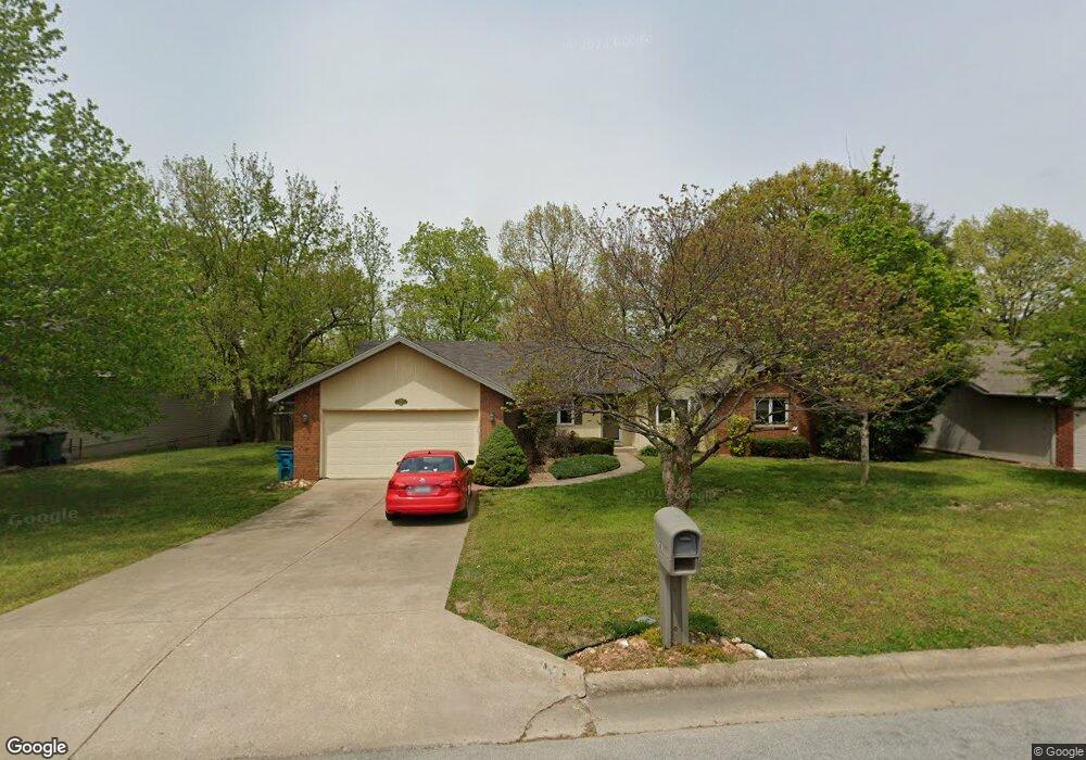
1241 W Vancouver St Springfield, MO 65803
Estimated Value: $248,749 - $302,000
3
Beds
2
Baths
1,732
Sq Ft
$157/Sq Ft
Est. Value
About This Home
This home is located at 1241 W Vancouver St, Springfield, MO 65803 and is currently estimated at $271,687, approximately $156 per square foot. 1241 W Vancouver St is a home located in Greene County with nearby schools including Truman Elementary School, Pleasant View K-8 School, and Hillcrest High School.
Ownership History
Date
Name
Owned For
Owner Type
Purchase Details
Closed on
Sep 7, 2012
Sold by
Randall Connie and Randall Bryan
Bought by
Nelson Virginia Randall
Current Estimated Value
Purchase Details
Closed on
Jul 28, 2011
Sold by
Depriest Don and Depriest Clara
Bought by
Nelson Scott and Nelson Virginia
Home Financials for this Owner
Home Financials are based on the most recent Mortgage that was taken out on this home.
Original Mortgage
$115,008
Interest Rate
4.25%
Mortgage Type
FHA
Create a Home Valuation Report for This Property
The Home Valuation Report is an in-depth analysis detailing your home's value as well as a comparison with similar homes in the area
Purchase History
| Date | Buyer | Sale Price | Title Company |
|---|---|---|---|
| Nelson Virginia Randall | -- | None Available | |
| Nelson Scott | -- | None Available |
Source: Public Records
Mortgage History
| Date | Status | Borrower | Loan Amount |
|---|---|---|---|
| Previous Owner | Nelson Scott | $115,008 |
Source: Public Records
Tax History
| Year | Tax Paid | Tax Assessment Tax Assessment Total Assessment is a certain percentage of the fair market value that is determined by local assessors to be the total taxable value of land and additions on the property. | Land | Improvement |
|---|---|---|---|---|
| 2025 | $1,627 | $30,080 | $6,650 | $23,430 |
| 2024 | $1,452 | $25,080 | $2,850 | $22,230 |
| 2023 | $1,444 | $25,080 | $2,850 | $22,230 |
| 2022 | $1,297 | $22,080 | $2,850 | $19,230 |
| 2021 | $1,241 | $22,080 | $2,850 | $19,230 |
| 2020 | $1,277 | $21,570 | $2,850 | $18,720 |
| 2019 | $1,241 | $21,570 | $2,850 | $18,720 |
| 2018 | $1,280 | $22,140 | $4,370 | $17,770 |
| 2017 | $1,269 | $20,960 | $4,370 | $16,590 |
| 2016 | $1,199 | $20,960 | $4,370 | $16,590 |
| 2015 | $1,190 | $20,960 | $4,370 | $16,590 |
| 2014 | $1,197 | $20,960 | $4,370 | $16,590 |
Source: Public Records
Map
Nearby Homes
- 1122 W Vancouver St
- 1158 W Bradley St
- 1420 W Farm Road 102
- 3879 N Williams Ct
- 3714 N Mount Zion Ct
- 3486 N Farm Road 143
- 3645 N Oak Point Ave
- 3582 N Thistlewood Ct
- 3740 N Oak Point Ave
- 3630 N Thistlewood Ct
- 671 W Bridgewood Ct
- 1835 W Farm Road 102
- 1632 N Grant Ave
- 1.16 Acres W Norton Rd
- 3764 N Huntington Ave
- 2105 W McClernon St
- 000 Missouri 13
- 2406 W Spring Water St
- 434 W Kerr St
- 2829 N Grant Ave
- 1241 Vancouver Dr
- 1301 W Vancouver St
- 1233 W Vancouver St
- 1311 Vancouver Dr
- 3628 N La Vista Ct
- 1225 W Vancouver St
- 1234 W Arlington Dr
- 1254 W Vancouver St
- 1254 Vancouver Dr
- 1302 W Vancouver St
- 1318 W Vancouver St
- 1214 W Arlington Dr
- 1336 W Vancouver St
- 1209 W Vancouver St
- 000 W Arlington
- 3643 N Vera Cruz Dr
- 1186 W Vancouver St
- 3619 N La Vista Ct
- 3556 N Del Lu Dr
- 1370 W Vancouver St
Your Personal Tour Guide
Ask me questions while you tour the home.