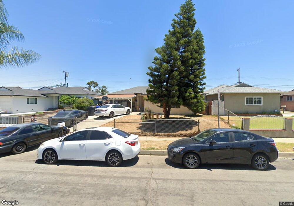
12410 Kayreid Dr Whittier, CA 90605
South Whittier NeighborhoodEstimated Value: $781,551 - $811,000
4
Beds
1
Bath
1,511
Sq Ft
$527/Sq Ft
Est. Value
About This Home
This home is located at 12410 Kayreid Dr, Whittier, CA 90605 and is currently estimated at $796,138, approximately $526 per square foot. 12410 Kayreid Dr is a home located in Los Angeles County with nearby schools including California High School, St. Paul Of The Cross Elementary School, and St. Gregory The Great.
Ownership History
Date
Name
Owned For
Owner Type
Purchase Details
Closed on
Jul 30, 2014
Sold by
Wu Edward C
Bought by
The Wu Family Trust
Current Estimated Value
Purchase Details
Closed on
Feb 23, 2011
Sold by
Fannie Mae
Bought by
Wu Edward C and Wu Amy
Purchase Details
Closed on
Jul 12, 2010
Sold by
Henriquez Jose O and Henriquez Thelma A
Bought by
Federal National Mortgage Association
Create a Home Valuation Report for This Property
The Home Valuation Report is an in-depth analysis detailing your home's value as well as a comparison with similar homes in the area
Home Values in the Area
Average Home Value in this Area
Purchase History
| Date | Buyer | Sale Price | Title Company |
|---|---|---|---|
| The Wu Family Trust | -- | None Available | |
| Wu Edward C | $212,000 | Servicelink | |
| Federal National Mortgage Association | $273,400 | Landsafe Title |
Source: Public Records
Tax History Compared to Growth
Tax History
| Year | Tax Paid | Tax Assessment Tax Assessment Total Assessment is a certain percentage of the fair market value that is determined by local assessors to be the total taxable value of land and additions on the property. | Land | Improvement |
|---|---|---|---|---|
| 2025 | $4,856 | $379,216 | $256,230 | $122,986 |
| 2024 | $4,856 | $371,781 | $251,206 | $120,575 |
| 2023 | $4,708 | $364,492 | $246,281 | $118,211 |
| 2022 | $4,739 | $357,346 | $241,452 | $115,894 |
| 2021 | $4,640 | $350,340 | $236,718 | $113,622 |
| 2020 | $4,591 | $346,748 | $234,291 | $112,457 |
| 2019 | $4,559 | $339,950 | $229,698 | $110,252 |
| 2018 | $4,371 | $333,286 | $225,195 | $108,091 |
| 2016 | $4,152 | $320,346 | $216,451 | $103,895 |
| 2015 | $4,049 | $315,535 | $213,200 | $102,335 |
| 2014 | $4,010 | $309,355 | $209,024 | $100,331 |
Source: Public Records
Map
Nearby Homes
- 12309 Ramsey Dr
- 13703 Placid Dr
- 13857 Leffingwell Rd
- 12818 Duffield Ave
- 14000 Lake View Dr
- 14036 Lake View Dr Unit 143
- 13513 Leffingwell Rd
- 13854 Adoree St
- 14034 Coteau Dr Unit 1103
- 14020 Lake Crest Dr Unit 84
- 13007 Duffield Ave
- 12726 Lake Forest Ave Unit 25
- 14135 Chere Dr
- 13531 Utica St
- 13481 Meyer Rd
- 13102 Sunnybrook Ln
- 13538 Lukay St
- 11624 Starlight Ave
- 14216 Adoree St
- 14243 Gagely Dr
- 12414 Kayreid Dr
- 12402 Kayreid Dr
- 12420 Kayreid Dr
- 12358 Kayreid Dr
- 12409 Kayreid Dr
- 12426 Kayreid Dr
- 12417 Kayreid Dr
- 12352 Kayreid Dr
- 12403 Kayreid Dr
- 12432 Kayreid Dr
- 12348 Kayreid Dr
- 12429 Kayreid Dr
- 13743 Placid Dr
- 13748 Saranac Dr
- 13761 Saranac Dr
- 12339 Ramsey Dr
- 12343 Ramsey Dr
- 12436 Kayreid Dr
- 12342 Kayreid Dr
- 12333 Ramsey Dr