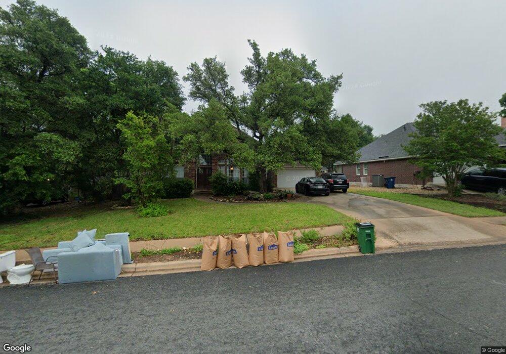
12411 W Cow Path Austin, TX 78727
Angus Ranch NeighborhoodEstimated Value: $612,172 - $759,000
--
Bed
2
Baths
2,251
Sq Ft
$307/Sq Ft
Est. Value
About This Home
This home is located at 12411 W Cow Path, Austin, TX 78727 and is currently estimated at $691,043, approximately $306 per square foot. 12411 W Cow Path is a home located in Travis County with nearby schools including Davis Elementary School, Murchison Middle School, and Anderson High School.
Ownership History
Date
Name
Owned For
Owner Type
Purchase Details
Closed on
Apr 30, 2004
Sold by
Degrasse Donald H and Degrasse Martha Moody
Bought by
Kiehn Todd and Kiehn Maria
Current Estimated Value
Home Financials for this Owner
Home Financials are based on the most recent Mortgage that was taken out on this home.
Original Mortgage
$200,000
Outstanding Balance
$92,979
Interest Rate
5.38%
Mortgage Type
Purchase Money Mortgage
Estimated Equity
$598,064
Purchase Details
Closed on
Jan 11, 1996
Sold by
Gaudio Gerard A and Gaudio Aileen M
Bought by
Degrasse Donald H and Moody Martha
Home Financials for this Owner
Home Financials are based on the most recent Mortgage that was taken out on this home.
Original Mortgage
$134,400
Interest Rate
7.31%
Create a Home Valuation Report for This Property
The Home Valuation Report is an in-depth analysis detailing your home's value as well as a comparison with similar homes in the area
Home Values in the Area
Average Home Value in this Area
Purchase History
| Date | Buyer | Sale Price | Title Company |
|---|---|---|---|
| Kiehn Todd | -- | Heritage Title | |
| Degrasse Donald H | -- | -- |
Source: Public Records
Mortgage History
| Date | Status | Borrower | Loan Amount |
|---|---|---|---|
| Open | Kiehn Todd | $200,000 | |
| Previous Owner | Degrasse Donald H | $134,400 |
Source: Public Records
Tax History Compared to Growth
Tax History
| Year | Tax Paid | Tax Assessment Tax Assessment Total Assessment is a certain percentage of the fair market value that is determined by local assessors to be the total taxable value of land and additions on the property. | Land | Improvement |
|---|---|---|---|---|
| 2025 | $9,650 | $565,398 | $178,161 | $387,237 |
| 2023 | $8,140 | $549,435 | $0 | $0 |
| 2022 | $8,582 | $499,486 | $0 | $0 |
| 2021 | $10,111 | $454,078 | $171,000 | $374,167 |
| 2020 | $8,854 | $412,798 | $171,000 | $263,493 |
| 2018 | $7,553 | $341,155 | $50,000 | $326,581 |
| 2017 | $6,917 | $310,141 | $45,000 | $265,141 |
| 2016 | $7,341 | $310,141 | $45,000 | $265,141 |
| 2015 | $6,224 | $311,623 | $45,000 | $273,959 |
| 2014 | $6,224 | $283,294 | $0 | $0 |
Source: Public Records
Map
Nearby Homes
- 12005 Mustang Chase
- 4812 Pelham Dr
- 5126 Ganymede Dr
- 12904 Garfield Ln
- 12706 Heinemann Dr
- 12705 Acadian Trail
- 12404 Sceptre Cove
- 5720 Shreveport Dr
- 12319 Wycliff Ln
- 4612 Ganymede Dr
- 12203 Arrowwood Dr
- 6009 Baton Rouge Dr
- 5001 Dull Knife Dr
- 12223 Antoinette Place
- 12103 Wycliff Ln
- 11929 Arabian Trail
- 5912 Richard Carlton Blvd
- 4513 Sidereal Dr
- 11907 Highland Oaks Trail
- 4508 Duval Rd Unit 6602
- 12409 W Cow Path
- 12501 W Cow Path
- 12407 W Cow Path
- 12404 Deer Track
- 12404 Deer Track
- 12419 Audane Dr
- 12422 Audane Dr
- 12406 Deer Track
- 12406 Deer Track
- 12405 W Cow Path
- 12402 Deer Track
- 12402 Deer Track
- 12404 W Cow Path
- 12420 Audane Dr
- 12417 Audane Dr
- 12507 W Cow Path
- 12402 W Cow Path
- 12400 Deer Track
- 12403 W Cow Path
- 12418 Audane Dr