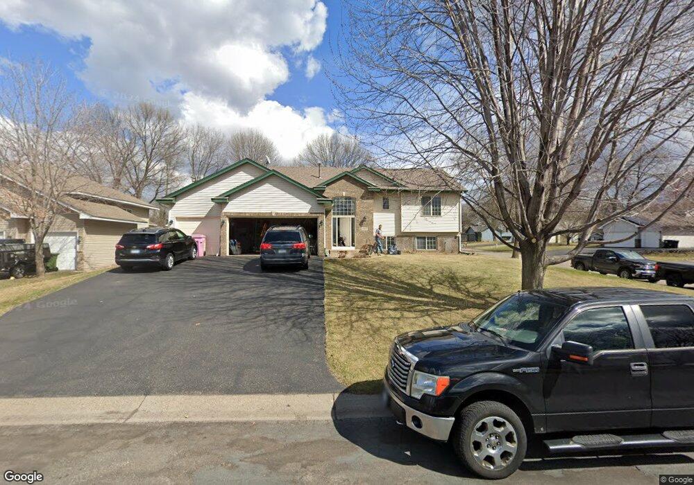
12413 Raven St NW Coon Rapids, MN 55448
Estimated Value: $394,000 - $431,000
4
Beds
3
Baths
1,362
Sq Ft
$306/Sq Ft
Est. Value
About This Home
This home is located at 12413 Raven St NW, Coon Rapids, MN 55448 and is currently estimated at $417,256, approximately $306 per square foot. 12413 Raven St NW is a home located in Anoka County with nearby schools including Lucile Bruner Elementary School, Hoover Elementary School, and Laughlin Junior/Senior High School.
Ownership History
Date
Name
Owned For
Owner Type
Purchase Details
Closed on
Jul 16, 1999
Sold by
Scott Olmstead Builders Inc
Bought by
Kish Robert J
Current Estimated Value
Purchase Details
Closed on
Mar 31, 1999
Sold by
Shamrock Development Inc
Bought by
Scott Olmstead Builders Inc
Create a Home Valuation Report for This Property
The Home Valuation Report is an in-depth analysis detailing your home's value as well as a comparison with similar homes in the area
Home Values in the Area
Average Home Value in this Area
Purchase History
| Date | Buyer | Sale Price | Title Company |
|---|---|---|---|
| Kish Robert J | $159,404 | -- | |
| Scott Olmstead Builders Inc | $34,900 | -- |
Source: Public Records
Mortgage History
| Date | Status | Borrower | Loan Amount |
|---|---|---|---|
| Closed | Scott Olmstead Builders Inc | -- |
Source: Public Records
Tax History Compared to Growth
Tax History
| Year | Tax Paid | Tax Assessment Tax Assessment Total Assessment is a certain percentage of the fair market value that is determined by local assessors to be the total taxable value of land and additions on the property. | Land | Improvement |
|---|---|---|---|---|
| 2025 | $4,328 | $412,100 | $86,000 | $326,100 |
| 2024 | $4,328 | $407,000 | $95,000 | $312,000 |
| 2023 | $3,910 | $395,900 | $82,000 | $313,900 |
| 2022 | $3,706 | $395,300 | $70,000 | $325,300 |
| 2021 | $3,629 | $334,500 | $59,000 | $275,500 |
| 2020 | $3,778 | $320,600 | $63,000 | $257,600 |
| 2019 | $3,552 | $319,400 | $67,000 | $252,400 |
| 2018 | $3,322 | $293,200 | $0 | $0 |
| 2017 | $2,738 | $267,500 | $0 | $0 |
| 2016 | $2,724 | $215,600 | $0 | $0 |
| 2015 | -- | $215,600 | $51,000 | $164,600 |
| 2014 | -- | $195,000 | $50,300 | $144,700 |
Source: Public Records
Map
Nearby Homes
- 2068 124th Ln NW
- 2147 125th Ln NW
- 12760 Raven St NW
- 1930 127th Cir NW
- 12365 Jay St NW
- 2675 128th Ave NW
- 1727 121st Ln NW
- 12888 Nightingale St NW
- 12554 Grouse St NW
- 12019 Zion St NW
- 12759 Ibis St NW
- 1593 126th Ln NW
- 12463 Drake St NW
- 1450 126th Ln NW
- 12010 Eagle St NW
- 1520 129th Ave NW
- 11749 Crooked Lake Blvd NW
- 13182 Zion St NW
- 1449 119th Ln NW
- 1687 131st Ln NW
- 2196 124th Ave NW
- 12412 Quinn St NW
- 12441 Raven St NW
- 2180 124th Ave NW
- 12422 Raven St NW
- 12426 Quinn St NW
- 12408 Raven St NW
- 12436 Raven St NW
- 12394 Raven St NW
- 2164 124th Ave NW
- 12380 Raven St NW
- 2148 124th Ave NW
- 12454 Quinn St NW
- 2189 123rd Ln NW
- 2173 123rd Ln NW
- 12425 Swallow Cir NW
- 12450 Raven St NW
- 2157 123rd Ln NW
- 12439 Swallow Cir NW
- 12366 Raven St NW