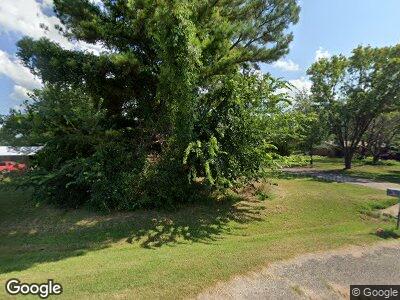
12413 Shady Dale Rd Marietta, OK 73448
Estimated Value: $177,903 - $247,000
3
Beds
2
Baths
1,296
Sq Ft
$161/Sq Ft
Est. Value
About This Home
This home is located at 12413 Shady Dale Rd, Marietta, OK 73448 and is currently estimated at $208,476, approximately $160 per square foot. 12413 Shady Dale Rd is a home located in Love County with nearby schools including Marietta Elementary School, Marietta Middle School, and Marietta High School.
Ownership History
Date
Name
Owned For
Owner Type
Purchase Details
Closed on
Oct 20, 2022
Sold by
Short Kimberly Ann and Short Glendon
Bought by
Harvey Jeffrey Lynn
Current Estimated Value
Purchase Details
Closed on
Feb 8, 2019
Sold by
Redding Dale W and Redding Cathy L
Bought by
Rueda Linda Ann
Home Financials for this Owner
Home Financials are based on the most recent Mortgage that was taken out on this home.
Original Mortgage
$116,161
Interest Rate
4.5%
Mortgage Type
New Conventional
Create a Home Valuation Report for This Property
The Home Valuation Report is an in-depth analysis detailing your home's value as well as a comparison with similar homes in the area
Home Values in the Area
Average Home Value in this Area
Purchase History
| Date | Buyer | Sale Price | Title Company |
|---|---|---|---|
| Harvey Jeffrey Lynn | -- | Arbuckle Closing & Escrow | |
| Rueda Linda Ann | $115,000 | Stewart Title Guaranty Co |
Source: Public Records
Mortgage History
| Date | Status | Borrower | Loan Amount |
|---|---|---|---|
| Previous Owner | Rueda Linda Ann | $116,161 | |
| Previous Owner | Redding Dale W | $35,000 |
Source: Public Records
Tax History Compared to Growth
Tax History
| Year | Tax Paid | Tax Assessment Tax Assessment Total Assessment is a certain percentage of the fair market value that is determined by local assessors to be the total taxable value of land and additions on the property. | Land | Improvement |
|---|---|---|---|---|
| 2024 | $1,371 | $12,286 | $480 | $11,806 |
| 2023 | $1,242 | $11,701 | $480 | $11,221 |
| 2022 | $1,425 | $13,800 | $480 | $13,320 |
| 2021 | $1,498 | $13,800 | $480 | $13,320 |
| 2020 | $1,356 | $13,800 | $480 | $13,320 |
| 2019 | $395 | $5,077 | $376 | $4,701 |
| 2018 | $382 | $4,929 | $345 | $4,584 |
| 2017 | $376 | $4,786 | $329 | $4,457 |
| 2016 | $360 | $4,648 | $347 | $4,301 |
| 2015 | $355 | $4,511 | $414 | $4,097 |
| 2014 | $326 | $4,380 | $314 | $4,066 |
Source: Public Records
Map
Nearby Homes
- 13034 Canton Dr
- 12107 Anson Dr
- 0 Clifton Rd
- 11751 Allen Rd
- 11370 Allen Rd
- 14537 U S 77
- 12992 Cemetary Rd
- 10602 Allen Rd
- 0 Aberdeen Dr Unit 2515065
- 16069 Tabler Rd
- 12992 Cemetery Rd
- 0 Cemetery Rd
- 11920 Hwy 32
- 0 Hwy 32 Unit 2512054
- 0 Grice Unit 2436456
- 9981 Addington Bend Rd
- 502 W Creek St
- 0 W Main St
- 0 State Highway 32
- 100 C E Colston Dr
- 12413 Shady Dale Rd
- 12413 Shady Dale Rd
- 12441 Shady Dale Rd
- 12389 Shady Dale Rd
- 12412 Shady Dale Rd
- 12444 Shady Dale Rd
- 12462 Shady Dale Rd
- 12462 Shady Dale Rd
- 13027 Canton Dr
- 12500 Shady Dale Rd
- 13089 Canton Dr
- 12247 Shady Dale Rd
- 12140 Shady Dale Rd
- 12140 Shady Dale Rd
- 12645 Shady Dale Rd
- 12645 Shady Dale Rd
- 12131 Shady Dale Rd
- 0 Canton Dr
- R 3 Box 2511 Shady Dale Rd Unit R 3Box 2511
- 12770 Shady Dale Rd
